Dorian Slowly Moving Away From The Northern Caribbean Sea
Hurricane Dorian Discussion Number 18
NWS National Hurricane Center Miami FL – AL052019
500 PM AST Wed Aug 28, 2019
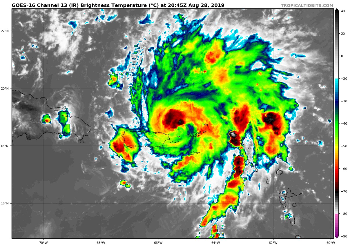
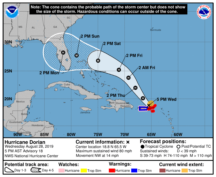
The cloud pattern has become better organized with a hint of an eye on high-resolution satellite imagery and plenty of convective bands. In addition, earlier data from a reconnaissance plane and surface observations from St. Thomas as Dorian moved by yield an initial intensity of 70 kt. Now that the hurricane has developed an inner core with a 15 to 20 n mi eye, strengthening is more likely. Given the favorable environment of warm waters and low shear prevailing in the western Atlantic, the NHC forecast calls for a marked intensification, and brings Dorian to category 3 intensity in 72 hours, and keeps it at that intensity until landfall. This forecast is very close to the intensity consensus, the HCCA model, and the SHIPS guidance.
Satellite and earlier reconnaissance plane fixes indicate that Dorian has been moving toward the northwest or 320 degrees at 12 kt. The cyclone is heading toward a weakness in the Atlantic subtropical ridge, and this northwest motion should continue for the next 24 to 48 hours. However, after that time, all the global models continue to build a strong ridge over the western Atlantic, and this flow pattern should force Dorian to turn more to the west-northwest toward Florida. All indications are that by this Labor Day weekend, a powerful hurricane will be near or over the Florida peninsula. The new NHC track forecast is a little bit to the south of the previous one, given that global models have a stronger ridge to the north and the track models show more of a westward motion. Users are reminded not to focus on the exact forecast track, as the average 5-day track error is around 200 miles.
KEY MESSAGES
1. Dangerous winds will continue in the Virgin Islands, Culebra, Vieques, and portions of Puerto Rico during the next few hours. Heavy rainfall over portions of Puerto Rico and the Virgin Islands could produce flash flooding through Thursday morning.
2. The risk of dangerous storm surge and hurricane-force winds later this week and this weekend continues to increase in the central and northwestern Bahamas and along the Florida east coast, although it is too soon to determine where these hazards will occur. Residents in these areas should ensure they have their hurricane plan in place and not focus on the exact forecast track of Dorian’s center.
3. Heavy rains are expected to occur over portions of the Bahamas, Florida, and elsewhere in the southeastern United States later this week and into early next week.
About the Author (Author Profile)
Scott Martin is an operational meteorologist, professional graphic artist, musician, husband, and father. Not only is Scott a member of the National Weather Association, but he is also the Central Alabama Chapter of the NWA president. Scott is also the co-founder of Racecast Weather, which provides forecasts for many racing series across the USA. He also supplies forecasts for the BassMaster Elite Series events including the BassMaster Classic.Subscribe
If you enjoyed this article, subscribe to receive more just like it.


