Latest Update On Dorian, Remains A Strong Category 4 Hurricane
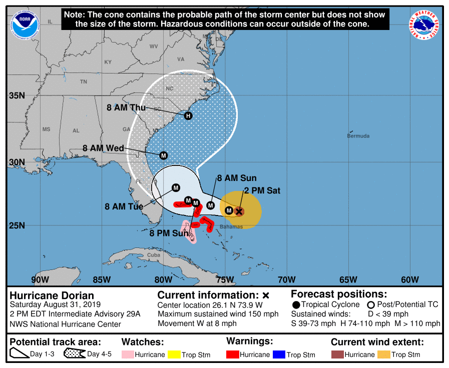
The latest forecast path keeps Dorian off of the southeastern United States coastline through Thursday morning, but east coasts of Florida, Georgia, and South Carolina remain in play as the cones still cover those locations. Here is the latest from the National Hurricane Center at 1:00 pm CT…
SUMMARY OF 200 PM EDT…1800 UTC…INFORMATION
———————————————-
LOCATION…26.1N 73.9W
ABOUT 205 MI…325 KM E OF GREAT ABACO IN THE BAHAMAS
ABOUT 385 MI…625 KM E OF WEST PALM BEACH FLORIDA
MAXIMUM SUSTAINED WINDS…150 MPH…240 KM/H
PRESENT MOVEMENT…W OR 280 DEGREES AT 8 MPH…13 KM/H
MINIMUM CENTRAL PRESSURE…945 MB…27.91 INCHES
SUMMARY OF WATCHES AND WARNINGS IN EFFECT:
——————————————
A Hurricane Warning is in effect for…
* Northwestern Bahamas excluding Andros Island
A Hurricane Watch is in effect for…
* Andros Island
DISCUSSION AND OUTLOOK
———————-
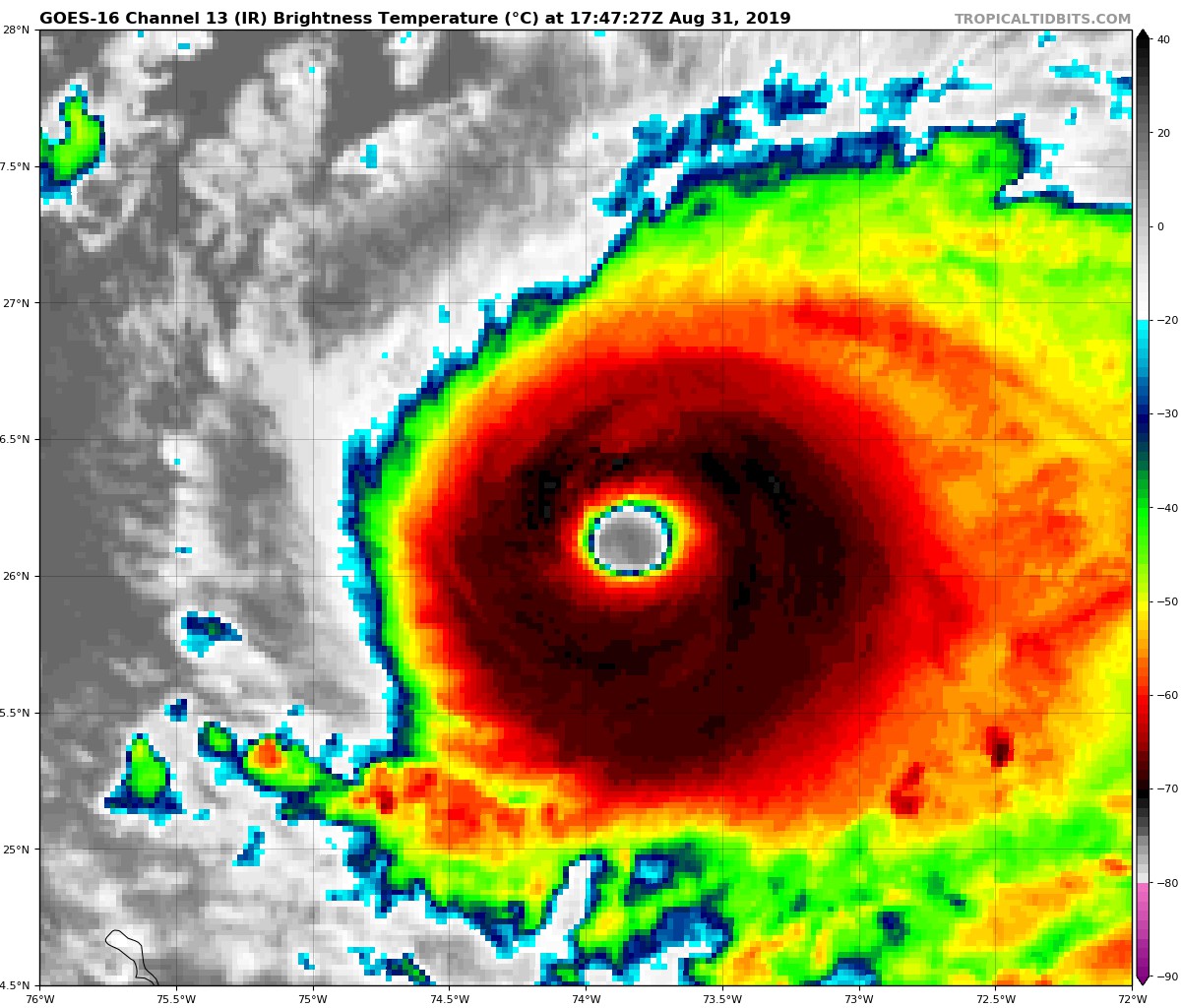
At 200 PM EDT (1800 UTC), the distinct eye of Hurricane Dorian was located near latitude 26.1 North, longitude 73.9 West. Dorian is moving toward the west near 8 mph (13 km/h), and a slower westward motion should continue into early next week. On this track, the core of Dorian should move over the Atlantic well north of the southeastern and central Bahamas today, be near or over the northwestern Bahamas on Sunday, and move near the Florida east coast late Monday through Tuesday.
Data from an Air Force reconnaissance plane indicate that the maximum sustained winds are near 150 mph (240 km/h) with higher gusts. Dorian is a category 4 hurricane on the Saffir-Simpson Hurricane Wind Scale. Some fluctuations in intensity are likely, but Dorian is expected to remain a powerful hurricane during the next few days.
Hurricane-force winds extend outward up to 30 miles (45 km) from the center and tropical-storm-force winds extend outward up to 115 miles (185 km).
The minimum central pressure reported by a reconnaissance plane was 945 MB (27.91 inches).
HAZARDS AFFECTING LAND
———————-
WIND: Hurricane conditions are expected in the hurricane warning area across the northwestern Bahamas by Sunday, with tropical storm winds beginning tonight.
STORM SURGE: A life-threatening storm surge will raise water levels by as much as 10 to 15 feet above normal tide levels in areas of onshore winds in Great Abaco and Grand Bahama. Near the coast, the surge will be accompanied by large and destructive waves.
RAINFALL: Dorian is expected to produce the following rainfall accumulations this weekend into the middle of next week:
Northwestern Bahamas…10 to 15 inches, isolated 25 inches.
Coastal sections of the southeast United States…4 to 8 inches, isolated 12 inches.
Central Bahamas…2 to 4 inches, isolated 6 inches.
This rainfall may cause life-threatening flash floods.
SURF: Swells will begin affect the east-facing shores of the Bahamas, the Florida east coast, and the southeastern United States coast during the next few days. These swells are likely to cause life-threatening surf and rip current conditions. Please consult products from your local weather office.
About the Author (Author Profile)
Scott Martin is an operational meteorologist, professional graphic artist, musician, husband, and father. Not only is Scott a member of the National Weather Association, but he is also the Central Alabama Chapter of the NWA president. Scott is also the co-founder of Racecast Weather, which provides forecasts for many racing series across the USA. He also supplies forecasts for the BassMaster Elite Series events including the BassMaster Classic.Subscribe
If you enjoyed this article, subscribe to receive more just like it.


