In Other Tropical News, Two Other Areas To Watch Over The Next Several Days
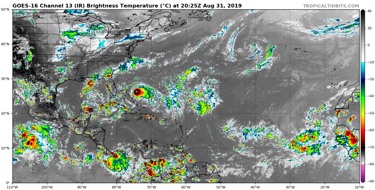
While most eyes have been fixed on Dorian to see if and where it may move onshore in the Southeastern US, we do have two other areas that we will need to watch over the next several days.
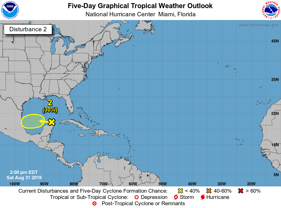
We have a tropical disturbance over the southeastern parts of the Gulf of Mexico which is only producing a limited amount of shower and thunderstorm activity. Some slow development is possible over the next few days as it will slowly move off to the west across the southern and southwestern parts of the Gulf of Mexico. If anything happens with this system, it should continue a westward journey and eventually move onshore in Mexico. The National Hurricane Center is only giving it a 30% chance of developing into a depression or tropical storm within the next five days.
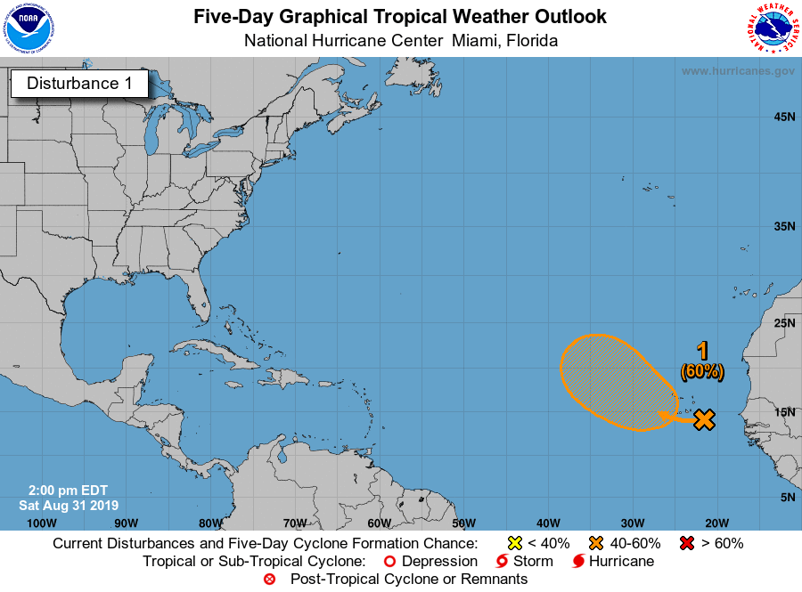
Another tropical disturbance is located east of the Cabo Verde Islands over the eastern Atlantic Ocean. As it moves westward, tropical development is likely and could become a depression at some point during next week. At this point, it is well too early to know where exactly this will end up, it looks like a curve to the northwest will happen over the next few days. The National Hurricane Center is giving it a 60% chance of developing into a depression or tropical storm within the next five days.
About the Author (Author Profile)
Scott Martin is an operational meteorologist, professional graphic artist, musician, husband, and father. Not only is Scott a member of the National Weather Association, but he is also the Central Alabama Chapter of the NWA president. Scott is also the co-founder of Racecast Weather, which provides forecasts for many racing series across the USA. He also supplies forecasts for the BassMaster Elite Series events including the BassMaster Classic.Subscribe
If you enjoyed this article, subscribe to receive more just like it.


