Late Night Notes on Hurricane Dorian
…Changes in warnings: the hurricane watch has been extended northward to the Mouth of the St. Mary’s River at the Florida/Georgia border…and the storm surge watch has also been extended to the Mouth of the St. Mary’s River.
…The core of the hurricane is now visible on the Miami radar. Here is the current view:
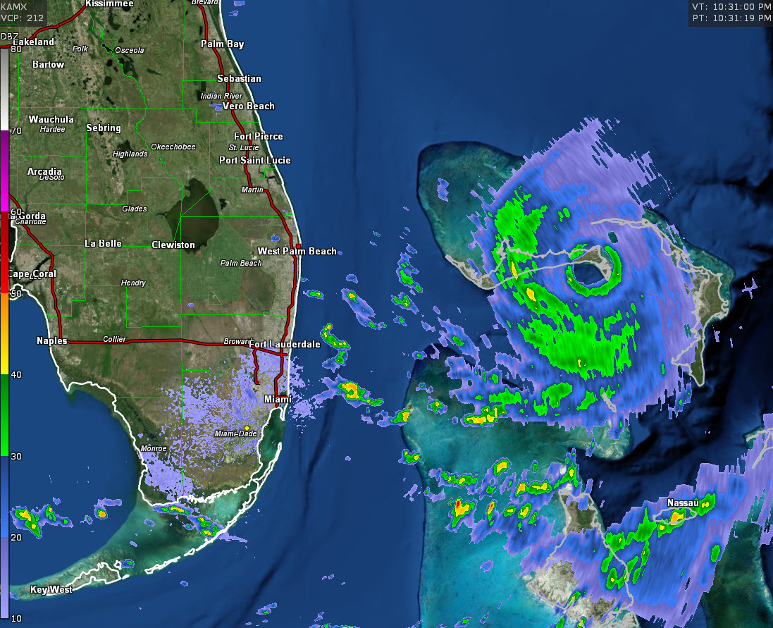
…There is still a tremendous amount of electrical activity in the hurricane’s eyewall. This is indicative of a very dynamic system.
…The latest vortex data message at 9:16 p.m. CDT shows a central pressure of 916 mb. Max winds at flight level were 177 mph. On the surface, 162 mph was reported. The closed eye is 12 nm in diameter.
…Early cycle track guidance looks consistent with recent runs, taking the center parallel to the coast all the way to North Carolina.
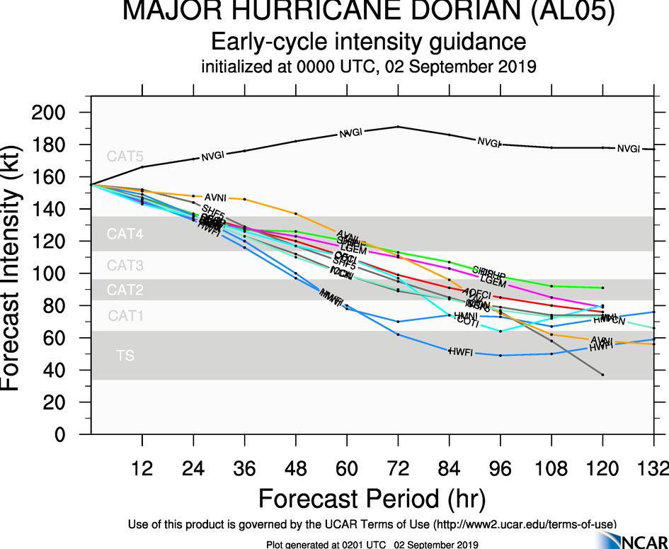
…Early cycle intensity guidance shows a gradual decrease in intensity, to cat 4 intensity by 24-48 hours. Only the NAVGEM intensifies the storm further out of that group of models.
…The 3km NAM deepens it, but didn’t initialize right, so it is only getting it to where it is now.
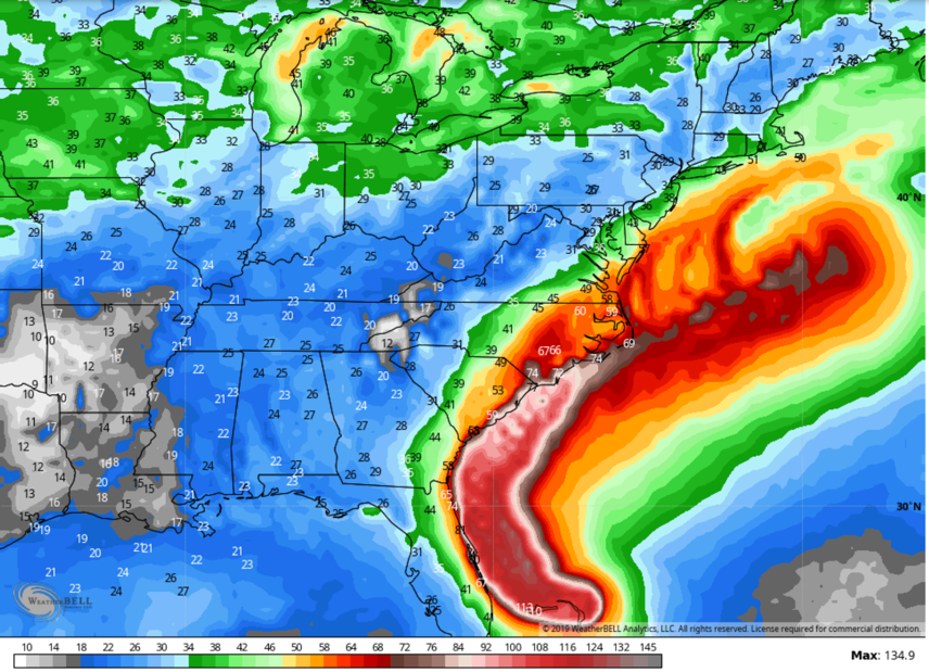
Here is the wind gust swath off the GFS operational which shows a landfall on the NC Coast:
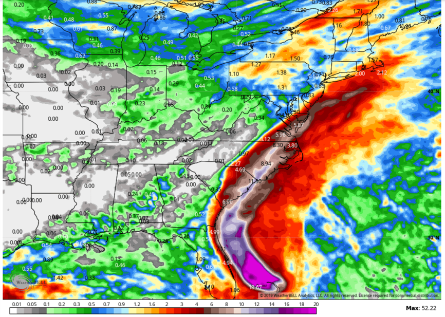
And the total rainfall:
About the Author (Author Profile)
Bill Murray is the President of The Weather Factory. He is the site's official weather historian and a weekend forecaster. He also anchors the site's severe weather coverage. Bill Murray is the proud holder of National Weather Association Digital Seal #0001 @wxhistorianSubscribe
If you enjoyed this article, subscribe to receive more just like it.


