A Quick Look at Hurricane Dorian Just Before Advisory Time
The tropics are heating up with Hurricane Dorian wearing out its welcome everywhere from the Bahamas to Florida northward to Virginia already, and the storm has only moved about 5 miles since yesterday.
KEY TAKEAWAYS FOR NOW
…Dorian is slowly letting up her historic assault on the Bahamas. The toll there is indescribable.
…Squalls over South Florida will be slowly subsiding today.
…Central and North Florida will experience increasing impacts starting today.
…Georgia, South Carolina, and North Carolina will experience significant life-threatening storm surge flooding of more than 6 feet.
…For North Carolina…impacts will be Thursday evening, with winds for tropical storm and possibly hurricane force, flooding rains, and surge.
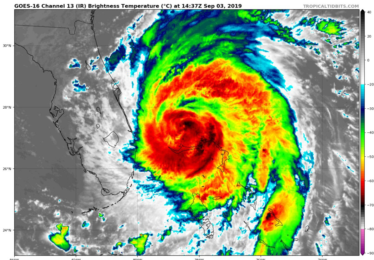
The storm is still a cat 3 with top winds of 120 mph. The plane recently found a central pressure of 955 mb. It continues to rise, which is great news. The plane’s highest flight-level wind was 125 mph, with translates to about 115 mph at the ground. That is still category 3.
The eye is 40 miles in diameter now, and is open to the southwest.
The eye is not as distinct on infrared or visible satellite this morning, showing that slow weakening trend.
it is still an impressive and powerful storm though.
it is crawling northward at 1 mph.
We will be getting a new forecast package from the National Hurricane Center here at 10 a.m., but don’t expect much in track changes. The GFS carries the storm very close to the coasts of South Carolina and North Carolina.
About the Author (Author Profile)
Bill Murray is the President of The Weather Factory. He is the site's official weather historian and a weekend forecaster. He also anchors the site's severe weather coverage. Bill Murray is the proud holder of National Weather Association Digital Seal #0001 @wxhistorianSubscribe
If you enjoyed this article, subscribe to receive more just like it.


