Mainly Sunny, Hot Saturday; A Strong Storm Possible
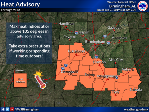
BIG HEAT, BIG STORMS?: First off, a Heat Advisory continues for much of Central and South Alabama today as temperatures are well into the 90s this afternoon, and with enough humidity around, heat indices are going to be over 105° at times through the afternoon hours.
We also note, a weak front is pushing south through the state today, and if we can get some storms to develop along it, they will be packing a punch with the threat of hail and damaging wind gusts. There could certainly be a few severe thunderstorms warnings later today.
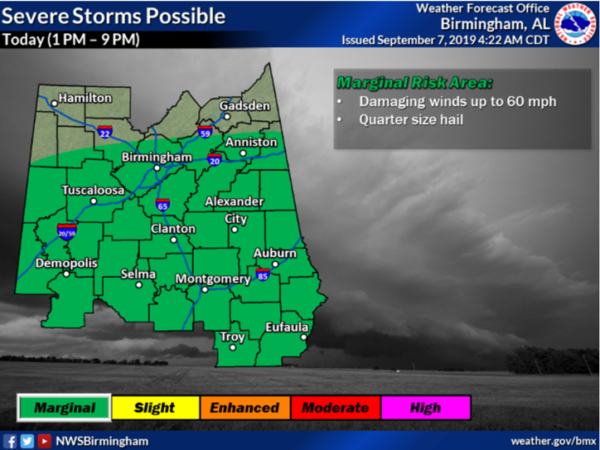
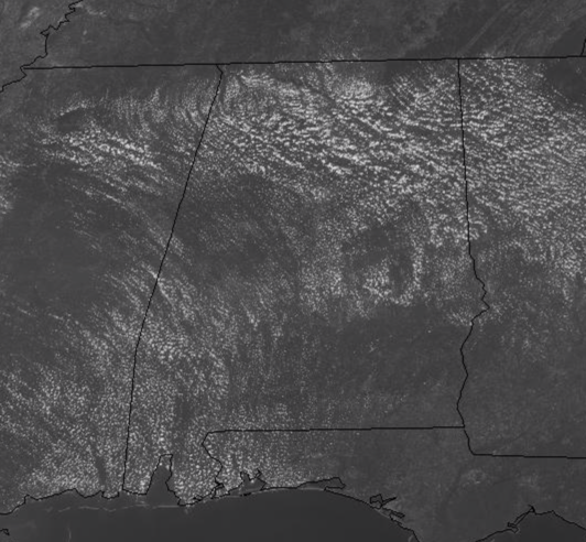
Early this afternoon, the radar was quiet, but once again, a few rouge strong storms are possible the rest of today and into the early evening hours. If you see some rain, consider yourself lucky as most locations will stay hot and dry.
FOR SUNDAY: Expect another hot and dry day, with the best chance for any rain tomorrow across South Alabama along the front. We should see ample sunshine tomorrow and highs will once again climb into the mid 90s across much of North/Central Alabama.
SO LONG DORIAN: At 200 PM AST, the center of Hurricane Dorian was located near latitude 42.8 North, longitude 64.9 West. Dorian is moving toward the northeast near 29 mph, and a general motion toward the northeast is expected to continue through Sunday night. On the forecast track, the center of Dorian is expected to move across central or eastern Nova Scotia this afternoon or this evening, pass near or over Prince Edward Island tonight, and then move near or over portions of Newfoundland and Labrador on Sunday.
Recent satellite wind data indicate that the maximum sustained winds are now near 100 mph with higher gusts. While Dorian is forecast to weaken and become a post-tropical cyclone during the next 24 hours, it is expected to maintain hurricane-force winds as it moves across eastern Canada this afternoon through Sunday. The estimated minimum central pressure is 953 mb (28.15 inches).
GABRIELLE: At 1230 PM AST (1630 UTC), the center of Tropical Storm Gabrielle was located near latitude 31.4 North, longitude 45.2 West. Gabrielle is moving toward the west-northwest near 22 mph. A northwestward motion at a slower forward speed is expected to begin by this evening and continue through Sunday. Gabrielle is then forecast to recurve toward the north and northeast on Monday and Tuesday. Maximum sustained winds are near 50 mph with higher gusts. Some strengthening is forecast during the next few days. The estimated minimum central pressure is 1002 mb (29.59 inches).\\\
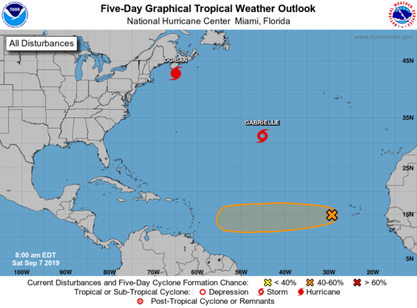
ELSEWHERE IN THE TROPICS: A broad area of low pressure associated with a tropical wave is producing disorganized showers and thunderstorms several hundred miles west of the Cabo Verde Islands. Gradual development of this system is possible, and a tropical depression could form by the middle of next week while the system moves westward across the eastern and central tropical Atlantic Ocean. Formation chance through 48 hours…low…10 percent. Formation chance through 5 days…medium…50 percent. This could become Tropical Storm Humberto over the next week. Most global models bring it into the Caribbean next week, but it remains to be seen if this will impact the Gulf of Mexico, or the United States.
BEACH FORECAST CENTER: Get the latest weather and rip current forecasts for the beaches from Fort Morgan to Panama City on our Beach Forecast Center page. There, you can select the forecast of the region that you are interested in visiting.
WORLD TEMPERATURE EXTREMES: Over the last 24 hours, the highest observation outside the U.S. was 123.4F at Failakah Island, Kuwait. The lowest observation was -96.3F at Vostok, Antarctica.
CONTIGUOUS TEMPERATURE EXTREMES: The highest observation was 115F at Death Valley and Thermal, CA. The lowest observation was 27F at Copper Basin, ID.
WEATHERBRAINS: This week we will be coming to you live from the National Weather Association Meeting in Huntsville with a squad of great guests. Getting good guests up here is like shooting fish in a barrel. They’re a dime a dozen! Check us out at www.WeatherBrains.com.
Category: Alabama's Weather, ALL POSTS
About the Author (Author Profile)
Macon, Georgia Television Chief Meteorologist, Birmingham native, and long time Contributor on AlabamaWX. Stormchaser. I did not choose Weather, it chose Me. College Football Fanatic. @Ryan_StinnetSubscribe
If you enjoyed this article, subscribe to receive more just like it.


