Very Hot At Midday; Few Isolated Showers Possible
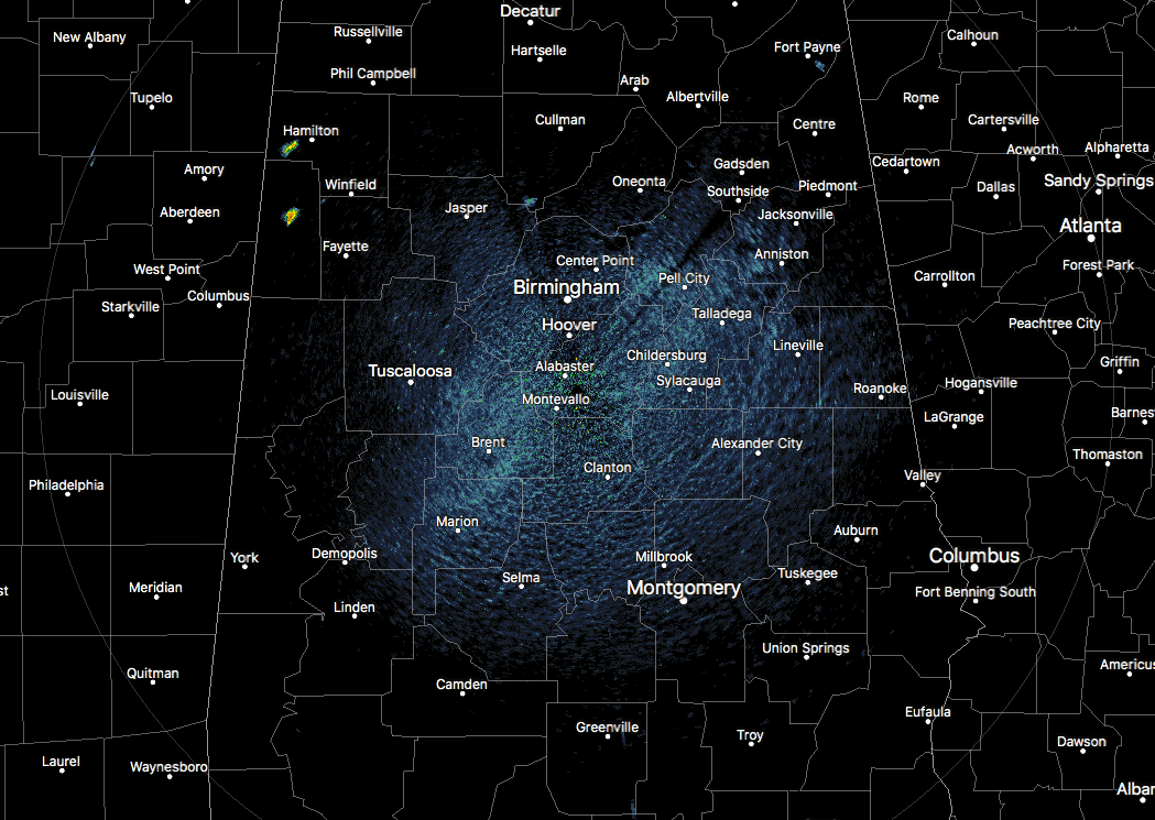
At 1:00 pm, skies are mostly clear across Central Alabama with nearly all location dry at this point. I say nearly because we have a couple of isolated showers that have formed over the southwestern parts of Marion County and over the central part of Lamar County. These are nearly stationary so we’ll have to watch how much rain falls with these showers. Temperatures are ranging from 91 degrees in Cullman to 97 degrees in both Uniontown and Montgomery.
***CODE ORANGE AIR QUALITY ALERT***
A Code Orange Air Quality Alert has been issued for Jefferson and Shelby counties today as ground-level ozone will be unhealthy for sensitive groups. Children and people with asthma are individuals most at risk under these expected conditions.
Skies will become partly cloudy as those will build with the convective heating of the day, but we only expect a few isolated afternoon showers and thunderstorms across the area through the rest of the afternoon and into the early evening hours. Afternoon highs will top out in the mid to upper 90s. Skies will be mostly clear tonight and through the overnight hours, with lows dropping into the upper 60s to the lower 70s.
Friday’s weather will be very similar to what we are seeing today… hot and mainly dry with partly to mostly sunny skies and a small risk of a few isolated afternoon showers and thunderstorms. Highs will be in the mid to upper 90s once again. Football games should be dry tomorrow night with temperatures starting off in the upper 80s to the lower 90s by 6:00 pm and dropping into the upper 70s to the lower 80s by 10:00 pm.
TROUBLE IN THE TROPICS
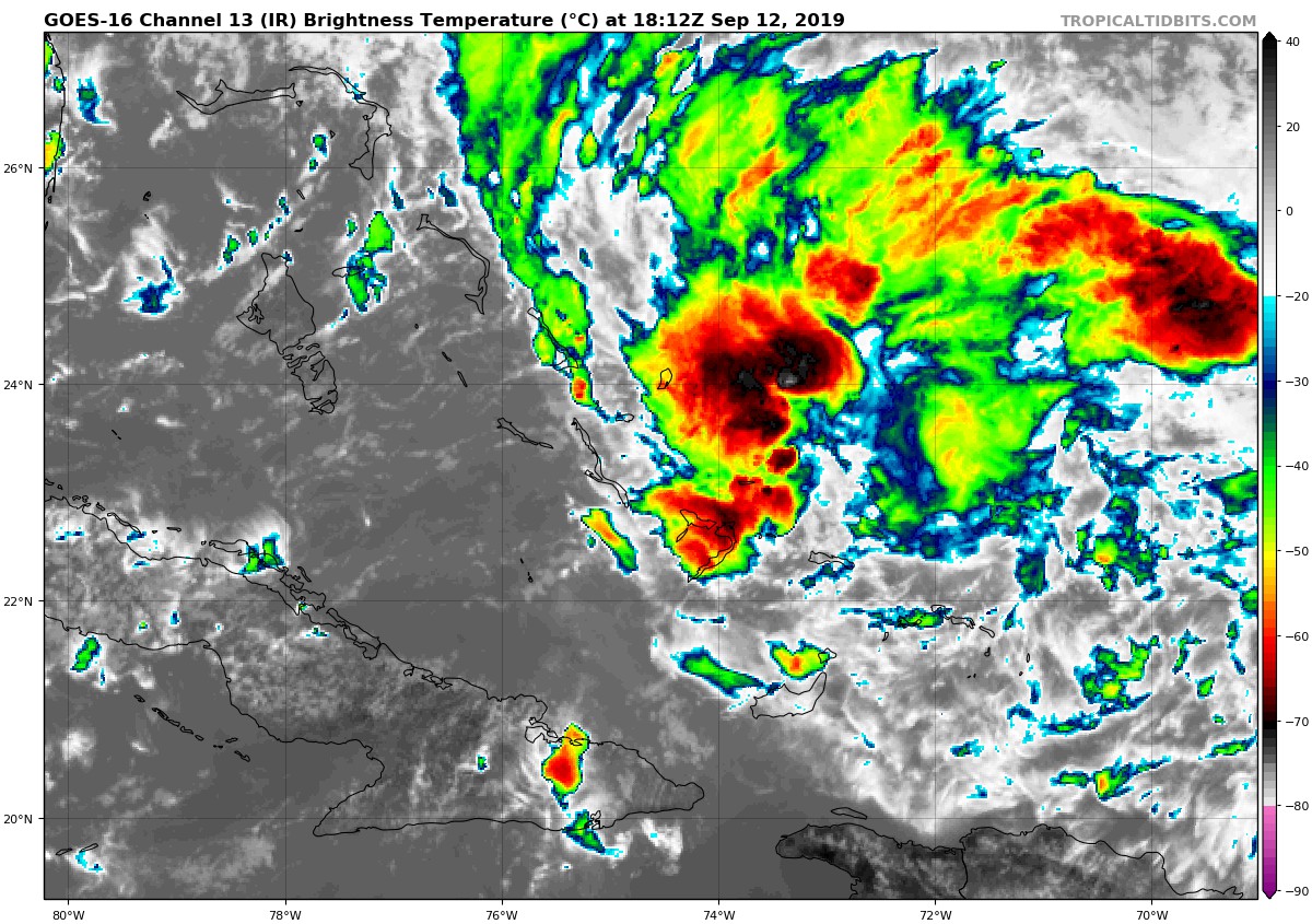
Invest 95L has not formed a closed circulation as it sits over the Bahamas, but conditions are favorable for the formation of a tropical depression within the next 24-36 hours. The National Hurricane Center has 95L forecast to move northwest toward the Florida Peninsula at 5-10 MPH. Hurricane Hunter aircraft is scheduled to fly through 95L this afternoon.
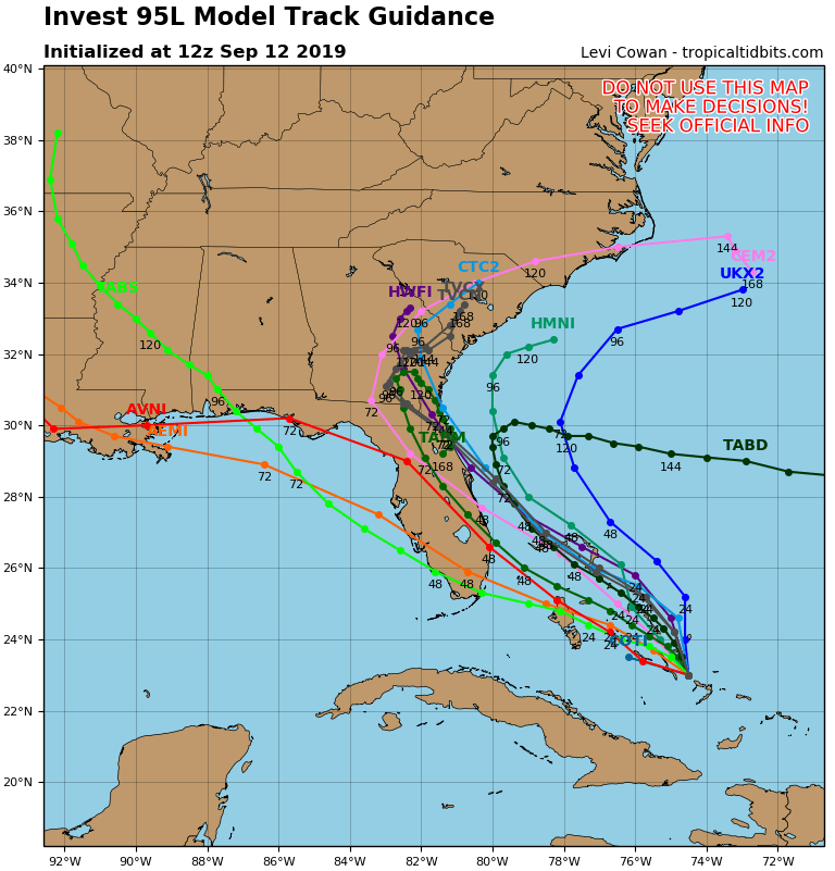
At this point, most of the ensemble members have 95L curving to the north-northwest and following the Atlantic Coast of Florida and moving inland over the extreme northeastern parts of Florida to the extreme southeastern parts of Georgia. If that is the case, we will once again see very little to no impact from 95L. At this point, it is just too early to tell. Until 95L develops a closed circulation and we get better data, there will be great uncertainty in the forecast. It is also too early to forecast an impact for anyone along the Gulf Coast or into Central Alabama.
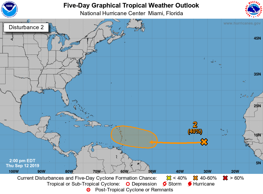
Another tropical wave is located to the west of the Cabo Verde Islands and will be moving into an environment that will allow for development. A tropical depression is possible as early as the start of next week as it moves westward. The National Hurricane Center is giving it a 40% chance of developing into a depression within the next five days. Way too early to forecast where this will go.
Category: Alabama's Weather, ALL POSTS
About the Author (Author Profile)
Scott Martin is an operational meteorologist, professional graphic artist, musician, husband, and father. Not only is Scott a member of the National Weather Association, but he is also the Central Alabama Chapter of the NWA president. Scott is also the co-founder of Racecast Weather, which provides forecasts for many racing series across the USA. He also supplies forecasts for the BassMaster Elite Series events including the BassMaster Classic.Subscribe
If you enjoyed this article, subscribe to receive more just like it.


