Hot, Mostly Dry Tomorrow; Still Watching The Tropics
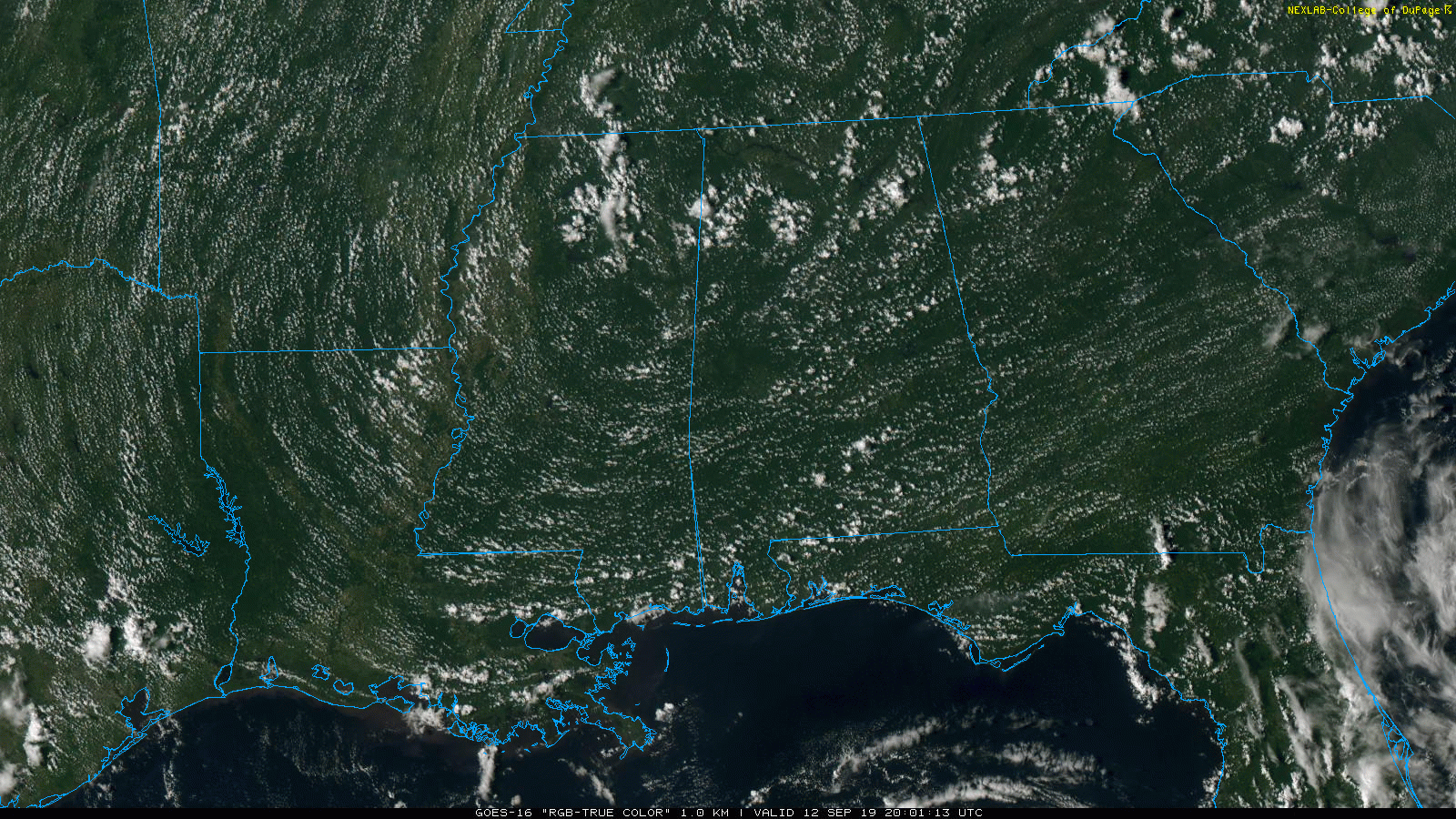
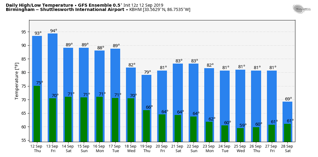
RADAR CHECK: As expected, we have only a handful of cooling showers across Alabama this afternoon; most places are dry with a partly to mostly sunny sky. Temperatures are in the mid to upper 90s, about 10 degrees above average for mid-September. The weather won’t change much tomorrow; look for a good supply of sunshine with a high well up in the 90s… odds of any one spot seeing a shower remain small.
THE ALABAMA WEEKEND: The strong upper ridge that has been responsible for the hot weather will begin to weaken a bit, and we will bring in a chance of scattered showers and thunderstorms Saturday with a mix of sun and clouds. Chance of any one location seeing rain is around 30 percent, and the high will be in the 88 to 91 degree range. Then, on Sunday, with deeper moisture arriving we expect scattered showers and thunderstorms to become more numerous. Still, not a wash out, and the high Sunday will be in the low to mid 80s.
NEXT WEEK: Confidence in the forecast is very low now since a tropical system will be involved. Alabama could see beneficial rain during the first half of the week but if the center of the tropical system passes to the east, we will be on the dry side and rain amounts will be much lighter. For now we will maintain elevated rain chances Monday through Wednesday, and adjust the forecast as needed in coming days. See the Weather Xtreme video for maps, graphics, and more details.
FOOTBALL WEATHER: The sky should be mostly clear for the high school games tomorrow night, with temperatures falling from the mid 80s at kickoff, to near 80 by the final whistle.
Saturday, Alabama travels to Columbia to take on South Carolina (2:30p CT kickoff)… the sky will be partly sunny with a kickoff temperature close to 90 degrees, then falling back slightly into the upper 80s by the fourth quarter. A few widely scattered showers are possible the region during the game.
Auburn hosts Kent State Saturday evening at Jordan-Hare Stadium (6:30p CT kickoff)… we can’t rule out the risk of a passing shower during the game, otherwise mostly fair with temperatures falling from around 88 at kickoff, into the low 80s by the game.
Jacksonville State has a home game Saturday against Eastern Washington (3:00p CT kickoff) a few scattered showers are possible over East Alabama during the game, otherwise expect a mix of sun and clouds with 89 degrees at kickoff, falling into the mid 80s by the fourth quarter.
TROPICS: A tropical wave between the Lesser Antilles and the African coast has a medium chance of developing over the next five days; too early to know if this will impact the Gulf of Mexico or the U.S.
Invest 95L is over the Southeast Bahamas, and NHC still gives it a high chance of becoming a tropical depression or storm during the next 48 hours. If the system achieves tropical storm strength, it will get the name “Humberto”.
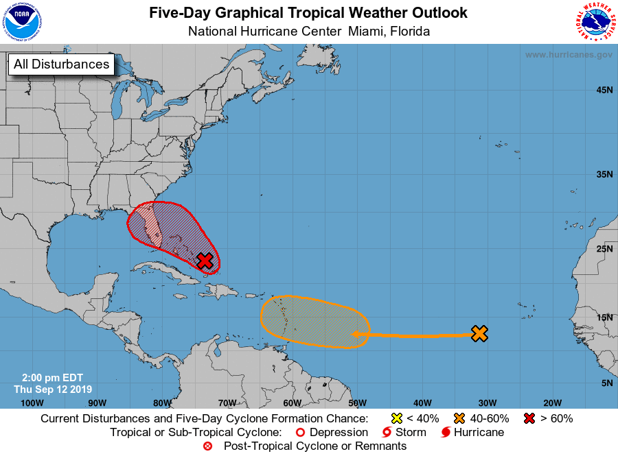
A reconnaissance aircraft is in the region now gathering data, which will help us know more about the current state of the system. But, until a low level center is identified, computer models will be all over the board due to the lack of good initialization. Models are basically split into two camps; one set takes it to near Jacksonville, Florida, and then recurves the system out into the Atlantic. But, another group pushes it to the Central Gulf Coast (a wet solution for Alabama). We will have much better clarity within 24 hours as the system begins to get its act together.
Most intensity guidance suggests for now that Humberto will not become a hurricane, but mostly a tropical storm loaded with moisture and a big rain maker. It is simply too early to forecast impact for any specific point along the Gulf Coast, or in the state of Alabama.
ON THIS DATE IN 1979: Hurricane Frederic made landfall at about 10 p.m. CT, passing over Dauphin Island and crossed the coastline near the Alabama/Mississippi border. A wind gust of 145 miles per hour was measured on equipment atop the Dauphin Island Bridge. The bridge was destroyed. A wind gust of 139 mph was measured at the Dauphin Island Sea Lab before the equipment failed. A storm surge of 12 feet was observed in Gulf Shores. Nearly all structures within 200 yards of the Alabama coast were destroyed. There were only two fatalities as a direct result of Frederic. Total damages were 2.3 billion dollars, making Frederic the most expensive hurricane ever to strike the United States up to that point.
BEACH FORECAST: Click here to see the AlabamaWx Beach Forecast Center page.
WEATHER BRAINS: Don’t forget you can listen to our weekly 90 minute show anytime on your favorite podcast app. This is the show all about weather featuring many familiar voices, including our meteorologists here at ABC 33/40.
CONNECT: You can find me on all of the major social networks…
Facebook
Twitter
Instagram
Pinterest
Snapchat: spannwx
I had a great time today visiting with the second graders at Westminster School at Oak Mountain… be looking for them on the Pepsi KIDCAM today at 5:00 on ABC 33/40 News! The next Weather Xtreme video will be posted here by 7:00 a.m. tomorrow…
Category: Alabama's Weather, ALL POSTS, Weather Xtreme Videos
About the Author (Author Profile)
James Spann is one of the most recognized and trusted television meteorologists in the industry. He holds the AMS CCM designation and television seals from the AMS and NWA. He is a past winner of the Broadcast Meteorologist of the Year from both professional organizations.Subscribe
If you enjoyed this article, subscribe to receive more just like it.


