Humberto Early Afternoon Update: Tropical Storm is Organizing and Intensifying; Still No Threat to U.S.
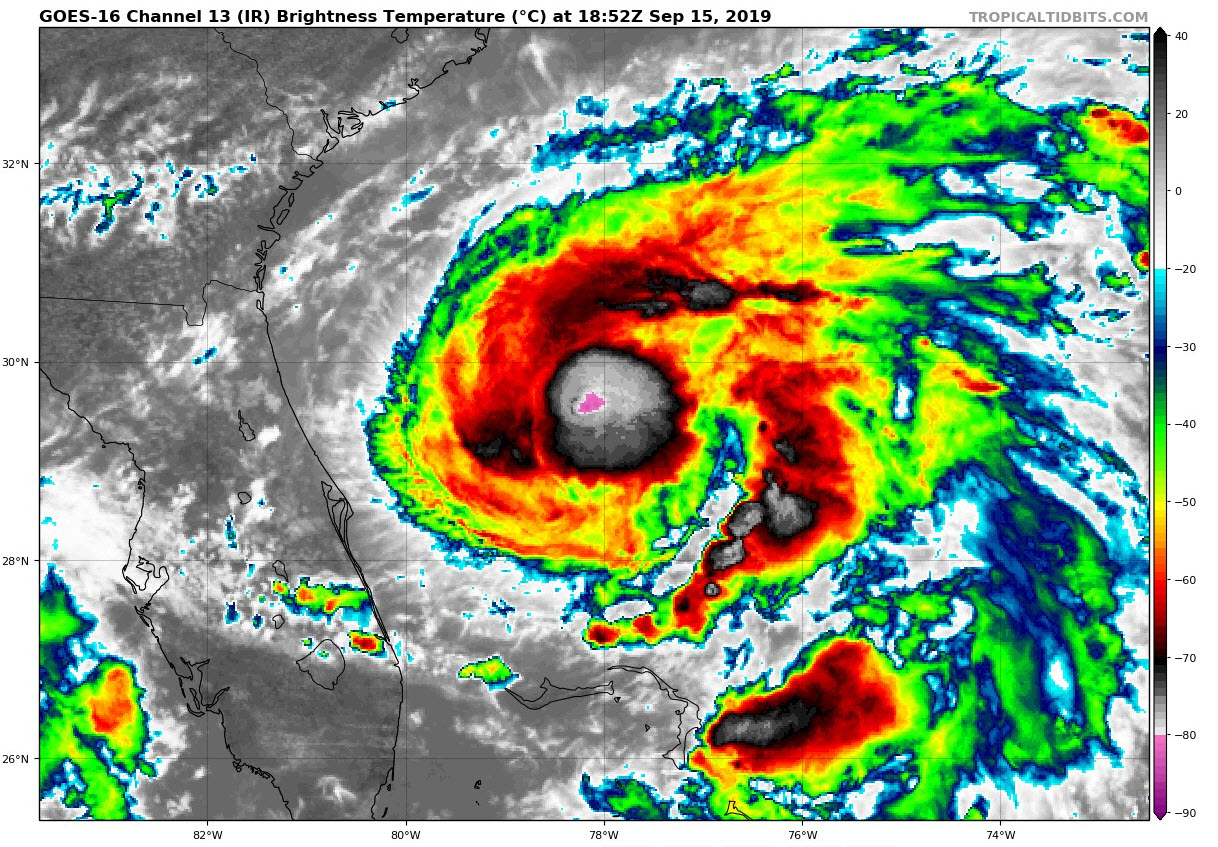
Satellite imagery this afternoon indicates that Tropical Storm Humberto continues to become better organized with extremely cold cloud tops forming around what appears to be a developing inner core. Infrared satellite images indicate cloud tops as cold as -85C, which is as cold, or colder than anything we saw in Dorian even at its peak.
There is now an enlarging central dense overcast and good anticyclonic outflow. The storm will become a hurricane soon and rapid intensification is possible in the near future.
Air Force reconnaissance just found a central pressure of 993 mb, which is down 7 millibars from last night. The highest surface wind found by the plane was around 65 mph.
Humberto should become a hurricane by tonight. It is in the progress of making its fairly sharp turn to the north and northeast and will not pose a threat to the United States.
The hurricane does pose a threat to the island nation of Bermuda. It will pass near the island late Wednesday. At that time, it could be a category two, or perhaps event category 3 hurricane with top winds in the 110-120 mph range.
Weakening should be commencing about that time though as well.
About the Author (Author Profile)
Bill Murray is the President of The Weather Factory. He is the site's official weather historian and a weekend forecaster. He also anchors the site's severe weather coverage. Bill Murray is the proud holder of National Weather Association Digital Seal #0001 @wxhistorianSubscribe
If you enjoyed this article, subscribe to receive more just like it.


