Rain Chances Pretty Much Non Existent Through Mid-Week
A hot Sunday is in progress across Alabama on this ides of September. After morning lows generally in the lower 70s, highs this afternoon will soar into the lower and middle 90s, with a few upper 90s smattered in for good measure. These readings are some ten degrees above normal. There could be an isolated shower or two this afternoon, including a couple that could develop lightning, but the chance is very small.
OUR FORECAST: The chance of rain is virtually nonexistent for Central Alabama through the next 7 days. It will be dry and hot through Wednesday, with highs in the middle and upper 90s. Some spots will approach 100F. A dry cold front will bring drier air and slightly cooler temperatures for the end of the week, but it will still be hot and dry.
NEXT RAIN CHANCES: The next rain chances look like they might come early in the following week, around Tuesday the 24th as a front sneaks into the area. DOn’t get your hopes up as far as rainfall goes, however. Amounts will be generally light.
IN FACT: Don’t get your hopes up through the end of October, if the Euro is to be believed. It is calling for less than a third of an inch of rain through the end of October for much of Central Alabama.
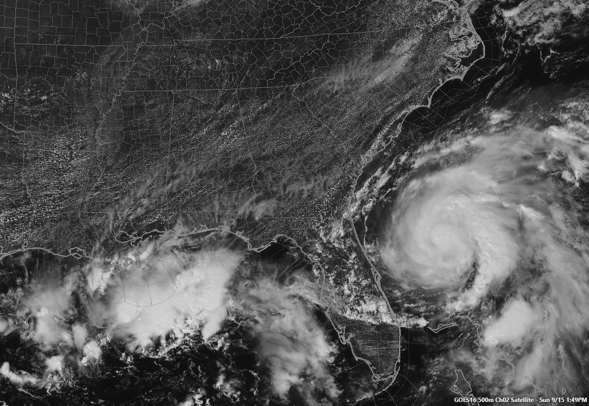
HUMBERTO: Tropical Storm Humberto is nearing hurricane strength this morning, located about 200 miles east of Cape Canaveral. The storm spent Saturday evening moving away from the Bahamas, which are still reeling from their encounter with Hurricane Dorian. The storm is beginning to make a hard right turn that will carry it away from the United States where the only impacts will be rough surf and rip currents along the East Coast. It should become a hurricane later today or tonight. Bermuda may be hard hit by what should be a category two hurricane on Wednesday, however.
ELSEWHERE IN THE TROPICS: The upper low over the Gulf of Mexico will move inland before it can develop. The disturbance in the Central Atlantic has a good chance to become a tropical cyclone, but it should pass north of the islands.
Category: Alabama's Weather, ALL POSTS
About the Author (Author Profile)
Bill Murray is the President of The Weather Factory. He is the site's official weather historian and a weekend forecaster. He also anchors the site's severe weather coverage. Bill Murray is the proud holder of National Weather Association Digital Seal #0001 @wxhistorianSubscribe
If you enjoyed this article, subscribe to receive more just like it.


