At Midday, We Are Still Getting Hit With The Blast Furnace
CONDITIONS AT 12:15 PM
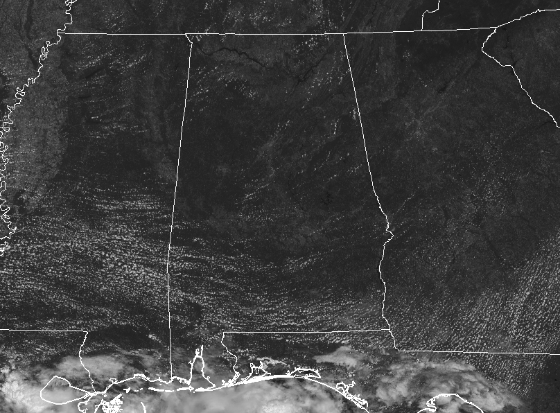
Plenty of sunshine bearing down on this very late summer midday in Central Alabama. No help from those fair-weather clouds to cast some shade on us and help us cool down, even for one minute. Temperatures across the area are currently in the lower to mid-90s. Birmingham was at 93 degrees while the warm spot was Uniontown at 96 degrees. Alexander City and Gadsden were tied as the cool spots at 90 degrees.
VERY HOT & DRY FOR THE REST OF YOUR MONDAY
A combination of high pressure to our northeast and the easterly flow from Hurricane Humberto will keep subsidence over Central Alabama for the rest of today. This means plenty of sunshine and high heat levels. Afternoon highs will top out in the mid to upper 90s across the area.
CODE ORANGE AIR QUALITY ALERT FOR MONDAY
The Alabama Department of Environmental Management has issued a Code Orange Air Quality Alert for Jefferson and Shelby counties for Monday, September 16th. Under code orange conditions, ground-level ozone concentrations are expected to reach levels that are unhealthy for sensitive groups. Children and people with asthma are individuals most at risk under these expected conditions.
THE BLAST FURNACE STAYS LIT ON TUESDAY
Not much change with the pattern on Tuesday… Skies will be mainly sunny with just a passing cloud or two with afternoon highs reaching the mid to upper 90s once again. I wouldn’t be surprised if a few locations take a run at 100 degrees.
ON THIS DAY IN WEATHER HISTORY
1988 – Hurricane Gilbert moved ashore into Mexico. The hurricane established an all-time record for the western hemisphere with a barometric reading of 26.13 inches. Winds approached 200 mph, with higher gusts. Gilbert devastated Jamaica and the Yucatan Peninsula. (The Weather Channel) Hurricane Gilbert made landfall 120 miles south of Brownsville TX during the early evening. Winds gusted to 61 mph at Brownsville and reached 82 mph at Padre Island. Six-foot tides eroded three to four feet off beaches along the Lower Texas Coast, leaving the waterline seventy-five feet farther inland. Rainfall totals ranged up to 8.71 inches at Lamar TX. Gilbert caused three million dollars damage along the Lower Texas Coast, but less than a million dollars damage along the Middle Texas Coast.
THE TROPICS
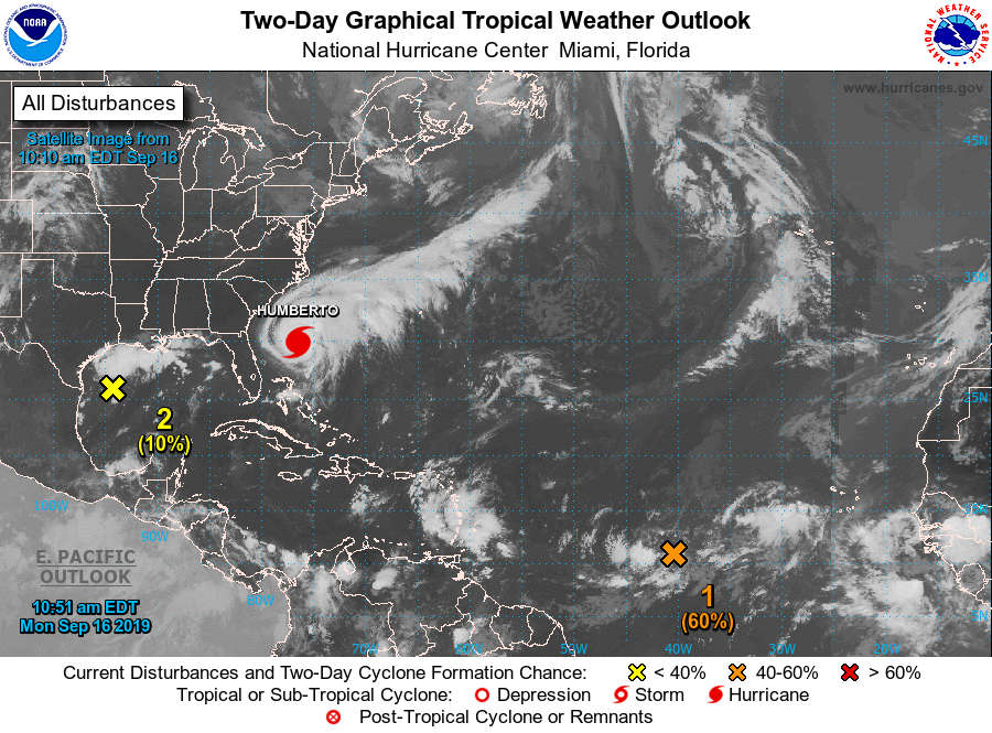
Hurricane Humberto continues to move off to the east-northeast at 7 MPH away from the southeastern US. Rough surf and rip currents will continue to be expected at least for the next few days until Humberto gets much further out to sea. Bermuda may get a close call from the southern edge of Humberto, but it looks like the worst of the storm will pass to the north.
We also have a disturbance that is producing showers and thunderstorms over the central tropical Atlantic. Satellite data also indicate that the low has become
better defined, and conditions are expected to be favorable for a depression to form during the next few days while it moves slowly northwestward to west-northwestward. 90% chance of developing into a depression within the next five days. It is expected to curve off to the north and away from the US.
There is also a disturbance over the northwestern Gulf of Mexico that is expected to move inland along the northwestern Gulf coast tonight or Tuesday. Staying below depression stage, this system is expected to produce locally heavy rainfall along portions of the central and upper Texas coastal areas later this week.
Category: Alabama's Weather, ALL POSTS
About the Author (Author Profile)
Scott Martin is an operational meteorologist, professional graphic artist, musician, husband, and father. Not only is Scott a member of the National Weather Association, but he is also the Central Alabama Chapter of the NWA president. Scott is also the co-founder of Racecast Weather, which provides forecasts for many racing series across the USA. He also supplies forecasts for the BassMaster Elite Series events including the BassMaster Classic.Subscribe
If you enjoyed this article, subscribe to receive more just like it.


