Imelda Moving Slowly Northward Bringing Heavy Rain & Flooding Potential Inland
SUMMARY & DISCUSSION AS OF 10:00 AM CT
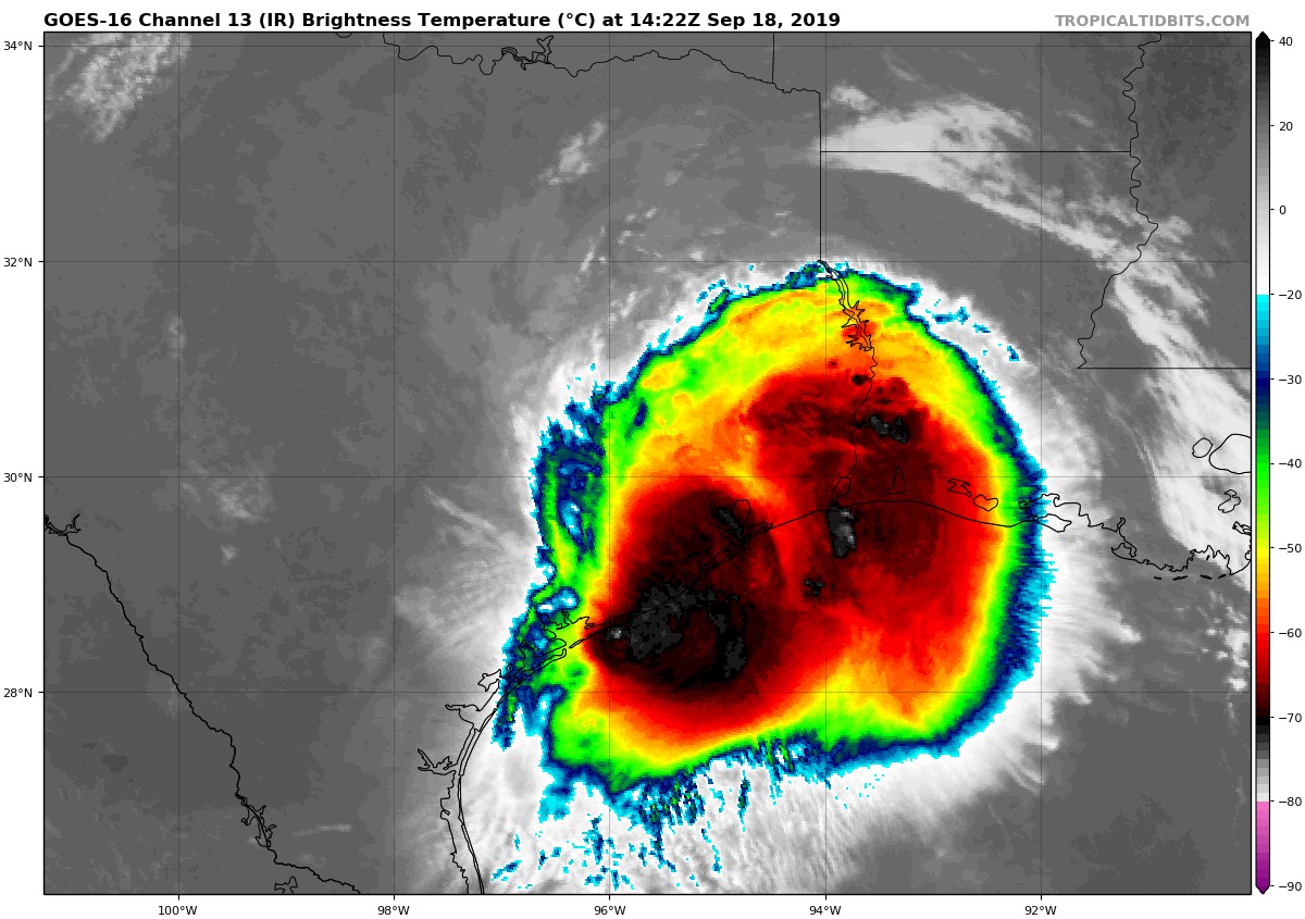
LOCATION…30.6N 95.6W
ABOUT 65 MI…100 KM N OF HOUSTON TEXAS
ABOUT 50 MI…75 KM E OF COLLEGE STATION TEXAS
MAXIMUM SUSTAINED WINDS…30 MPH…45 KM/H
PRESENT MOVEMENT…N OR 360 DEGREES AT 5 MPH…7 KM/H
MINIMUM CENTRAL PRESSURE…1009 MB…29.80 INCHES
Flash flood watches are in effect for southeast Texas and extreme southwest Louisiana.
At 1000 AM CDT (1500 UTC), the center of Tropical Depression Imelda was located near latitude 30.6 North, longitude 95.6 West. The depression is moving toward the north near 5 mph (7 km/h) and this motion is expected to continue through tonight.
Maximum sustained winds are near 30 mph (45 km/h) with higher gusts. Little change in strength is forecast during the next 48 hours.
The estimated minimum central pressure is 1009 mb (29.80 inches).
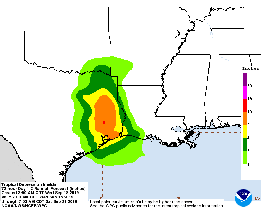
RAINFALL: Imelda is expected to produce the following rainfall amounts through Friday:
Across the Upper Texas Coast into eastern Texas, including the Houston and Galveston areas…additional 5 to 10 inches. Isolated storm totals of 20 to 25 inches.
Across portions of southwest Louisiana…4 to 8 inches with isolated totals of 10 inches.
These rainfall totals may produce significant to life threatening flash floods.
About the Author (Author Profile)
Scott Martin is an operational meteorologist, professional graphic artist, musician, husband, and father. Not only is Scott a member of the National Weather Association, but he is also the Central Alabama Chapter of the NWA president. Scott is also the co-founder of Racecast Weather, which provides forecasts for many racing series across the USA. He also supplies forecasts for the BassMaster Elite Series events including the BassMaster Classic.Subscribe
If you enjoyed this article, subscribe to receive more just like it.


