Jerry Continues To Grow Stronger; Tropical Storm Watches Issued For The Leeward Islands
SUMMARY & FORECAST DISCUSSION AS OF 4:00 PM CT
———————————————-
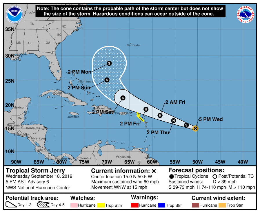
LOCATION…15.0N 50.5W
ABOUT 765 MI…1230 KM E OF THE LEEWARD ISLANDS
MAXIMUM SUSTAINED WINDS…60 MPH…95 KM/H
PRESENT MOVEMENT…WNW OR 290 DEGREES AT 15 MPH…24 KM/H
MINIMUM CENTRAL PRESSURE…1000 MB…29.53 INCHES
The government of St. Maarten has issued a Tropical Storm Watch for St. Maarten. Meteo-France has issued a Tropical Storm Watch for St. Martin and St. Barthelemy. The government of the Netherlands has issued a Tropical Storm Watch for Saba and St. Eustatius.
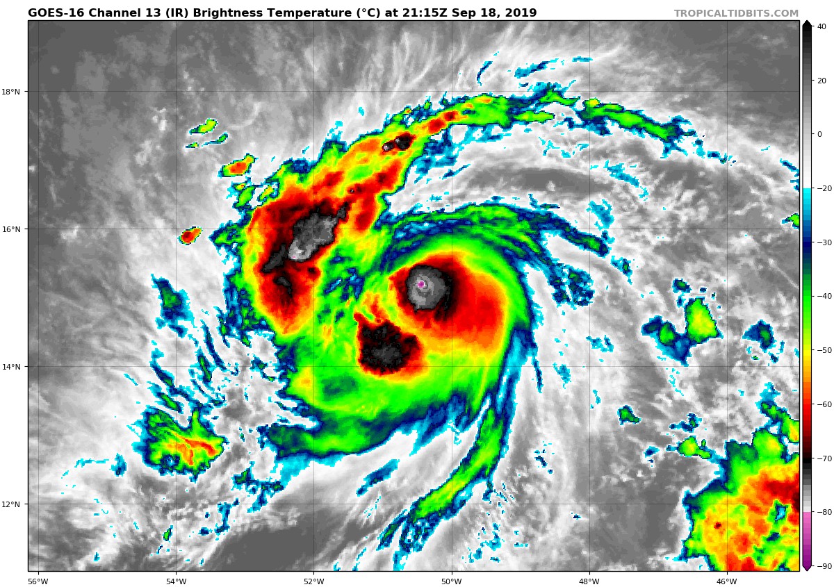
Jerry continues to strengthen this afternoon, as indicated by 1-min GOES-16 satellite imagery, with a large burst of convection close to the center. In addition, microwave data show that the central structure has improved, displaying a tightly wrapped band near the center. The initial wind speed is set to 50 kt, on the conservative side of the intensity estimates.
The storm should become a hurricane on Thursday while it is moving over very warm waters with light shear. Dropsondes from the NOAA G-IV aircraft this afternoon show that Jerry is surrounded by some very dry air in the lower to mid-levels, and this is likely the main limiting factor on the cyclone’s strengthening rate in the near term. By 48 hours, almost all of the models show an increase in northwesterly shear due to flow from an upper-level ridge, which seems likely to cause some weakening. At long range, Jerry is likely to interact with a mid-latitude trough, which is notoriously difficult to forecast. Only small changes were made to the previous wind speed prediction, and this advisory is close to a blend of the various consensus aids.
The initial motion continues to be west-northwestward, or 290/13 kt. There’s no substantial change to the track forecast on this package, with a subtropical ridge providing a well-defined steering current. This ridge should move Jerry along at a faster forward speed in about the same direction for the next couple of days, taking the center close to but north of the northern Leeward Islands. Afterward, a northwest to northward turn, influenced by a weakness in the aforementioned ridge left behind by Humberto and a new mid-latitude shortwave, is anticipated. The new forecast is very close to the previous one and a blend of the latest ECMWF ensemble mean and the corrected-consensus HCCA.
Key Messages:
1. Jerry is expected to become a hurricane before it moves close to the northern Leeward Islands Friday. Although the core of Jerry is currently expected to pass north of the islands, tropical-storm-force winds and locally heavy rainfall are possible, and tropical storm watches have been issued for a portion of this area.
About the Author (Author Profile)
Scott Martin is an operational meteorologist, professional graphic artist, musician, husband, and father. Not only is Scott a member of the National Weather Association, but he is also the Central Alabama Chapter of the NWA president. Scott is also the co-founder of Racecast Weather, which provides forecasts for many racing series across the USA. He also supplies forecasts for the BassMaster Elite Series events including the BassMaster Classic.Subscribe
If you enjoyed this article, subscribe to receive more just like it.


