Imelda: Heavy Rain & Significant Flash Flooding Continue To Spread Over Parts Of Texas & Louisiana
SUMMARY AS OF 4:00 PM CT
LOCATION…30.8N 95.0W
ABOUT 80 MI…130 KM NNE OF HOUSTON TEXAS
ABOUT 85 MI…135 KM E OF COLLEGE STATION TEXAS
MAXIMUM SUSTAINED WINDS…30 MPH…45 KM/H
PRESENT MOVEMENT…N OR 360 DEGREES AT 5 MPH…7 KM/H
MINIMUM CENTRAL PRESSURE…1010 MB…29.83 INCHES
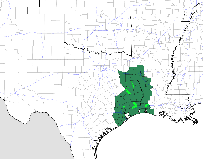
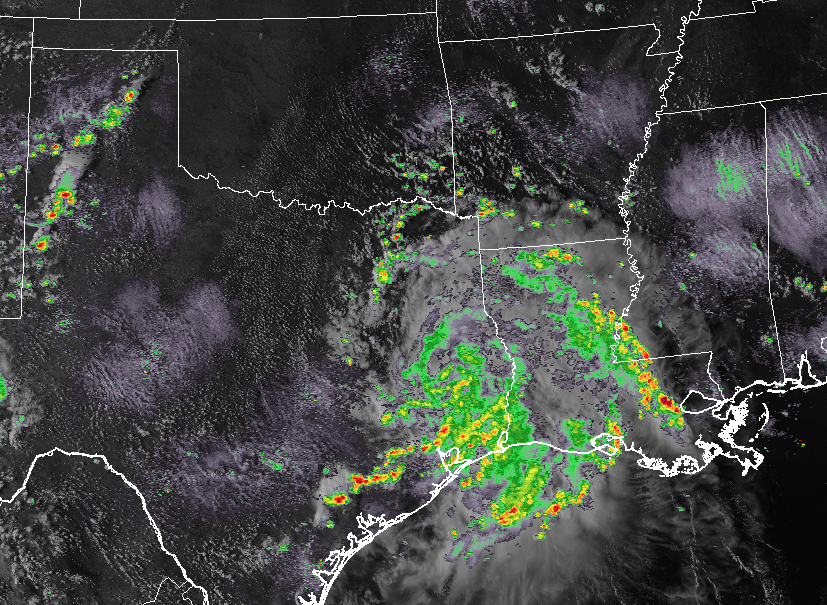
Flash flood watches are in effect for southeast Texas and extreme southwest Louisiana.
At 400 PM CDT (2100 UTC), the center of Tropical Depression Imelda was located near latitude 30.8 North, longitude 95.0 West. The depression is moving toward the north near 5 mph (7 km/h) and this motion is expected to gradually decrease in speed this evening and then make a gradual turn towards the northwest.
Maximum sustained winds are near 30 mph (45 km/h) with higher gusts. Little change in strength is forecast overnight before a gradual weakening trend begins.
The estimated minimum central pressure is 1010 mb (29.83 inches).
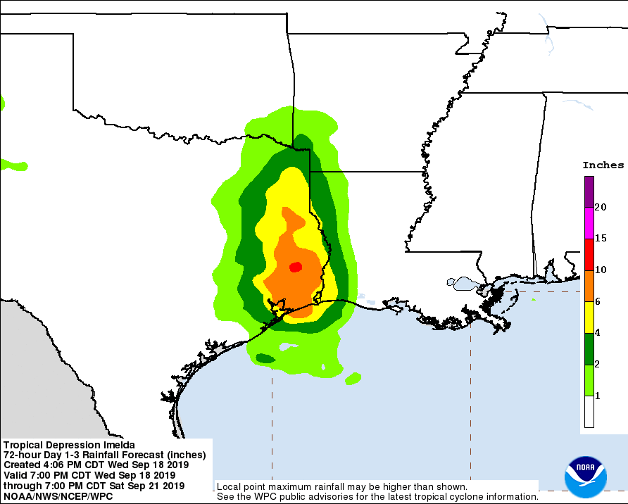
RAINFALL: Imelda is expected to produce the following rainfall amounts through Friday:
Across the Upper Texas Coast into the Piney Woods of eastern Texas…additional 5 to 10 inches of rain is expected with isolated storm totals of 20 to 25 inches. Across portions of southwest Louisiana…4 to 8 inches with isolated totals of 10 inches.
These rainfall totals may produce significant to life threatening flash floods.
About the Author (Author Profile)
Scott Martin is an operational meteorologist, professional graphic artist, musician, husband, and father. Not only is Scott a member of the National Weather Association, but he is also the Central Alabama Chapter of the NWA president. Scott is also the co-founder of Racecast Weather, which provides forecasts for many racing series across the USA. He also supplies forecasts for the BassMaster Elite Series events including the BassMaster Classic.Subscribe
If you enjoyed this article, subscribe to receive more just like it.


