Jerry Strengthening, Will Become A Hurricane Soon
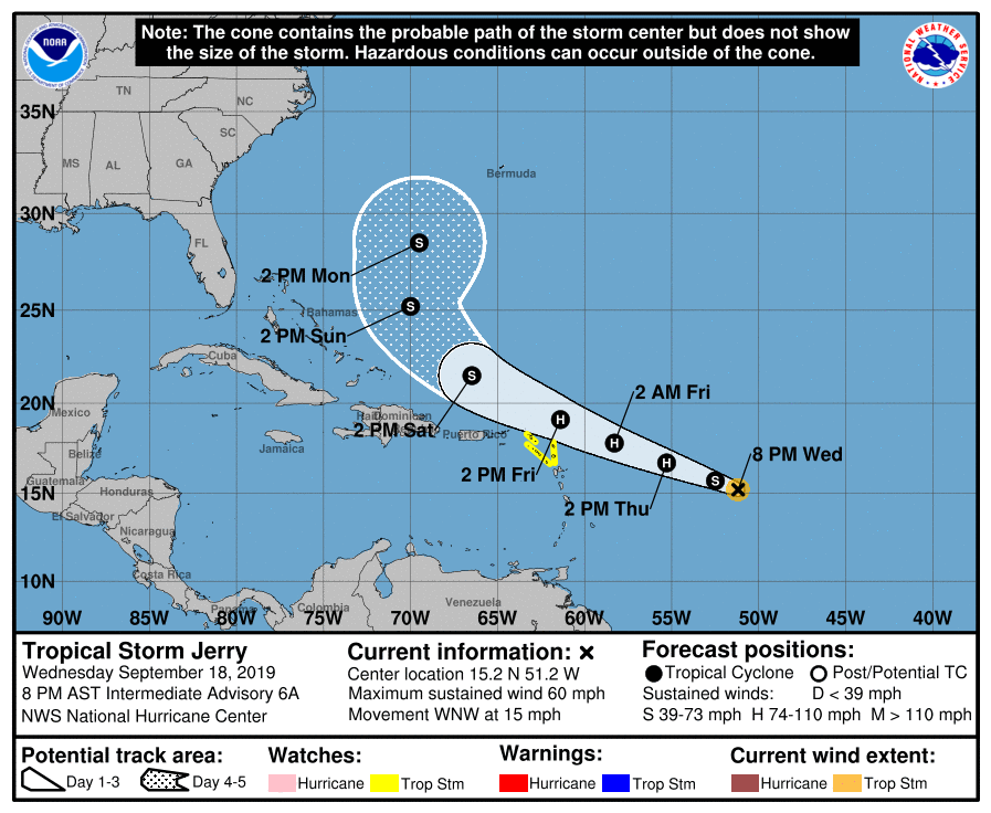
SUMMARY OF 10:00 PM CT
LOCATION…15.4N 51.8W
ABOUT 675 MI…1085 KM E OF THE LEEWARD ISLANDS
MAXIMUM SUSTAINED WINDS…65 MPH…100 KM/H
PRESENT MOVEMENT…WNW OR 290 DEGREES AT 15 MPH…24 KM/H
MINIMUM CENTRAL PRESSURE…997 MB…29.44 INCHES
A Tropical Storm Watch is in effect for Barbuda, Anguilla, St. Maarten, St. Martin, St. Barthelemy, Saba, and St. Eustatius.
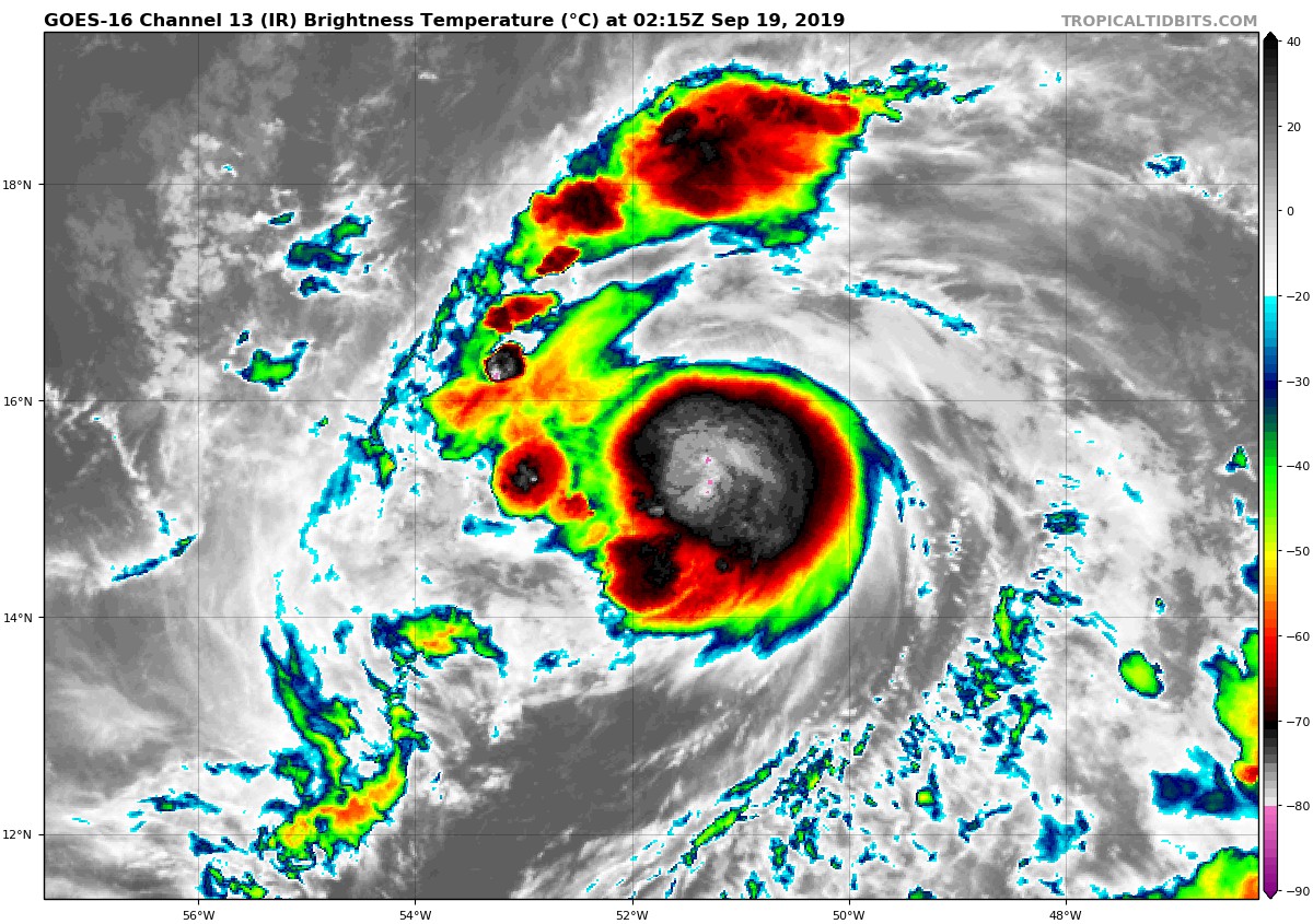
Jerry is gradually becoming better organized, with a small circular CDO and some banding features over its northwestern quadrant. Although the storm has some modest upper-level outflow, there is evidence of west-northwesterly winds undercutting the system just below the outflow layer. An upper-level cyclone is located a few hundred miles to the northwest of Jerry, as confirmed by synoptic surveillance observations taken recently by the NOAA G-IV jet. However, the global models suggest that this feature should remain far enough to the north of the tropical cyclone so that its shearing influence will be minimal in the short term. The current intensity estimate is 55 kt based on Dvorak classifications from TAFB and SAB. Since the environment is likely to be modestly conducive during the next day or so, strengthening is predicted for the next 24 hours. Thereafter, the dynamical guidance shows some increase in shear, which should result in a leveling off of Jerry’s intensity. Later in the forecast period, the global models predict a significant increase in shear, so some weakening is likely. The official intensity forecast is close to the multi-model consensus.
The storm remains on track with the motion continuing around 290/13 kt. There are no important changes to the track forecast from the previous advisory. Jerry should move along the southwestern periphery of a subtropical ridge over the next couple of days. In 3-5 days, the tropical cyclone is likely to turn northwest, north-northwest, and eventually north following a weakness in the ridge near 70-75W longitude. The official track forecast is close to the latest corrected multi-model consensus guidance.
Key Messages:
1. Jerry is expected to become a hurricane before it moves close to the northern Leeward Islands Friday. Although the core of Jerry is currently expected to pass north of the islands, tropical-storm-force winds and locally heavy rainfall are possible, and tropical storm watches have been issued for a portion of this area.
About the Author (Author Profile)
Scott Martin is an operational meteorologist, professional graphic artist, musician, husband, and father. Not only is Scott a member of the National Weather Association, but he is also the Central Alabama Chapter of the NWA president. Scott is also the co-founder of Racecast Weather, which provides forecasts for many racing series across the USA. He also supplies forecasts for the BassMaster Elite Series events including the BassMaster Classic.Subscribe
If you enjoyed this article, subscribe to receive more just like it.


