Center Of Humberto Now Moving Away From Bermuda

SUMMARY OF 10:00 PM CT
LOCATION…34.0N 63.9W
ABOUT 130 MI…205 KM NNE OF BERMUDA
MAXIMUM SUSTAINED WINDS…120 MPH…195 KM/H
PRESENT MOVEMENT…NE OR 55 DEGREES AT 23 MPH…37 KM/H
MINIMUM CENTRAL PRESSURE…952 MB…28.12 INCHES
The Bermuda Weather Service has changed the Hurricane Warning to a Tropical Storm Warning for Bermuda.
Normal communications with the Bermuda Weather Service have been restored. However, the weather radar on Bermuda is currently down.
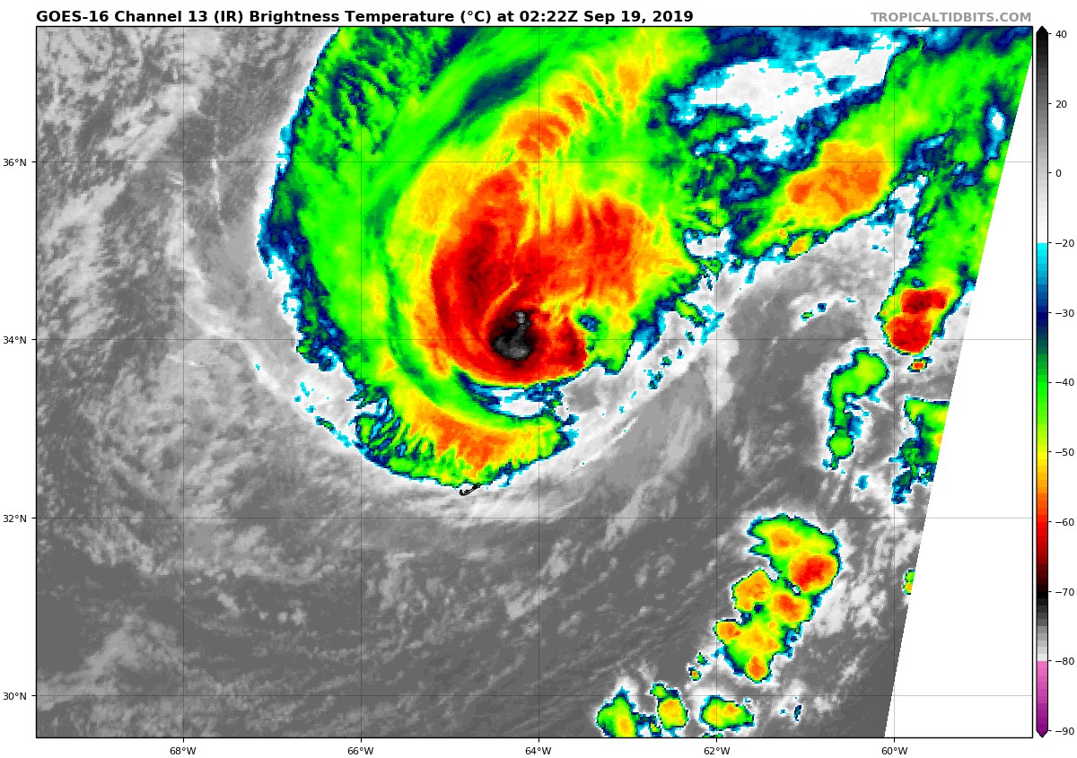
The center of Humberto made its closest approach to Bermuda a few hours ago, with many weather stations on the island reporting sustained hurricane force winds and gusts near or over 100 kt. Since that time, an Air Force Reserve Hurricane Hunter aircraft has arrived at the storm and reported little change in strength despite a decaying appearance in satellite imagery. The SFMR surface wind estimates were in the 100-105 kt range to the west of the center, and the central pressure was near 952 mb. Based on these data, the initial intensity is held at a possibly conservative 105 kt.
The decay in the satellite signature is due to Humberto starting to undergo extratropical transition, a process that the global models forecast to be complete by 36 h. Those models forecast that the cyclone should steadily weaken during and after the transition until it is absorbed by another low pressure system between 96-120 h, and the intensity forecast follows this scenario. The new intensity forecast is basically an update of the previous forecast, with a slightly faster decrease in intensity during the first 48 h.
The initial motion is now 055/20. Humberto is forecast to turn north-northeastward as it becomes extratropical, followed by a turn back toward the east-northeastward as the extratropical low is steered by the mid-latitude westerlies. The track guidance remains tightly clustered, and the new forecast track has only minor adjustments from the previous forecast.
Key Messages:
1. Tropical-storm conditions on Bermuda should subside during the next several hours.
2. Storm surge and dangerous breaking waves, while diminishing, could cause coastal flooding tonight and Thursday along the coast of Bermuda.
3. Swells will continue to affect the northwestern Bahamas and the southeastern coast of the United States from east-central Florida to North Carolina during the next couple of days, creating life-threatening surf and rip current conditions.
Category: ALL POSTS
About the Author (Author Profile)
Scott Martin is an operational meteorologist, professional graphic artist, musician, husband, and father. Not only is Scott a member of the National Weather Association, but he is also the Central Alabama Chapter of the NWA president. Scott is also the co-founder of Racecast Weather, which provides forecasts for many racing series across the USA. He also supplies forecasts for the BassMaster Elite Series events including the BassMaster Classic.Subscribe
If you enjoyed this article, subscribe to receive more just like it.


