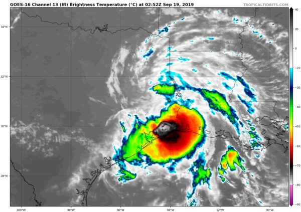
Imelda Continues To Bring Heavy Rains And Flash Flooding Potential To Parts Of Texas & Louisiana
SUMMARY OF 10:00 PM CT
LOCATION…31.2N 94.9W
ABOUT 110 MI…175 KM NNE OF HOUSTON TEXAS
ABOUT 100 MI…160 KM ENE OF COLLEGE STATION TEXAS
MAXIMUM SUSTAINED WINDS…30 MPH…45 KM/H
PRESENT MOVEMENT…NW OR 320 DEGREES AT 3 MPH…6 KM/H
MINIMUM CENTRAL PRESSURE…1008 MB…29.77 INCHES
Flash flood watches are in effect for parts of eastern Texas and extreme southwest Louisiana.
At 1000 PM CDT (0300 UTC), the center of Tropical Depression Imelda was located near latitude 31.2 North, longitude 94.9 West. The depression is moving toward the northwest near 3 mph (6 km/h). Imelda should continue to move slowly northwest with only a slight acceleration late on Thursday.
Maximum sustained winds are near 30 mph (45 km/h) with higher gusts. Little change in strength is forecast through the day on Thursday before weakening Thursday night and eventually dissipating on Friday.
The estimated minimum central pressure is 1008 mb (29.77 inches).
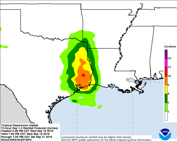
RAINFALL: Imelda is expected to produce the following rainfall amounts through Friday:
Across the Upper Texas Coast into the Piney Woods of eastern Texas…additional 5 to 10 inches of rain with isolated storm totals of 20 to 25 inches. Across portions of southwest Louisiana…4 to 8 inches with isolated totals of 10 inches.
These rainfall totals may produce significant to life threatening flash floods.


