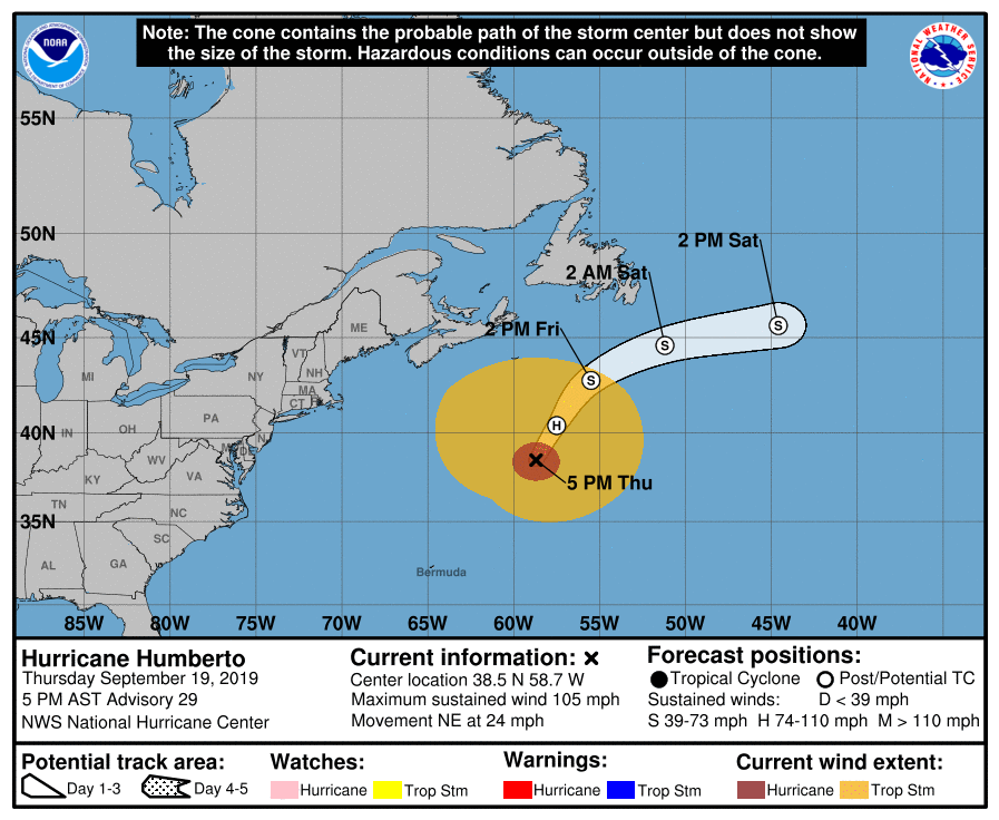
Humberto Expected To Become Post-Tropical Within The Next 6-12 Hours
SUMMARY & FORECAST DISCUSSION AS OF 4:00 PM CT
LOCATION…38.5N 58.7W
ABOUT 550 MI…885 KM NE OF BERMUDA
MAXIMUM SUSTAINED WINDS…105 MPH…165 KM/H
PRESENT MOVEMENT…NE OR 35 DEGREES AT 24 MPH…39 KM/H
MINIMUM CENTRAL PRESSURE…960 MB…28.35 INCHES
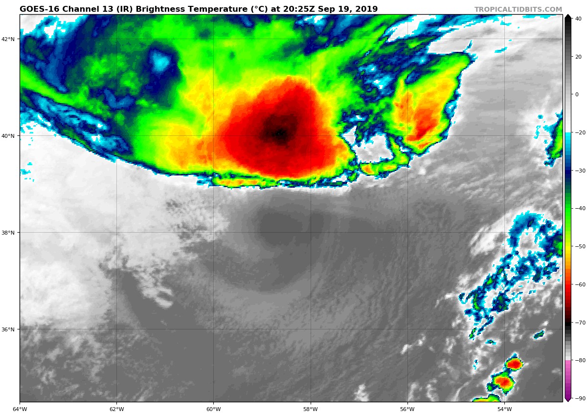
Humberto is almost a post-tropical cyclone. Satellite images show a well-defined cold and warm front, but they do not appear to be fully connected to the center of circulation yet. In addition, the cyclone is still producing an area of deep convection to the northwest of the exposed low-level center. ASCAT data from earlier today indicated that the wind field of Humberto is very large with tropical-storm-force winds extending up to 330 n mi from the center and hurricane-force winds extending out to 70 n mi from the center. The initial intensity is lowered a little to 90 kt for this advisory.
The cyclone is anticipated to become fully extratropical soon, within the next 6 to 12 hours. Although weakening is forecast, Humberto is expected to be a large and powerful extratropical cyclone for a couple of days before it is absorbed by another extratropical low over the north Atlantic. The NHC intensity forecast generally follows the guidance of the GFS model, which typically handles extratropical lows better than the tropical cyclone intensity guidance.
Humberto is moving northeastward at 21 kt. A slight turn to the left and a decrease in forward speed are expected during the next 12 to 24 hours as the cyclone rotates around the east and north sides of a mid- to upper-level low to its west. After that time, a faster east-northeast or east motion is expected when the cyclone becomes embedded in the mid-latitude westerlies. The NHC track forecast is largely an update of the previous one and near the various consensus aids.
Key Messages: Large swells will continue to affect Bermuda, the northwestern Bahamas, and the east coast of the United States from east-central Florida to the Mid-Atlantic States during the next couple of days. These swells could create life-threatening surf and rip current conditions.
About the Author (Author Profile)
Scott Martin is an operational meteorologist, professional graphic artist, musician, husband, and father. Not only is Scott a member of the National Weather Association, but he is also the Central Alabama Chapter of the NWA president. Scott is also the co-founder of Racecast Weather, which provides forecasts for many racing series across the USA. He also supplies forecasts for the BassMaster Elite Series events including the BassMaster Classic.Subscribe
If you enjoyed this article, subscribe to receive more just like it.


