Flooding Threat Continues in Parts of The Leeward Islands Due To Jerry
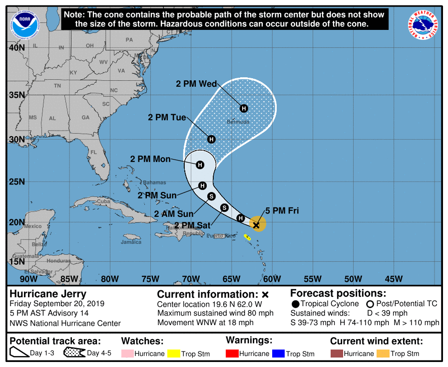
SUMMARY OF 4:00 PM CT
LOCATION…19.6N 62.0W
ABOUT 140 MI…225 KM N OF BARBUDA
ABOUT 120 MI…195 KM NE OF ANGUILLA
MAXIMUM SUSTAINED WINDS…80 MPH…130 KM/H
PRESENT MOVEMENT…WNW OR 295 DEGREES AT 18 MPH…30 KM/H
MINIMUM CENTRAL PRESSURE…991 MB…29.27 INCHES
A Tropical Storm Watch is in effect for St. Maarten, St. Martin, and St. Barthelemy. The government of the Netherlands has discontinued the Tropical Storm Watch for Saba and St. Eustatius.
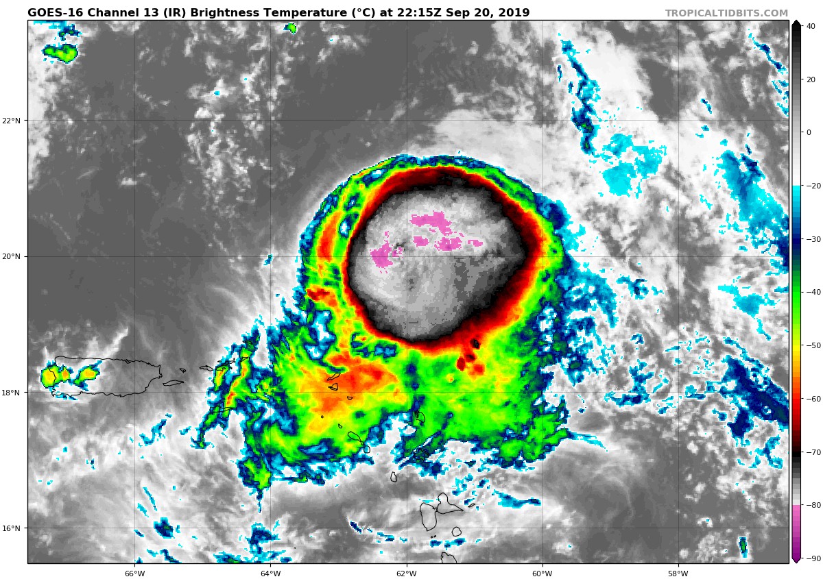
Satellite images indicate that deep convection has re-developed near and northeast of the center, with a new rainband also present in the southwest quadrant. Overall the degradation in satellite seen this morning has stopped, and that trend basically matches the last aircraft data from several hours ago. The initial wind speed is set to 70 kt on this advisory, and another Air Force Reserve Hurricane Hunter aircraft is scheduled to investigate the hurricane tonight.
Jerry has been moving a little faster today, west-northwestward at 16 kt, perhaps due to the system becoming a little shallower and feeling the faster low-level flow. There are no significant track changes to the NHC forecast this afternoon. The hurricane’s motion should gradually bend to the right and slow down during the next few days while the cyclone is steered around the western flank of a weakening subtropical ridge. At longer range, a mid-latitude trough will likely turn the hurricane northward and northeastward, but how quickly that occurs is an open question. The guidance spread has only increased this afternoon, although the model consensus hasn’t changed much, so the NHC forecast will hold the course on this advisory.
Northwesterly shear is forecast to persist near Jerry for the next day or so, and further weakening is expected. While the shear might not change much by late this weekend, a combination of very warm water and a more moist mid-level environment could sustain the cyclone and even allow some strengthening afterward. The long-range intensity forecast depends on the mid-latitude trough and whether it is a trough that tends to shear the cyclone, or whether it gives Jerry a baroclinic kick to increase the winds. I’m hesitant to change anything at this point given the huge track spread, so the latest intensity forecast is basically an update of the previous one, near or slightly above the model consensus.
Key Messages: Although the core of Jerry is expected to move north of the northern Leeward Islands, heavy rainfall and flash floods are possible there tonight.
About the Author (Author Profile)
Scott Martin is an operational meteorologist, professional graphic artist, musician, husband, and father. Not only is Scott a member of the National Weather Association, but he is also the Central Alabama Chapter of the NWA president. Scott is also the co-founder of Racecast Weather, which provides forecasts for many racing series across the USA. He also supplies forecasts for the BassMaster Elite Series events including the BassMaster Classic.Subscribe
If you enjoyed this article, subscribe to receive more just like it.


