Lorenzo Moving West-Northwest Over The Eastern Tropical Atlantic
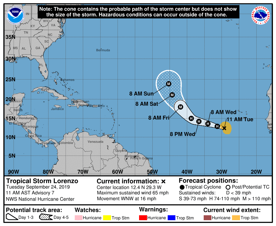
SUMMARY OF 10:00 AM CDT
LOCATION…12.4N 29.3W
ABOUT 370 MI…595 KM WSW OF THE SOUTHERNMOST CABO VERDE ISLANDS
MAXIMUM SUSTAINED WINDS…65 MPH…100 KM/H
PRESENT MOVEMENT…WNW OR 285 DEGREES AT 16 MPH…26 KM/H
MINIMUM CENTRAL PRESSURE…997 MB…29.44 INCHES
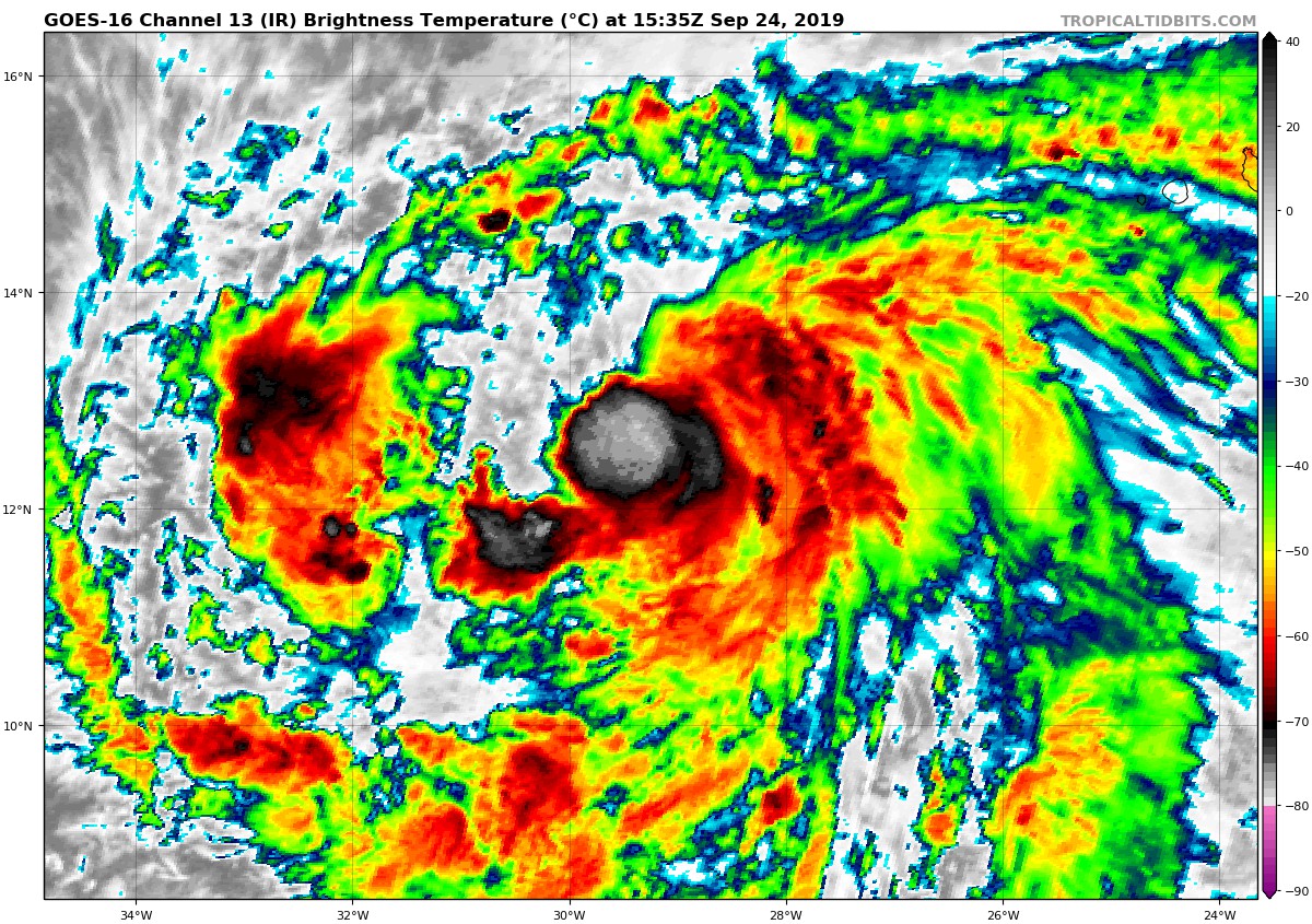
Lorenzo’s structure has not changed much during the morning. A small central dense overcast continues over the center with multiple curved bands within the circulation. A recent ASCAT pass showed winds just over 45 kt to the north of the center, but given sampling considerations, the initial intensity remains 55 kt, which matches Dvorak classifications provided by TAFB and SAB.
Despite the brief interruption in the strengthening trend, sufficiently warm waters, low shear, and an ambient moist air mass should foster intensification during the next several days. Because Lorenzo has not strengthened further since the previous advisory, the persistence factor has caused the Rapid Intensification (RI) Index (a 25-kt increase in 24 hours) to drop from 53 percent to 23 percent. In addition, the overall guidance envelope is showing slightly lower peak intensities in 3-4 days. The NHC intensity forecast remains near the upper edge of the guidance for much of the forecast period, lying closest to the HWRF and the Florida State Superensemble. RI is still a possibility, but as of yet we have not observed a low-level cyan ring in 37-GHz microwave imagery, which is usually a harbinger of an RI episode.
The initial motion remains west-northwestward, or 285/14 kt. Lorenzo is located to the south of a mid-level ridge which extends from Morocco and Madeira Island westward to 40W. Ridging is relatively non-existent west of 40W due to a mid-/upper-level low over the central Atlantic and Tropical Storm Jerry over the western Atlantic. With this pattern in place, Lorenzo is expected begin recurving around the ridge axis over the central Atlantic on days 3-5. During that period, the track guidance envelope is bracketed by the easternmost GFS and westernmost ECMWF models, which are about 350 nm apart on day 5. This spread isn’t too significant, and the updated NHC track forecast is only shifted slightly eastward from the previous one, very close to the two corrected consensus aids.
About the Author (Author Profile)
Scott Martin is an operational meteorologist, professional graphic artist, musician, husband, and father. Not only is Scott a member of the National Weather Association, but he is also the Central Alabama Chapter of the NWA president. Scott is also the co-founder of Racecast Weather, which provides forecasts for many racing series across the USA. He also supplies forecasts for the BassMaster Elite Series events including the BassMaster Classic.Subscribe
If you enjoyed this article, subscribe to receive more just like it.


