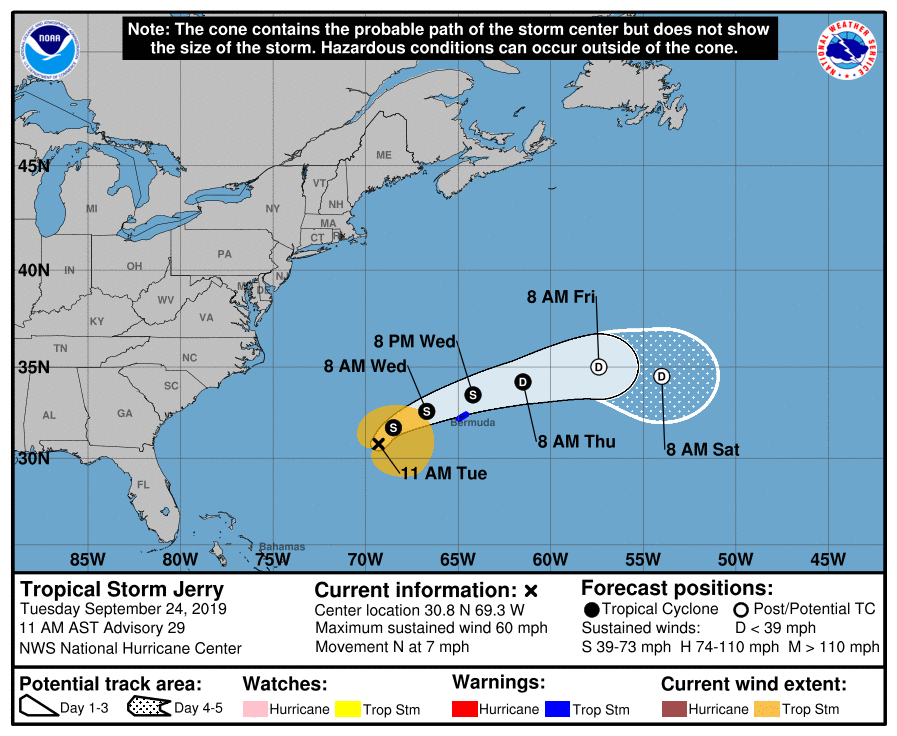
Jerry Expected To Bring Tropical Storm Conditions To Bermuda On Wednesday
SUMMARY OF 10:00 AM CDT
LOCATION…30.8N 69.3W
ABOUT 285 MI…460 KM WSW OF BERMUDA
MAXIMUM SUSTAINED WINDS…60 MPH…95 KM/H
PRESENT MOVEMENT…N OR 350 DEGREES AT 7 MPH…11 KM/H
MINIMUM CENTRAL PRESSURE…991 MB…29.27 INCHES
A Tropical Storm Warning is in effect for Bermuda.
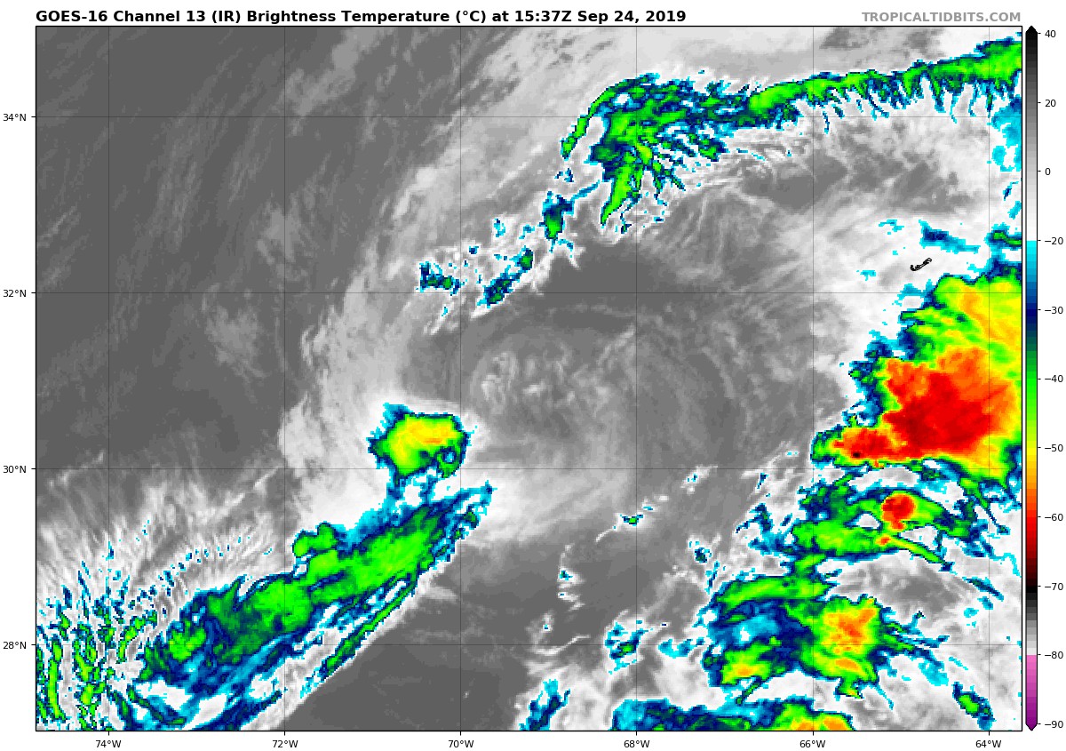
Jerry’s interaction with an upper-level trough has resulted in a system that is less tropical in appearance, with a lack of central convection and most of the heavier showers displaced to the west and well southeast of the center. In fact, the cyclone looks somewhat subtropical at this time. For simplicity, however, we will continue to carry Jerry as a tropical storm. Flight-level winds from an Air Force Reserve Unit Hurricane Hunter plane still support an intensity of 50 kt. Jerry will be encountering an increasingly unfavorable environment during the next few days, with the ambient air mass becoming drier and vertical shear becoming stronger. The official intensity forecast calls for continued weakening and degeneration to a remnant low later in the forecast period. This is similar to the consensus of the model guidance.
Based on fixes from the Hurricane Hunters, the center has moved a little to the left of previous estimates, and the initial motion estimate is 350/6 kt. There are no significant changes to the track forecast philosophy, however. Over the next couple of days Jerry should turn northeastward and then east-northeastward in the flow to the south of a broad mid-latitude trough. Later in the period, the weakening cyclone should move eastward to east-southeastward on the northeast side of a subtropical anticyclone. The official track forecast is close to the previous one and in general agreement with the corrected multi-model consensus guidance.
Key Messages: Tropical-storm-force winds are expected on Bermuda by tonight or early Wednesday. Large swells are also expected to affect the coast of Bermuda during the next few days. These swells could cause life-threatening rip currents. See products issued by the Bermuda Weather Service for more information.
About the Author (Author Profile)
Scott Martin is an operational meteorologist, professional graphic artist, musician, husband, and father. Not only is Scott a member of the National Weather Association, but he is also the Central Alabama Chapter of the NWA president. Scott is also the co-founder of Racecast Weather, which provides forecasts for many racing series across the USA. He also supplies forecasts for the BassMaster Elite Series events including the BassMaster Classic.Subscribe
If you enjoyed this article, subscribe to receive more just like it.


