A Brief Shower Or Two Out There At Midday
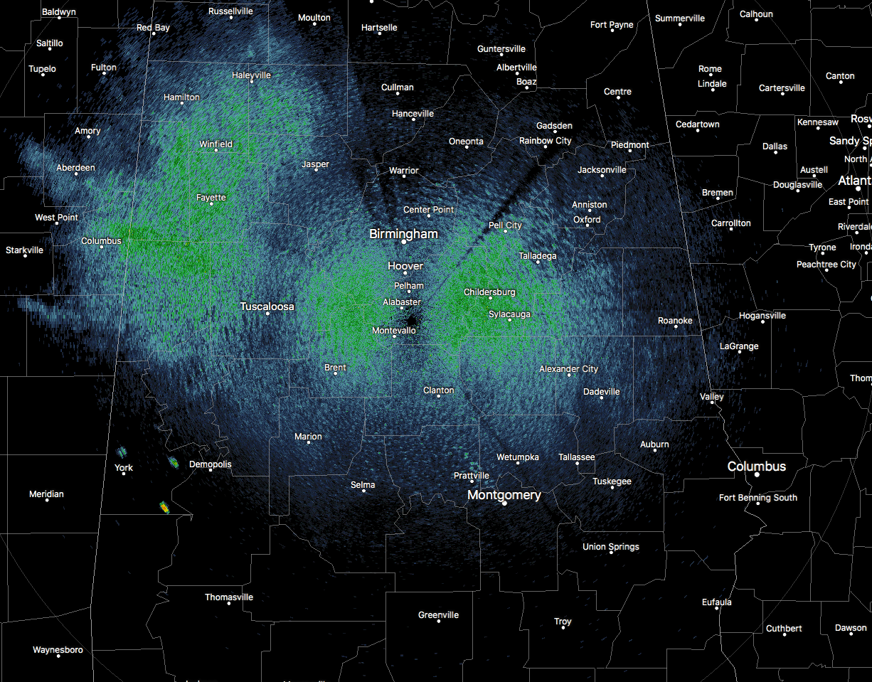
AT 11:50 AM CDT: While there looks to be rain on the radar all across Central Alabama, most of that is a false return that normally happens in an airmass as we have right now with the radar set in precipitation mode. It looks like the only true showers on radar at this point are over portions of Sumter County. The rest of Central Alabama is dry at this point. Temperatures were in the mid-80s to the lower 90s across the area at this point. The cool spot was Haleyville at 84 degrees. Birmingham was at 88 degrees. Several locations were tied as the warm spots at 90 degrees.
REST OF TODAY: A cold front continues to move southward through the area and will allow for a very small chance of isolated to scattered showers and storms in the southern half of the area, with the higher chances being located south of a line from Eutaw to Prattville to Goshen (Pike Co.). For the northern half of the area, skies will be mainly clear with no chance of rain today. Afternoon highs will be in the upper 80s to the mid-90s across the area. Any activity should diminish rapidly at or just after sunset and we’ll be left with some clouds through midnight. After that, skies will clear out and lows will fall into the upper 50s to the upper 60s across the area.
WEDNESDAY’S WEATHER: Another cold front will begin to move southward toward the state, but it will stay well to our north. There is a very small risk of an isolated shower or storm over the extreme northwest corner of Central Alabama during the afternoon, but the rest of the area will stay mainly sunny and hot. Afternoon highs will top out in the lower to mid-90s.
THURSDAY & FRIDAY’S WEATHER: The cold front never makes it into the state on Thursday and will actually be heading northward as a warm front away from us on Friday. With that being said, there will be a very small risk of an afternoon isolated shower or storm for the northern third of Central Alabama on Thursday and for the extreme northeastern parts of the area on Friday. For the rest of the area, we’ll be mainly sunny and dry with highs reaching the lower to mid-90s on both days. A few upper 90s may be seen on Friday in the southern parts of the area.
THE CENTRAL ALABAMA WEEKEND: No rain insight as we can continue to expect plenty of sunshine and more dry weather. Afternoon highs will mainly be in the mid to the upper 90s across the area. The same can be said for the start of the next work week… hot and dry with highs in the mid to the upper 90s.
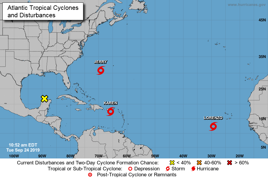
TROPICS: Tropical Storm Jerry is headed away from the US mainland and back out to the open water of the Atlantic, but it will pass to the north of Bermuda on Wednesday bringing tropical storm conditions through the day. A tropical storm warning is in effect for the entire island. Large waves and life-threatening rip currents will affect the island over the next few days. The good news is that Jerry will be in a weakening trend through the next few days until it is expected to become post-tropical on Friday.
Tropical Storm Lorenzo is expected to become a strong hurricane within a few days but the good news is that it will be a fish storm and not affect any land. The latest forecast track has Lorenzo curving back to the north into the middle of the Atlantic.
Tropical Storm Karen is in the process of moving over Puerto Rico and The Virgin Islands at this point with maximum sustained winds at 40 MPH. Tropical Storm Warnings are up for the U.S. Virgin Islands, Puerto Rico, including Vieques and Culebra, and for the British Virgin Islands. The official forecast track has Karen moving north-northeastward until the end of the workweek until making a hard left turn on Late Friday or early Saturday. Several ensemble members have Karen moving westward toward the east coast of the southeastern US with a few of those crossing over the Florida peninsula and into the Gulf of Mexico. That is way too far out into Voodoo Land to be certain, but that idea is on the board. We’ll have to watch to see what Karen will do after the next five days.
Category: Alabama's Weather, ALL POSTS, Tropical
About the Author (Author Profile)
Scott Martin is an operational meteorologist, professional graphic artist, musician, husband, and father. Not only is Scott a member of the National Weather Association, but he is also the Central Alabama Chapter of the NWA president. Scott is also the co-founder of Racecast Weather, which provides forecasts for many racing series across the USA. He also supplies forecasts for the BassMaster Elite Series events including the BassMaster Classic.Subscribe
If you enjoyed this article, subscribe to receive more just like it.


