Karen Moving Northeastward; Heavy Squalls Continue Over Puerto Rico & The Virgin Islands
SUMMARY OF 700 PM CDT
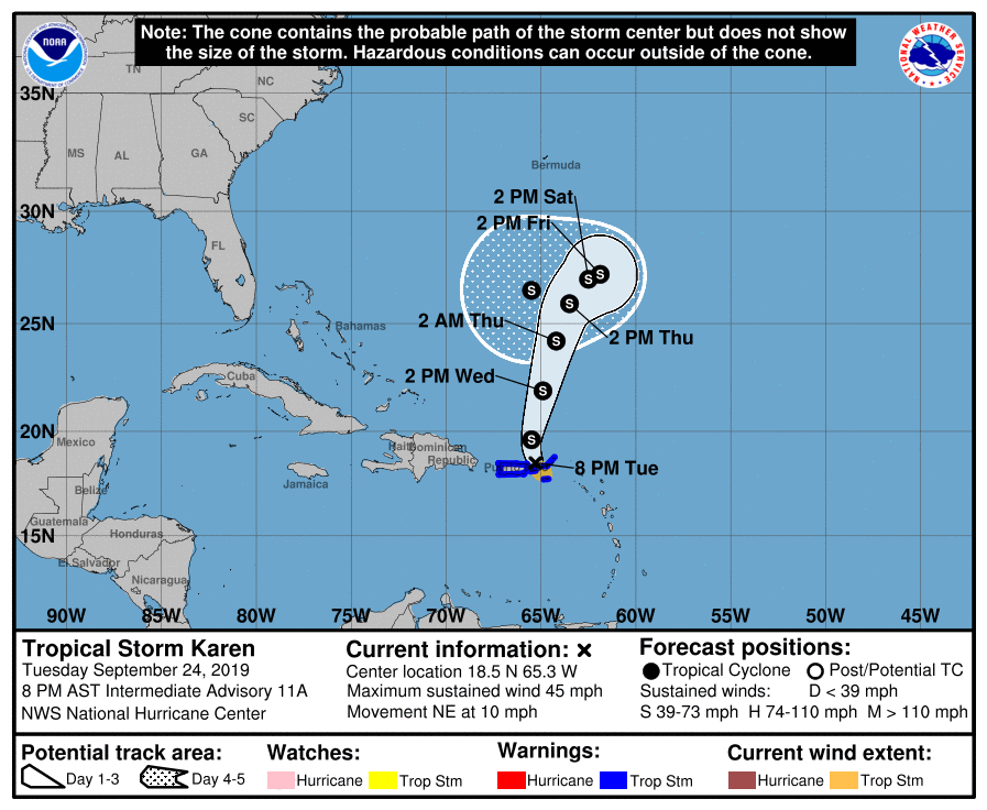
LOCATION…18.5N 65.3W
ABOUT 45 MI…75 KM E OF SAN JUAN PUERTO RICO
ABOUT 10 MI…20 KM N OF CULEBRA
MAXIMUM SUSTAINED WINDS…45 MPH…75 KM/H
PRESENT MOVEMENT…NE OR 045 DEGREES AT 10 MPH…16 KM/H
MINIMUM CENTRAL PRESSURE…1003 MB…29.62 INCHES
Tropical Storm Warnings continue for the U.S. Virgin Islands, Puerto Rico, including Vieques and Culebra, and the British Virgin Islands.
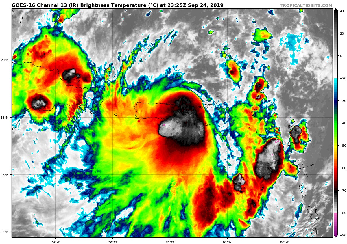
Surface observations indicate that the broad circulation center of Karen moved near or over the islands of Vieques and Culebra during the past hour or so. At 800 PM AST (0000 UTC), the center of Tropical Storm Karen was estimated near latitude 18.5 North, longitude 65.3 West. Karen has been moving toward the northeast near 10 mph (16 km/h). However, Karen should move toward the north-northeast with some increase in forward speed tonight, with this motion continuing through Wednesday night. On the forecast track, the center of Karen will move away from Puerto Rico and the Virgin Islands during the next few hours, but the strong squalls which are to the south of the center will continue to affect that area through tonight. Karen should move over the western Atlantic later tonight and Wednesday.
Data from an Air Force reconnaissance plane indicate that the maximum sustained winds remain near 45 mph (75 km/h) with higher gusts. These winds are confined mostly to the southeast of the center. Some strengthening is possible during the next couple of days. Tropical-storm-force winds extend outward up to 80 miles (130 km) mainly to the southeast of the center. St. Thomas has recently reported a wind gust of 43 mph (69 km/h). The estimated minimum central pressure from surface observations and data from a reconnaissance plane is 1003 MB (29.62 inches).
HAZARDS AFFECTING LAND
RAINFALL: Karen is expected to produce the following rainfall accumulations through Wednesday…
Puerto Rico and the Virgin Islands: 3 to 6 inches, isolated 10 inches. Leeward Islands: 1 to 3 inches, isolated 5 inches. These rains may cause flash flooding and mudslides, especially in mountainous areas.
WIND: Tropical-storm-force winds, especially in gusts, are currently spreading across the warning area. Winds could be higher on the windward sides of hills and mountains, and also in elevated terrain.
About the Author (Author Profile)
Scott Martin is an operational meteorologist, professional graphic artist, musician, husband, and father. Not only is Scott a member of the National Weather Association, but he is also the Central Alabama Chapter of the NWA president. Scott is also the co-founder of Racecast Weather, which provides forecasts for many racing series across the USA. He also supplies forecasts for the BassMaster Elite Series events including the BassMaster Classic.Subscribe
If you enjoyed this article, subscribe to receive more just like it.


