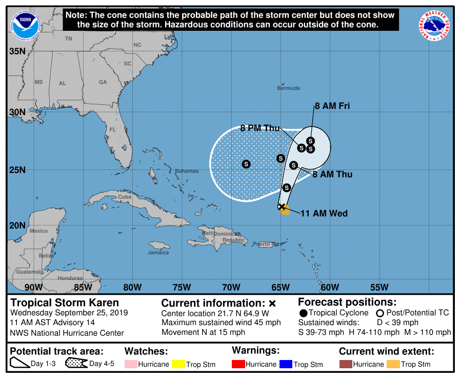
Center Of Karen Moving Northward Over The Southwestern Atlantic
Heavy Rains Continue Over Puerto Rico, The Virgin Islands, And Portions Of The Northern Leeward Islands
SUMMARY OF 1000 AM CDT INFORMATION
LOCATION…21.7N 64.9W
ABOUT 240 MI…385 KM NNE OF SAN JUAN PUERTO RICO
MAXIMUM SUSTAINED WINDS…45 MPH…75 KM/H
PRESENT MOVEMENT…N OR 360 DEGREES AT 15 MPH…24 KM/H
MINIMUM CENTRAL PRESSURE…1003 MB…29.62 INCHES
There are no coastal watches or warnings in effect.
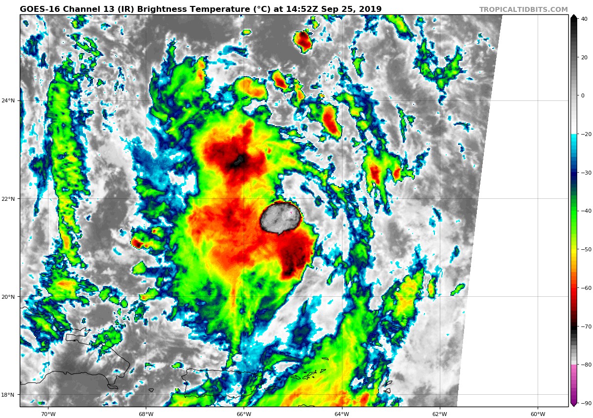
Karen is still having a tough time establishing and maintaining a well-organized structure. The deep convection which developed over the center earlier this morning has since collapsed, leaving a ragged and disorganized cloud pattern. In addition, a sizable outflow boundary moving away from the eastern part of the circulation suggests that there is dry air within the vortex. The initial intensity is being held at 40 kt, pending possible scatterometer data later this morning and a reconnaissance flight this afternoon.
The initial position is a little difficult to locate, but the best estimate of the current motion is 360/13 kt. Karen is moving northward between a mid-level high centered over the central Atlantic and a mid- to upper-level low located just east of the Bahamas. This low is expected to slowly retrograde westward, with ridging developing over the western Atlantic by day 3. This change in steering will cause Karen to turn northeastward during the next 48 hours but then make a clockwise loop once it is blocked by the ridge. After day 3, the ridge should force Karen to move west-southwestward. Most of the track models agree on this general scenario. There is some latitudinal spread on days 4 and 5 after the loop occurs, with the HWRF being the most notable outlier by not showing much of a westward motion. The consensus aids, however, have remained fairly steady, and therefore there was no compelling reason to make any significant changes compared to the previous track forecast.
Except for the possibility of dry air in the circulation, it’s not quite evident why Karen has not been able to sustain organization. Still, the cyclone is expected to move beneath an upper-level anticyclone during the next 24-48 hours, and if the shear does indeed decrease, then some strengthening would be expected. There continues to be a dichotomy among the intensity models, with the dynamical models (including the GFS and ECMWF) keeping the cyclone weak while the statistical-dynamical models still show intensification through days 4 and 5. It’s difficult to ignore what’s being shown by the global models since there must be something in the environment that they’re deeming to be negative for continued strengthening. The best course of action at this point is to maintain a steady intensity after 48 hours, but it should be noted that what is shown in the official forecast still lies above the ICON intensity consensus and the HCCA corrected consensus aid.
Key Messages: Karen will continue to produce heavy rainfall, potentially causing additional flash floods and mudslides, across Puerto Rico and the Virgin Islands today even as the center moves away from the region.
About the Author (Author Profile)
Scott Martin is an operational meteorologist, professional graphic artist, musician, husband, and father. Not only is Scott a member of the National Weather Association, but he is also the Central Alabama Chapter of the NWA president. Scott is also the co-founder of Racecast Weather, which provides forecasts for many racing series across the USA. He also supplies forecasts for the BassMaster Elite Series events including the BassMaster Classic.Subscribe
If you enjoyed this article, subscribe to receive more just like it.


