Post-Tropical Cyclone Jerry Will Pass Near Bermuda Today
SUMMARY OF 700 AM CDT INFORMATION
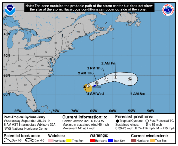
LOCATION…32.0N 67.4W
ABOUT 155 MI…245 KM W OF BERMUDA
MAXIMUM SUSTAINED WINDS…45 MPH…75 KM/H
PRESENT MOVEMENT…NE OR 55 DEGREES AT 7 MPH…11 KM/H
MINIMUM CENTRAL PRESSURE…997 MB…29.44 INCHES
A Tropical Storm Warning continues for Bermuda.
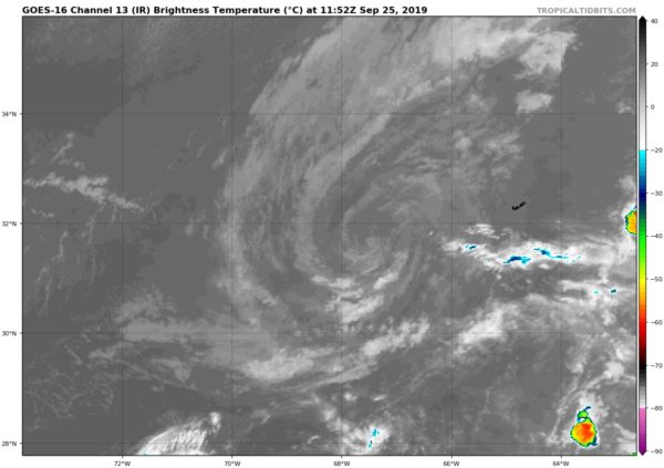
At 700 AM CDT (1200 UTC), the center of Post-Tropical Cyclone Jerry was located near latitude 32.0 North, longitude 67.4 West. The post-tropical cyclone is moving toward the northeast near 7 mph (11 km/h). A continued northeasterly motion is expected through today, followed by a turn toward the east on Thursday. On the forecast track, the center of Jerry is expected to pass near Bermuda later today.
Maximum sustained winds are near 45 mph (75 km/h) with higher gusts. Gradual weakening is expected during the next few days. Tropical-storm-force winds extend outward up to 140 miles (220 km) from the center. The estimated minimum central pressure is 997 MB (29.44 inches).
HAZARDS AFFECTING LAND
WIND: Tropical storm conditions are expected on Bermuda by this afternoon and could continue through this evening.
RAINFALL: Jerry is expected to produce 1 inch or less of rainfall across Bermuda through tonight.
SURF: Swells generated by Jerry will continue to affect Bermuda during the next few days. These swells are likely to cause life-threatening surf and rip current conditions.


