Lorenzo Continues To Strengthen; Expected To Become A Major Hurricane By Thursday
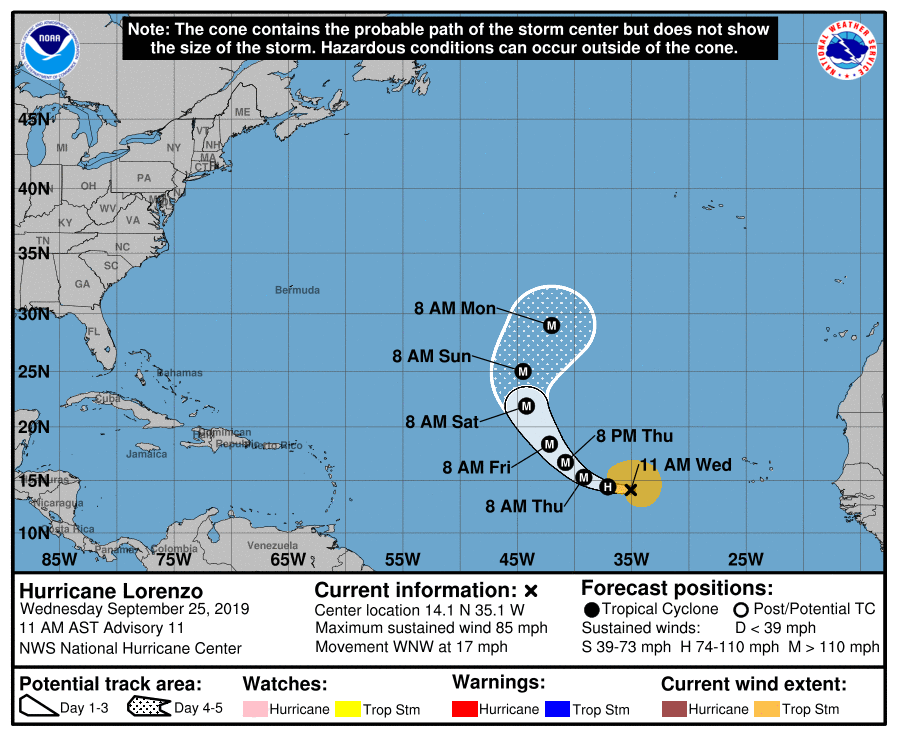
SUMMARY OF 1000 AM CDT INFORMATION
LOCATION…14.1N 35.1W
ABOUT 715 MI…1155 KM W OF THE SOUTHERNMOST CABO VERDE ISLANDS
MAXIMUM SUSTAINED WINDS…85 MPH…140 KM/H
PRESENT MOVEMENT…WNW OR 285 DEGREES AT 17 MPH…28 KM/H
MINIMUM CENTRAL PRESSURE…983 MB…29.03 INCHES
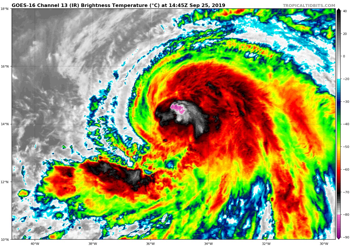
Conventional satellite imagery indicates that Lorenzo continues to become better organized, with a small central convective feature surrounded by a large complex of outer bands in all quadrants except the northwest, where some dry air may be entraining. Satellite intensity estimates from TAFB, SAB, and the CIMMS satellite consensus technique have increased to near 75 kt, and that will be the initial intensity for this advisory. The hurricane currently has good cirrus outflow in all directions.
The initial motion is 285/15. The subtropical ridge to the north and northeast of Lorenzo should steer the hurricane west-northwestward for the next day or so, followed by a turn toward the northwest as a break develops in the ridge between 45W-50W. Lorenzo is subsequently forecast to turn northward into the break by 96 h and recurve into the westerlies around 120 h. While the guidance agrees with this scenario, there is some spread on the longitude of the recurvature between the easternmost GFS model and the westernmost ECMWF model. The new forecast lies between these models in the best overall agreement with the HCCA corrected consensus guidance.
Lorenzo should remain over warm water and in a light shear environment during the next three days, with the only negative factor for intensification being episodic intrusions of dry air. The intensity guidance forecasts continued steady strengthening, with rapid strengthening possible during the first 24-36 h. The new intensity forecast is increased from the previous forecast, and for the first 36-48 h it lies near the upper edge of the intensity guidance. The intensity forecast shows little change in strength between 36-72 h, although some fluctuations in intensity are likely due to eyewall replacement cycles during this time. After 72 h, Lorenzo is likely to encounter some southwesterly shear, and thus some weakening is forecast.
About the Author (Author Profile)
Scott Martin is an operational meteorologist, professional graphic artist, musician, husband, and father. Not only is Scott a member of the National Weather Association, but he is also the Central Alabama Chapter of the NWA president. Scott is also the co-founder of Racecast Weather, which provides forecasts for many racing series across the USA. He also supplies forecasts for the BassMaster Elite Series events including the BassMaster Classic.Subscribe
If you enjoyed this article, subscribe to receive more just like it.


