Another Hot Midday, Even Though It Is Fall
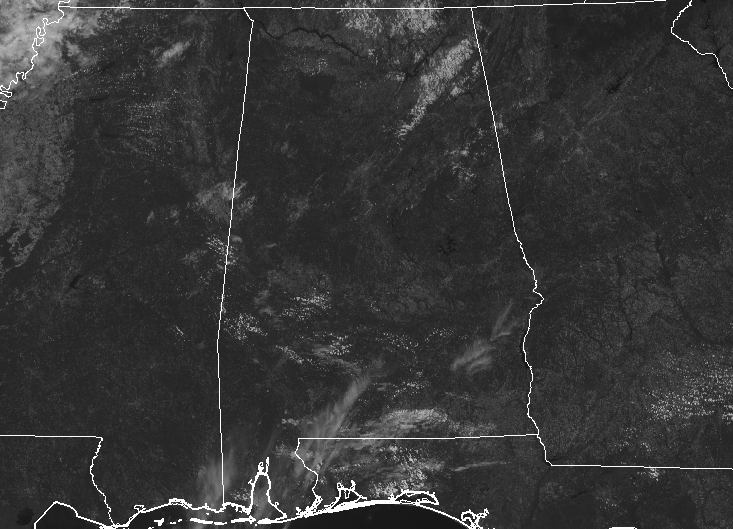
At 11:40 am on this very warm Wednesday, skies are mainly clear across Central Alabama as we have a ridge of high pressure settled on top of us. That ridging is allowing temperatures to rise into the mid-80s to the lower 90s at this time. Birmingham was at 90 degrees. The cool spot was Gadsden at 84 degrees. The hot spot was Uniontown at 93 degrees.
WEATHER FOR THE REST OF YOUR HUMP DAY
We’ll continue to have mostly clear skies over the eastern half of the area while we could have a few extra clouds build over the western half with the heating of the day. With those extra clouds, we may see a few isolated showers or thunderstorms this afternoon over the western-third of the area, but the rest of Central Alabama will remain hot and dry. Afternoon highs will be in the lower to mid-90s. All activity will diminish quickly after sunset, but there is a very small chance that a lingering shower or two may persist until the late-night hours. We’ll be dry for the overnight and lows will be in the upper 60s to the lower 70s.
THURSDAY MAY INVOLVE A FEW SHOWERS
The main focus on that headline is “few.” A cold front will be pushing very slowly southward toward the northern parts of Alabama which may bring just enough moisture and lift for a few isolated to scattered showers and thunderstorms to form over the northeastern and eastern parts of Central Alabama. The rest of the area will stay dry. Afternoon highs will be in the lower to mid-90s with a few locations getting into the upper 90s briefly.
THE TROPICS
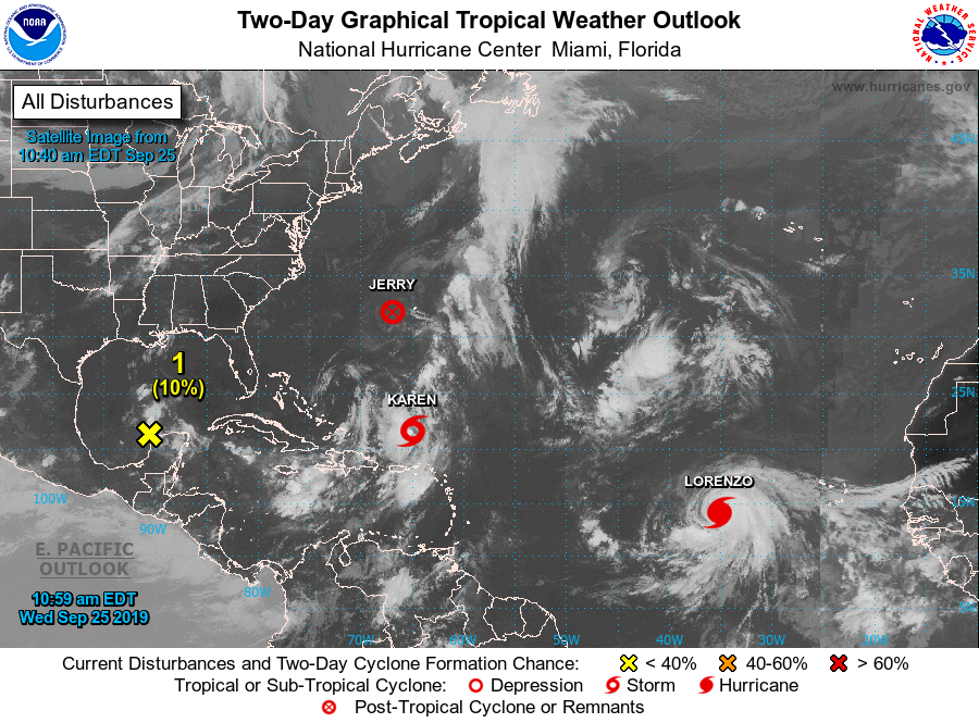
Jerry is no longer tropical in nature and is passing by Bermuda as I type. Some gusty winds and periods of tropical rain can be expected through the rest of the day. Tropical storm warnings do remain in effect for the entire island.
Hurricane Lorenzo continues to strengthen and is forecast to become a major hurricane at some point during the day on Thursday. Lorenzo will curve off to the north well away from any land and will just be a hindrance to the fishes of the sea.
Tropical Storm Karen will be the one we’ll need to watch, especially during next week. The official forecast path has Karen making a loop out in the Atlantic then heading westward starting on Friday night or on Saturday morning. Several ensemble members continue to show Karen heading westward through the end of the model run, but the model mean shows Karen eventually moving back to the northwest and north away from land. Needless to say, there is a lot of uncertainty after the next five days.
We also have a disturbance just off of the Yucatan Peninsula that has a very small risk of development before moving onshore on the east coast of Mexico by Saturday. No threat to the US.
Category: Alabama's Weather, ALL POSTS, Tropical
About the Author (Author Profile)
Scott Martin is an operational meteorologist, professional graphic artist, musician, husband, and father. Not only is Scott a member of the National Weather Association, but he is also the Central Alabama Chapter of the NWA president. Scott is also the co-founder of Racecast Weather, which provides forecasts for many racing series across the USA. He also supplies forecasts for the BassMaster Elite Series events including the BassMaster Classic.Subscribe
If you enjoyed this article, subscribe to receive more just like it.


