Lorenzo Remains A Major Hurricane, Now Moving Northward
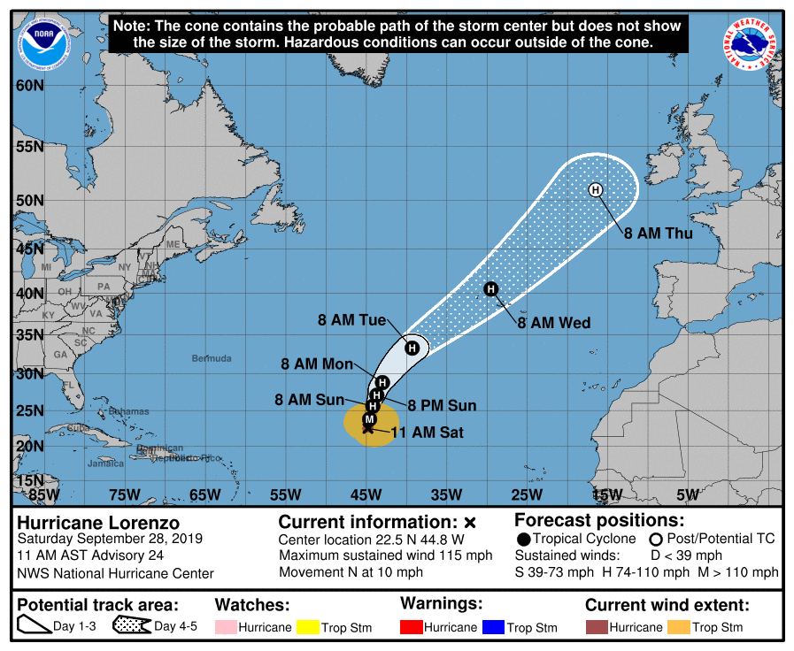
SUMMARY OF 10:00 AM CDT INFORMATION
LOCATION…22.5N 44.8W
ABOUT 1500 MI…2415 KM SW OF THE AZORES
MAXIMUM SUSTAINED WINDS…115 MPH…185 KM/H
PRESENT MOVEMENT…N OR 350 DEGREES AT 10 MPH…17 KM/H
MINIMUM CENTRAL PRESSURE…957 MB…28.26 INCHES
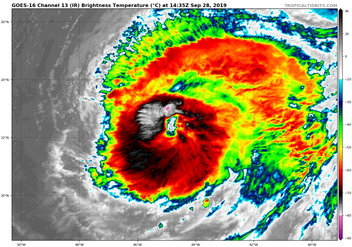
Lorenzo appears to be in the final stages of an eyewall replacement. 37-GHz GCOM imagery from overnight suggested that a smaller inner eyewall was embedded within a larger eye, and the new eyewall now extends 40-45 n mi from the center of circulation. An eye has also reappeared in GOES-16 visible and infrared satellite imagery during the past several hours. Based on Dvorak intensity estimates of T5.5/102 kt from TAFB and SAB, and an ADT estimate of T5.3/97 kt, Lorenzo’s intensity is still estimated to be 100 kt.
Although the hurricane seems to be wobbling a bit, fixes indicate that it has generally turned northward with an initial motion of 350/9 kt. The track forecast remains straightforward, with very little spread among the models and their ensembles. Lorenzo is expected to be nudged north-northeastward and then northeastward starting in 36 hours by strong ridging building over the western Atlantic. The northeastward motion is expected to increase on day 3 when Lorenzo is picked up by a strong deep-layer trough over the North Atlantic, and that acceleration is forecast to continue through day 5. The NHC track forecast lies near the consensus aids and is very similar to the previous forecast.
A little bit of west-southwesterly shear continues over Lorenzo, but it’s not strong enough to disrupt the circulation significantly. Only a very slow, gradual weakening is forecast during the next 3 days, matching what is indicated by many of the intensity models. Extratropical transition is expected to have begun by day 4 while Lorenzo is moving near the Azores, but that process is not expected to be complete until day 5. Although Lorenzo’s winds are forecast to decrease a bit during the extratropical transition due to stronger shear and cold waters, the cyclone is expected to maintain hurricane-force winds through the end of the forecast period.
Lorenzo’s wind field will remain large, and the hurricane-force wind radii are expected to grow in size during the next couple of days. In addition, large swells continue to radiate outward away from the hurricane and will reach much of the western and northern side of the Atlantic basin in a few days.
About the Author (Author Profile)
Scott Martin is an operational meteorologist, professional graphic artist, musician, husband, and father. Not only is Scott a member of the National Weather Association, but he is also the Central Alabama Chapter of the NWA president. Scott is also the co-founder of Racecast Weather, which provides forecasts for many racing series across the USA. He also supplies forecasts for the BassMaster Elite Series events including the BassMaster Classic.Subscribe
If you enjoyed this article, subscribe to receive more just like it.


