A Few Strong Storms This Afternoon.
Thunderstorms have been active across Alabama this afternoon and the ridge of high pressure is breaking down across our state. The low-level ridge is now centered from off Maine to near Northeast Florida.
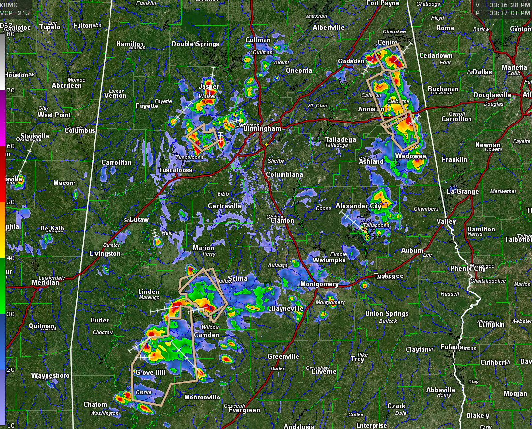
Low-level southeasterly flow around the backside of the high has created a couple of convergence zones across Central Alabama, with two areas of showers and storms, one northwest of Birmingham and one southeast.
The northernmost line extends from Cullman County down through Walker County into western Jefferson and northeastern Tuscaloosa counties. The biggest concentration is between Jasper and Brookwood. There is a significant weather advisory for northeastern Tuscaloosa County.
To the south, showers and storms extend from Cherokee, Calhoun and Cleburne Counties, into Tallapoosa County. Several significant weather advisories are in effect for these storms, which are the strongest in the state.
Others extend from the Montgomery area westward through Autauga, Dallas, and Butler Counties, into Clarke County. More significant weather alerts over areas from southwest of Selma to near Grove Hill in Clarke County.
Expect lots of lightning and brief heavy rain with the stronger activity.
Movement is slowly to the north northwest at about 15 mph.
Category: Alabama's Weather, ALL POSTS
About the Author (Author Profile)
Bill Murray is the President of The Weather Factory. He is the site's official weather historian and a weekend forecaster. He also anchors the site's severe weather coverage. Bill Murray is the proud holder of National Weather Association Digital Seal #0001 @wxhistorianSubscribe
If you enjoyed this article, subscribe to receive more just like it.


