Midday Nowcast: Fantastic Fall Weather
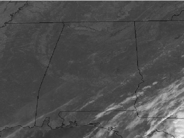
Our Tuesday has featured a clearing sky as drier moves into the state, and we also have breezy northwest winds at times today in the 10-20 mph range. This afternoon, we are seeing a sunny sky with temperatures in the upper 60s and lower 70s.
With the clear sky tonight, we are in store for a rather chilly night as lows fall down into the lower 40s, and we should see some upper 30s in those colder spots too. For tomorrow and Thursday, the great weather will continue with sunny and pleasant days, and highs generally in the lower 70s; nights will be chilly and refreshing with lows in the 40s.
RAIN RETURNS?: By late Thursday night and into Friday, our weather pattern begins to change and becomes more active with rain chances increasing for the state. However, for Friday and the weekend, confidence in the overall forecast is very low due to continued model madness as the two main global models show huge differences in the forecast. We know that an upper-level trough will develop to our west later this week, depending on the timing of this, will determine when rain returns to the state. The GFS (American model) is faster and brings rain back to the state by Friday morning, lasting through the day Friday and exiting the state Saturday morning, followed by relatively dry weather for the rest of weekend. The ECMWF (European model) is much slower and shows rain well to the west of Alabama Friday, and actually holding it off until later in the weekend with Friday and Saturday both relatively dry with the main rain event arriving Sunday.
So what do we do? Well we wait and see if we can get some consistency in the models in the coming days. Our forecast for now, which will obviously change in the coming days, we will mention scattered rain returning to the state Friday, Saturday, and Sunday, with the possibility for a few thunderstorms Sunday as well. Highs should be in the upper 60s to lower 70s, while nights will see lows return to the 50s. Once again, this is a low confidence forecast and will likely be changing in the days ahead.
FOOTBALL WEATHER: Remember, these forecasts are very low confidence due to the issues mentioned above. For the high school games Friday night, the sky will be cloudy with some risk of light rain; temperatures will be in the 60-65 degree range.
For Saturday’s Magic City Classic at Legion Field in Birmingham (Alabama State vs Alabama A&M, 2:30p CT kickoff), the sky will be mostly cloudy, and some light rain can’t be ruled out during the day, but no “wash out”. Kickoff temperature near 65 degrees, falling into the low 60s by the final whistle.
Auburn travels to Baton Rouge Saturday to take on LSU (2:30p CT kickoff)… for now we are forecasting a mix of sun and clouds, with a passing shower possible during the game. Temperatures will fall from the upper 60s at kickoff into the mid 60s by the fourth quarter.
It is homecoming at the University of Alabama Saturday; the Tide will host Arkansas at Bryant-Denny Stadium (6:00p CT kickoff). Look for a mostly cloudy sky; a little light rain can’t be ruled out, and temperatures will fall from the low 60s at kickoff into the upper 50s by the final whistle.
Jacksonville State will host Murray State Saturday (3:00p CT kickoff)… mostly cloudy conditions are expected with the chance of a shower during the game; temperatures will be in the low to mid 60s during the game.
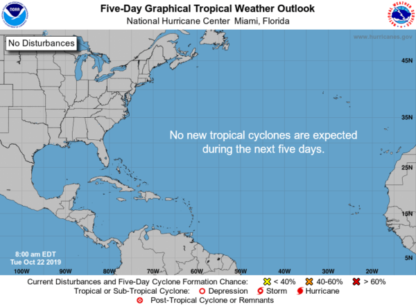
IN THE TROPICS: We are still in hurricane season, but we are getting late in the season when things really begin to calm down, but still the season continues through November 30th. For the North Atlantic, Caribbean Sea, and the Gulf of Mexico: Tropical cyclone formation is not expected during the next 5 days.
BEACH FORECAST CENTER: Get the latest weather and rip current forecasts for the beaches from Fort Morgan to Panama City on our Beach Forecast Center page. There, you can select the forecast of the region that you are interested in visiting.
WORLD TEMPERATURE EXTREMES: Over the last 24 hours, the highest observation outside the U.S. was 112.1F at Beitbridge, Zimbabwe. The lowest observation was -73.5F at Dome A, Antarctica.
CONTIGUOUS TEMPERATURE EXTREMES: Over the last 24 hours, the highest observation was 98F at Anaheim, CA. The lowest observation was 6F at Pikes Peak Summit, CO.
WEATHER ON THIS DATE IN 1988: A “nor’easter” swept across the coast of New England. Winds gusted to 75 mph, and large waves and high tides caused extensive shoreline flooding. A heavy wet snow blanketed much of eastern New York State, with a foot of snow reported in Lewis County.
Category: Alabama's Weather, ALL POSTS
About the Author (Author Profile)
Macon, Georgia Television Chief Meteorologist, Birmingham native, and long time Contributor on AlabamaWX. Stormchaser. I did not choose Weather, it chose Me. College Football Fanatic. @Ryan_StinnetSubscribe
If you enjoyed this article, subscribe to receive more just like it.


