

Dry For Now At Midday, But Most Will See Rain Before Sunrise
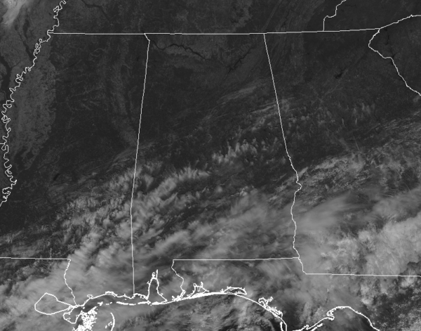
We are already starting to see some clouds work in from the south and southwest out ahead of the cold front that will be moving through this weekend. Plus, some tropical moisture is being pulled up from the south as a disturbance looks to play a role in enhancing rainfall across the southeast. Temperatures at 12:00 pm are in the mid-60s to the lower 70s across the area. Birmingham was at 69 degrees. The cool spot was Gadsden at 65 degrees. Montgomery and Uniontown were both tied at 71 degrees for the warm spot.
We’ll continue to have mainly sunny skies over the northern half of Central Alabama through the rest of the daylight hours, but some clouds will begin to move in over the southern half of the area. We’ll stay dry with mild temperatures, reaching the lower to mid-70s across the area. Clouds will continue to increase from the south and will eventually move in across the entire area. Later tonight, showers will move in from the south and southwest and will eventually spread over much of Central Alabama before dawn. Lows will be in the mid-50s to the lower 60s.
Friday looks to be a mighty wet day across all of Central Alabama as there will be widespread rain with a few embedded thunderstorms. Rain chances will be the highest north of the I-85 corridor and west of I-65. While rain chances are still high for the southeastern corner of Central Alabama, they will be less than the rest of the area as most of the activity will remain to the north and east. Highs will top out in the lower 60s to the upper 70s.
Rain continues to look likely across much of Central Alabama for the Friday night high school football games, but much of the southeastern portions could be dry throughout the evening. Some thunder will remain possible throughout the evening where showers are occurring. Temperatures at kickoff will start off in the lower 60s to the mid-70s and falling into the 60s across the area by the final whistle. Overnight lows will be around the same temperatures as you will see at 10:00 pm.
THE TROPICS:
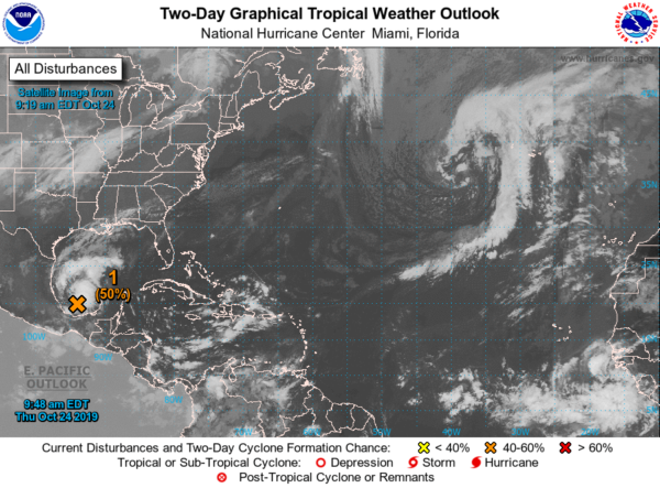
We have a disturbance over the Bay of Campeche that is starting to show signs of better organization and definition. There is a possibility that this could become a tropical depression or a low-end tropical storm before it merges with a cold front on Friday evening. At this point, NHC is giving it a 50/50 shot of becoming a depression. For more information about what this means for Central Alabama this weekend, please read my post from earlier today.
Category: Alabama's Weather, ALL POSTS, Tropical
About the Author (Author Profile)
Scott Martin is an operational meteorologist, professional graphic artist, musician, husband, and father. Not only is Scott a member of the National Weather Association, but he is also the Central Alabama Chapter of the NWA president. Scott is also the co-founder of Racecast Weather, which provides forecasts for many racing series across the USA. He also supplies forecasts for the BassMaster Elite Series events including the BassMaster Classic.Subscribe
If you enjoyed this article, subscribe to receive more just like it.


