At Midday, Plenty Of Rain In The North, Slight Risk Introduced In The Southwest
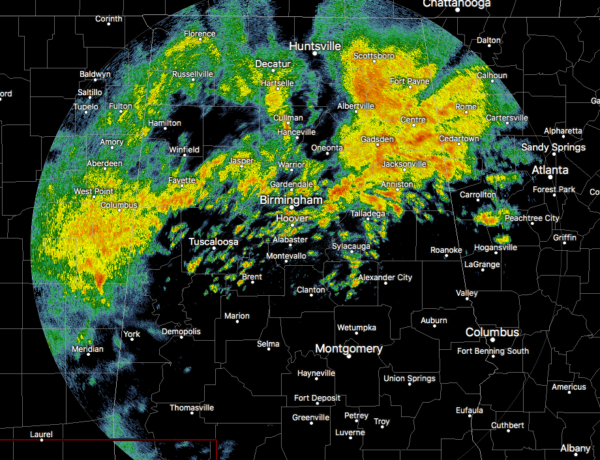
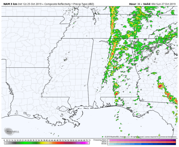
As of 11:00 am this morning, plenty of locations across Central Alabama have seen a good bit of rainfall, while some are still receiving beneficial rain. Most locations south of the 1-20 and 1-59/20 corridors are drying out at the moment as most of the activity has now moved north. We still have a few lingering scattered showers, but those will be north of those corridors within the next hour or so.
Temperatures were in the mid-50s to the mid-70s across the area. The wide spread in temperatures is due to the rainfall and cloud cover in the north and a warm front starting to work northward in the extreme southern parts of the state. Birmingham was at 59 degrees with rain. The cold spot was Talladega at 55 degrees with light rain. The warm spot was Montgomery at 73 degrees with cloudy skies.
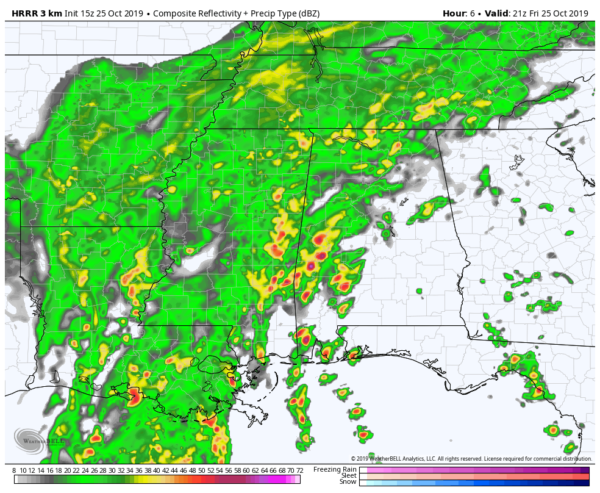
HRRR valid at 4:00 pm today.
We’ll continue to have showers and a few embedded claps of thunder in the northern parts of the area for several more hours while more showers and thunderstorms are expected to move into the west and southwestern parts of the area, keeping rain chances very high across much of the area. Rain chances will be lower in the southeastern parts of Central Alabama, especially along and south of the I-85 corridor. Highs should reach the lower 60s to the upper 70s across the area fron northwest to southeast.
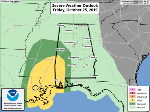
The Storm Prediction Center has introduced a Slight Risk of severe storms for the extreme southwestern portions of Central Alabama and down into southwest Alabama. The Marginal Risk has expanded to include nearly all of the southwest corner of Central Alabama. We could see a couple tornadoes along with damaging winds up to 60 MPH across the risk locations. Main timing will be from now through 10 PM tonight.
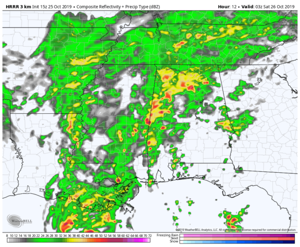
Much of Central Alabama will be wet during the evening hours for the high school football games, but the southeastern parts south of the I-85 corridor will have much less rain chances. North of the I-85 corridor, rain will continue to be likely with some thunder possible around time for kickoff. Temperatures across the area will be in the lower 60s to the mid-70s from northwest to southeast. By the final whistle, rain chances will continue to be likely north of the I-59 corridor while chances south of that will have diminished somewhat. Temperatures will be in the lower 60s to the lower 70s.
For the late night and overnight hours across Central Alabama, rain will continue to stay likely across the northern parts of the area north of the I-59 corridor while rain chances continue to lessen south of that as a warm front moves northward through the southern parts of the area. Lows will be in the lower 60s to the lower 70s.
NAM valid at 7:00 pm Saturday.
We’ll start off the day on Saturday with cloudy skies and some scattered showers possible over mainly the western parts of the area closest to the AL/MS state line. As the day progresses, the cold front will begin to move through the area and rain chances will greatly increase along and ahead of the front. The front will probably enter the state around the 12:00 pm-2:00 pm time frame, make it to the I-65 corridor around the 6:00 pm-8:00 pm time frame, and will be exiting the state by the 12:00 am-2:00 am time frame. Afternoon highs will be in the lower 70s to the lower 80s. At this point, no severe weather is expected as instability and lapse rates will be very weak.
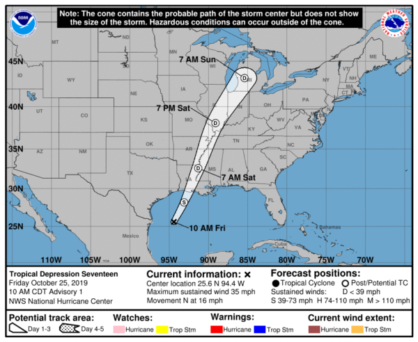
Tropical Depression #17 developed earlier this morning over the western Gulf of Mexico and is currently headed to the north at 16 MPH. Some strengthening could occur during the afternoon hours and we may briefly have Tropical Storm Olga before it merges with the approaching cold front and quickly becomes a post-tropical low. No tropical watches or warnings are expected to be issued along the Gulf Coast. However, as the low moves northward along the cold front, winds will be gusty and rainfall will be greatly enhanced, especially north and east of the low.
Category: Alabama's Weather, ALL POSTS, Severe Weather, Tropical
About the Author (Author Profile)
Scott Martin is an operational meteorologist, professional graphic artist, musician, husband, and father. Not only is Scott a member of the National Weather Association, but he is also the Central Alabama Chapter of the NWA president. Scott is also the co-founder of Racecast Weather, which provides forecasts for many racing series across the USA. He also supplies forecasts for the BassMaster Elite Series events including the BassMaster Classic.Subscribe
If you enjoyed this article, subscribe to receive more just like it.


