

Significant Wx Advisory For Parts Of Shelby County Until 8:15 AM
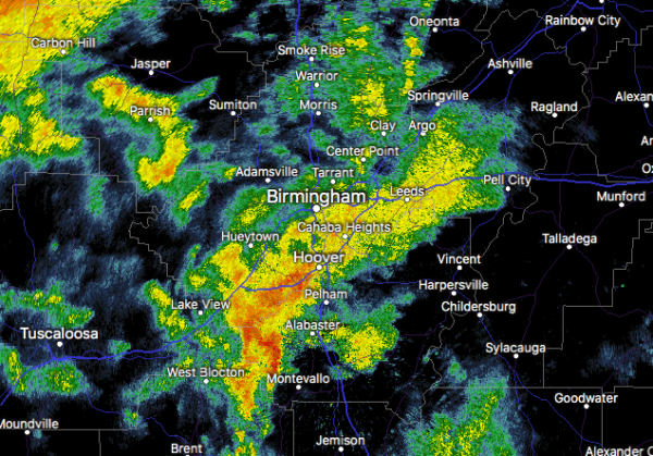
At 723 AM CDT, Doppler radar was tracking a strong thunderstorm near Maylene, or near Montevallo, moving northeast at 45 mph.
Winds in excess of 40 mph will be possible with this storm.
Locations impacted include…
Hoover, Alabaster, Pelham, Helena, Leeds, Calera, Chelsea, Montevallo, Wilsonville, Indian Springs Village, Vincent, Harpersville, Westover, American Village, Oak Mountain State Park, Vandiver, Maylene, Oak Mountain Amphitheater, Greystone and Highland Lakes.
PRECAUTIONARY/PREPAREDNESS ACTIONS…
Torrential rainfall is also occurring with this storm, and may lead to localized flooding. Do not drive your vehicle through flooded roadways.
To report severe weather, contact your nearest law enforcement agency. They will relay your report to the National Weather Service office in Birmingham.
Category: Alabama's Weather, ALL POSTS, Severe Weather
About the Author (Author Profile)
Scott Martin is an operational meteorologist, professional graphic artist, musician, husband, and father. Not only is Scott a member of the National Weather Association, but he is also the Central Alabama Chapter of the NWA president. Scott is also the co-founder of Racecast Weather, which provides forecasts for many racing series across the USA. He also supplies forecasts for the BassMaster Elite Series events including the BassMaster Classic.Subscribe
If you enjoyed this article, subscribe to receive more just like it.


