Severe Threat Is Over, Temperatures Dropping Fast After Frontal Passage
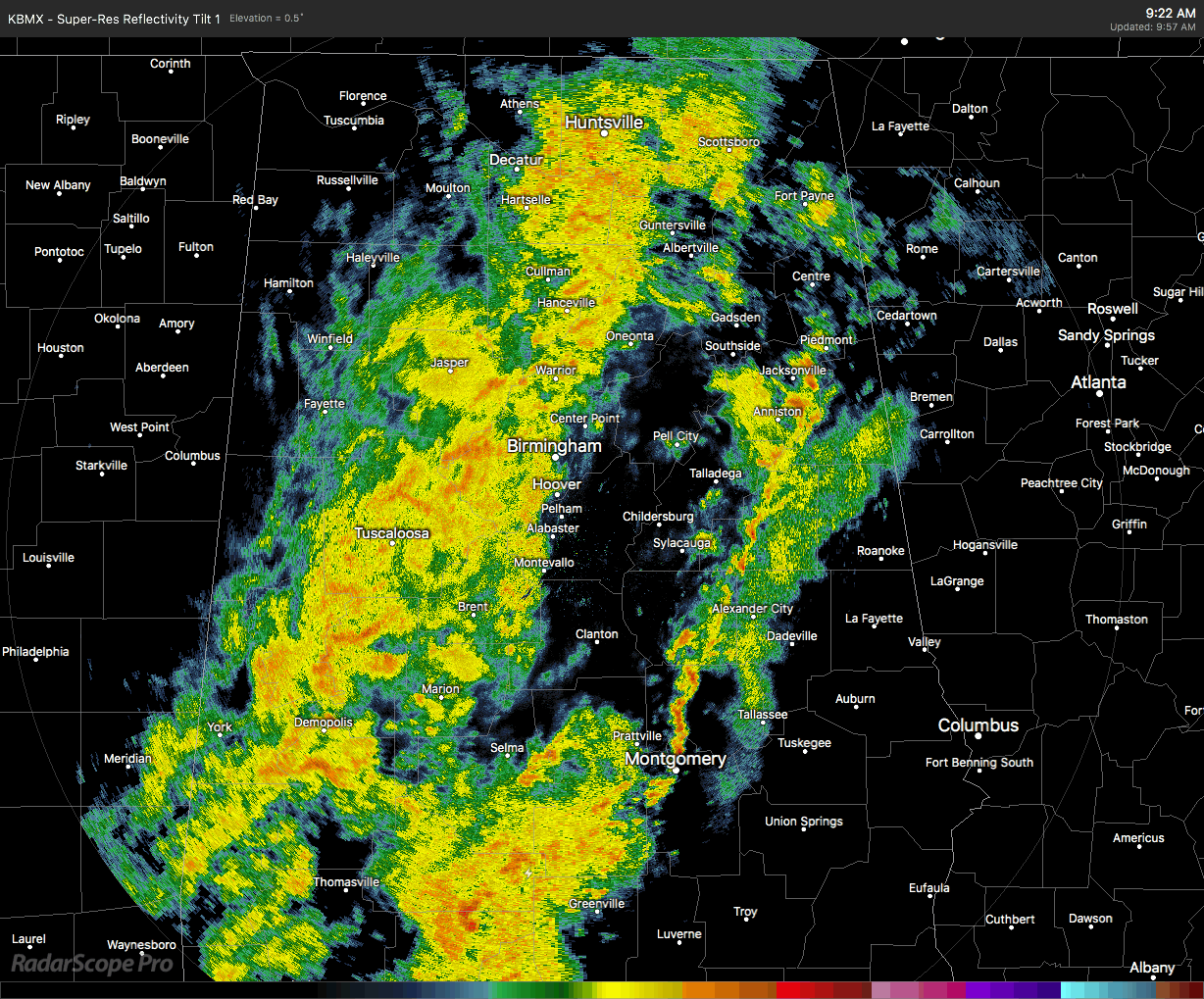
At 10:00 am, the cold front is now beginning to exit the state and move over into Georgia, and boy we can already tell the difference. We still have a ragged band of showers continuing to move slowly eastward across Central Alabama but the majority of the rainfall is occurring well behind the front.
Temperatures were in the lower 40s in the northwestern parts of the area to the upper 70s in the southeastern parts. Birmingham has fallen to 50 degrees. Haleyville is the cold spot at 42 degrees. The warm spot was Troy at 77 degrees. That is a 35-degree spread in temperature across the area… I would say that was definitely a strong cold front.
With that occurring, the severe threat is now definitely over across the area, and rain has already ended for locations west of a line from Haleyville to Carbon Hill to Gordo. Rain should be ending in Birmingham, Oneonta, Brent, and Demopolis over the next 60-90 minutes. In Tuscaloosa, the rain will be ending within 30 minutes or less.
So by midday, rain will have ended for most of the western parts of the area while the eastern half will still have showers and maybe a rumble of thunder or two. Temperatures will be in the mid-40s to the lower 70s across the area.
Nearly all of Central Alabama should be dry by 4:00 pm, but a few lingering showers or drizzle may be left over in the southeastern parts of the area. Temperatures will be in the mid-40s to the upper 50s.
It will be both breezy and chilly as we reach the 7:00 pm hour. Skies will begin to clear out from the west and all rain will be well out of the state. Temperatures will be in the lower 40s to the lower 50s across the area from northwest to southeast.
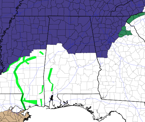
Don’t forget, freeze warnings go into effect for the counties in the NWS Huntsville CWA at midnight, and for the northern counties in the NWS Birmingham CWA at 1:00 am. Warnings are set to expire at 9:00 am.
Category: Alabama's Weather, ALL POSTS, Severe Weather
About the Author (Author Profile)
Scott Martin is an operational meteorologist, professional graphic artist, musician, husband, and father. Not only is Scott a member of the National Weather Association, but he is also the Central Alabama Chapter of the NWA president. Scott is also the co-founder of Racecast Weather, which provides forecasts for many racing series across the USA. He also supplies forecasts for the BassMaster Elite Series events including the BassMaster Classic.Subscribe
If you enjoyed this article, subscribe to receive more just like it.


