

Strong Storms Starting To Move Into Northwest Alabama
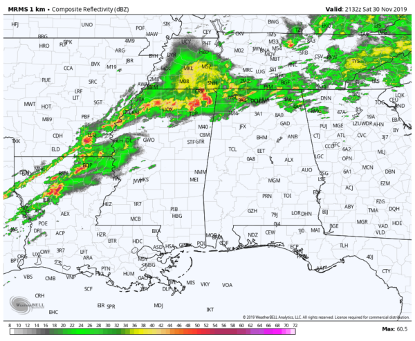
Strong thunderstorms are affecting parts of Mississippi and one severe storm will soon be moving into the northwestern corner of Alabama. A Severe Thunderstorm Warning has been issued for parts of Colbert and Lauderdale counties until 4:00 pm for the threat of damaging winds and hail up to 1-inch in diameter.
There are general showers and thunderstorms across the northern parts of North Alabama but nearly all of Central Alabama is rain-free at the moment.
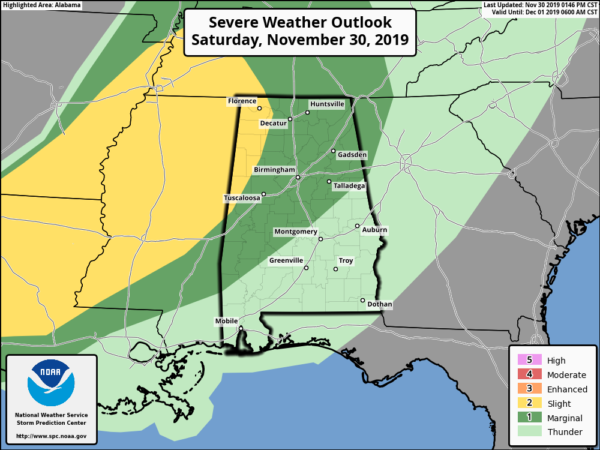
A Slight Risk continues for the western and northwestern parts of the area while a Marginal Risk continues for much of the rest of Central Alabama. Those risks are mainly for tonight’s activity that will move in. The main window for stronger to severe storms continues to be from 7:00 pm tonight through 7:00 am Sunday morning.
Warm and moist air advection continues to take place over the area which will lead to destabilization of the atmosphere. We will have plenty of shear and helicity in place, and the latest look at instability shows that those values will continue to increase and make it into the 500-1000 J/kg range. If that turns out to be true, we may have a slightly higher threat in severe storms with tornadoes and damaging winds possible, especially over the western half of the area.
More updates to come throughout the rest of the afternoon and through the night.
Category: Alabama's Weather, ALL POSTS, Severe Weather
About the Author (Author Profile)
Scott Martin is an operational meteorologist, professional graphic artist, musician, husband, and father. Not only is Scott a member of the National Weather Association, but he is also the Central Alabama Chapter of the NWA president. Scott is also the co-founder of Racecast Weather, which provides forecasts for many racing series across the USA. He also supplies forecasts for the BassMaster Elite Series events including the BassMaster Classic.Subscribe
If you enjoyed this article, subscribe to receive more just like it.


