Midday Nowcast: Cloudy and Cold Friday
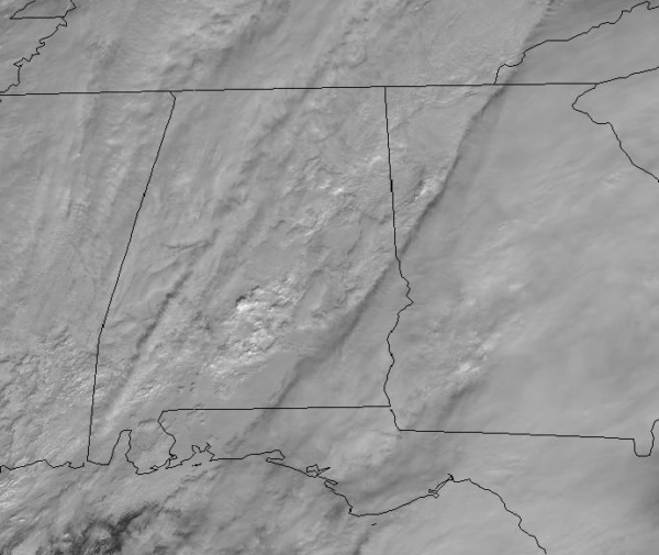
For the rest of today, the clouds will continue to stick around with areas of mainly light rain across North/Central Alabama. The more widespread rain with a few embedded storms will continue to be across the southern half of the state closer to the area of low pressure tracking out of the Northern Gulf.
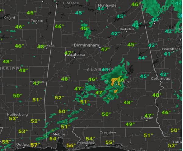
At midday, temperature are in the 40s, and could climb into the lower 50s by the end of the afternoon, but many spots will stay in the 40s today. As we head into the overnight hours, the rain will be tapering off from west to east across the state with lows generally in the lower 40s.
WEEKEND WEATHER: Tomorrow will feature a mainly cloudy sky with temperatures in the mid to upper 50s. We will mention the chance for a few showers over the northern third of the state tomorrow due to an upper-trough passing through the region, but by the end of the day, the sky should begin clearing. Sunday will be mainly sunny with highs in the lower 60s.
STORMS FOR MONDAY: A potent storm system brings rain and storms back to Alabama Monday and Monday night, and some of those storms could be on the strong to severe side. The SPC has a decent part of the state in a severe weather risk area Monday on their “Day 4” convective outlook.
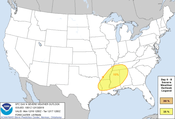
Temperatures will climb into the low 70s Monday and moisture levels increase, which will make for an unstable air mass and will provide plenty of instability for the rain and storms. At this time, the main window for severe storms in Alabama will come from about 2PM until roughly midnight. The greater risk for stronger storms will be over northern and western parts of the state. All modes of severe weather look possible with this event, which includes strong, possibly damaging winds, hail, and even a few tornadoes. We will be much more specific about the threat over the weekend as we get closer to the event.
BEACH FORECAST CENTER: Get the latest weather and rip current forecasts for the beaches from Fort Morgan to Panama City on our Beach Forecast Center page. There, you can select the forecast of the region that you are interested in visiting.
WORLD TEMPERATURE EXTREMES: Over the last 24 hours, the highest observation outside the U.S. was 111.2F at Rivadavia, Argentina. The lowest observation was -58.0F at Ekyuchchyu, Russia.
CONTIGUOUS TEMPERATURE EXTREMES: Over the last 24 hours, the highest observation was 84F at Naples, Marco Island, and Key West Naval Air Station, FL. The lowest observation was -7F at Estcourt Station, ME.
WEATHER ON THIS DATE IN 1962: A severe Florida freeze occurred. Morning lows reached 35 degrees at Miami, 18 degrees at Tampa, and 12 degrees at Jacksonville. It was the coldest December weather of the 20th century and caused millions of dollars damage to crops and foliage. In Georgia, the morning low of 9 degrees below zero at Blairsville established a state record for the month of December.
Category: Alabama's Weather, ALL POSTS
About the Author (Author Profile)
Macon, Georgia Television Chief Meteorologist, Birmingham native, and long time Contributor on AlabamaWX. Stormchaser. I did not choose Weather, it chose Me. College Football Fanatic. @Ryan_StinnetSubscribe
If you enjoyed this article, subscribe to receive more just like it.


