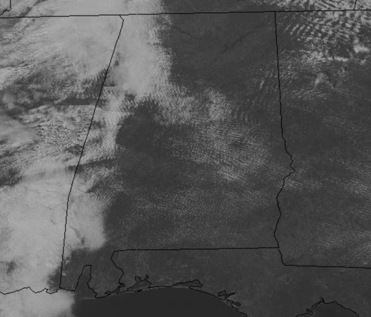
Saturday Afternoon Clearing Sky
It has been a pretty cloudy morning across the state, and there have even been some light areas of drizzle, but through the afternoon, we will continue to see conditions improve…The light drizzle has come to an end and we are expecting to see a good bit of sunshine the rest of today.
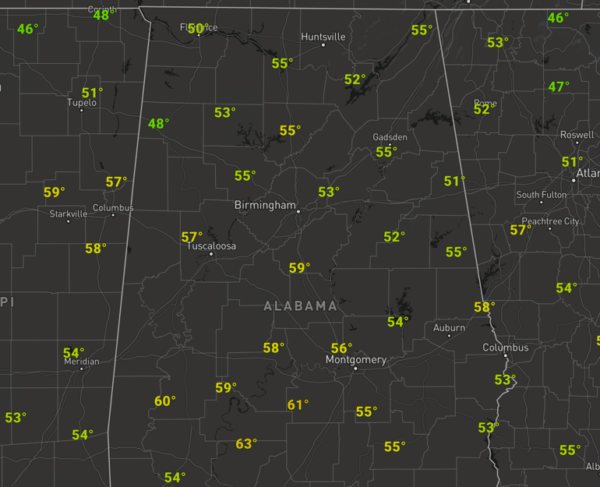
It has been a chilly day, but the 40s from the morning are being replaced but low to upper 50s this afternoon.
Overnight, the sky will be generally cloudy across North/Central Alabama with temperatures ranging from the upper 30s to lower 40s.
MILDER SUNDAY: Tomorrow, looks to feature more clouds than sun, but temperatures should be milder as lower to mid 60s are expected across the state. Despite the clouds, we should remain dry.
STRONG STORMS MONDAY: Starting the new work week, we will be watching a potent storm system moving out of the Plains, and this is the system that will bring rain and storms back to Alabama, and yes strong to severe storms are expected in Alabama. The low-level jet will kick in ahead of the system, and we are going to see strong warm air advection from the south as temperatures climb towards the 70s Monday afternoon. The day should feature more clouds than sun and gusty southerly winds before the rain and storms arrive in the state during the afternoon hours.
With an unstable air mass in place, dynamics increasing with the storm system, and additional lift ahead of the front, we are certainly expecting to see strong to severe storms in the state on Monday. The SPC has most of Alabama in a “Slight Risk” (level 2/5), while the remainder of the state is in a “Marginal Risk” (level 1/5) for severe storms Monday afternoon and evening.
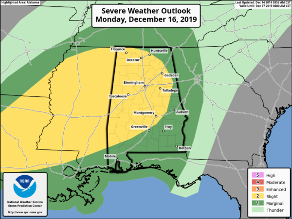
All modes of severe weather look to be possible: tornadoes, damaging winds up to 60 MPH, and hail up to 1-inch in diameter. At this point, the timing for strong to severe storms to impact Alabama will come from 2PM Monday afternoon through 2AM Tuesday morning. Of course, we are still a couple of days away from the event, and we will be fine-tuning the forecast tomorrow and Monday as we get a better idea of what we can expect.
BEACH FORECAST CENTER: Get the latest weather and rip current forecasts for the beaches from Fort Morgan to Panama City on our Beach Forecast Center page. There, you can select the forecast of the region that you are interested in visiting.
CONTIGUOUS TEMPERATURE EXTREMES: Over the last 24 hours, the highest observation was 87F at Falcon Lake, TX. The lowest observation was -17F at Rugby and Harvey, ND.
WEATHER ON THIS DATE IN 1924: The temperature at Helena, MT, plunged 79 degrees in 24 hours, and 88 degrees in 34 hours. The mercury plummeted from 63 above to 25 below zero. At Fairfield MT the temperature plunged 84 degrees in just 12 hours, from 63 at Noon to 21 below zero at midnight.
Category: Alabama's Weather, ALL POSTS
About the Author (Author Profile)
Macon, Georgia Television Chief Meteorologist, Birmingham native, and long time Contributor on AlabamaWX. Stormchaser. I did not choose Weather, it chose Me. College Football Fanatic. @Ryan_StinnetSubscribe
If you enjoyed this article, subscribe to receive more just like it.


