

Strong To Severe Storm Potential Continues For Later Today Through Tuesday Morning
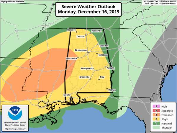
SPC continues an Enhanced Risk for locations along and west of a line from Kennedy (Lamar Co.) to Northport (Tuscaloosa Co.) to Demopolis (Marengo Co.). A Slight Risk continues for locations east of that to a line stretching from Huntsville (Madison Co.) to Glencoe (Etowah Co.) to just west of Smiths Station (Lee Co.). The rest of North and Central Alabama remains in a Marginal Risk.
All of Central Alabama will see a potential of strong to severe storms starting later this afternoon around 4:00 pm in the west and northwestern parts of the area and coming to an end in the east and southeastern parts of the area around 7:00 am Wednesday morning. All modes of severe weather are possible: tornadoes, damaging straight-line winds up to 70 MPH, and golf ball size hail.
Dewpoints over the western parts of the area are already up into the lower 60s with higher dewpoints along and just north of the Gulf Coast, which means more moisture-rich air will be pulled up into Central Alabama throughout the day. We’ll also have a strengthening low-level jet that will mix the atmosphere enough to cause breaks in the clouds and allow the sun to heat the surface somewhat. Most locations will see highs in the lower to mid-70s.

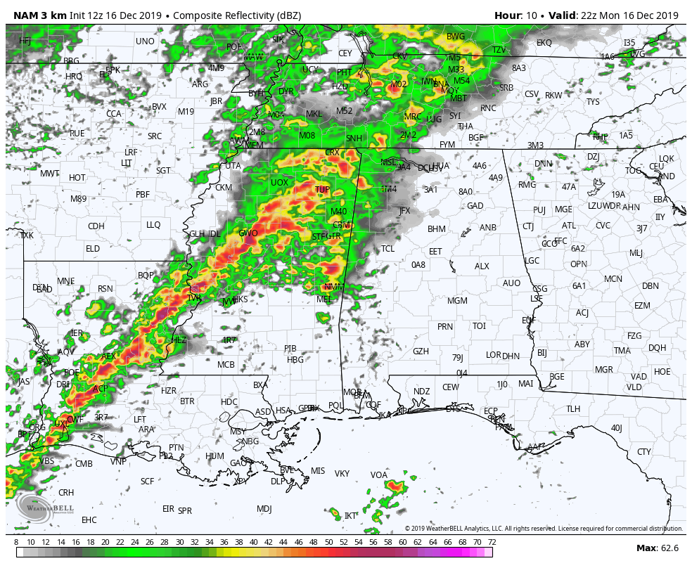
Surface-based instability valid at midnight tonight (12z NAM-3k).
Lapse rates are starting to become a little concerning as values look to reach as high as 7-8ºC/km which will be supportive of hail reaching up to 1.75 inches in diameter, or golf ball size. Surface-based instability values in the 700-1200 J/kg range will be decent enough to support and prolong stronger to severe storms. Helicity values will be in the 200-350 m2/s2 which is supportive of rotating updrafts and an increased risk of tornadoes.
Much of the activity that will affect Central Alabama looks to be in the form of a broken line of thunderstorms that will start to move into the northwestern parts of Central Alabama later this afternoon. What we’ll have to watch for is the potential for a few supercells to develop out ahead on the main action. If those supercells can develop without any interference from other storms, the potential for a stronger tornado to form will be there. At this point, that risk is really low, but not zero.
There also could be a lull in the activity for the southern parts of the area around midnight or so, which could lead to instability to rise ahead of the line and the cold front. That is also the main reason why the severe threat window has been extended to 7:00 am as storms could possibly last a little longer in the southeastern parts of the area.
Go ahead and have your safety kits prepared and your safe place ready to go just in case your location goes under a warning during the event on Monday night into Tuesday morning. Since this will be affecting some people while asleep, have multiple ways of getting an alert that will wake you up. If you have your Wireless Emergency Alerts deactivated on your phone, go ahead and reactivate them for this event. Be sure to have fresh batteries in your flashlights and in your NOAA WeatherRadios. Keep your smartphones charged and have a reliable news app downloaded that has the capability to show a live video feed so you can watch tornado coverage from your safe place.
I do not believe this is going to be a large outbreak, but all it takes is for one tornado to come down your street to make it a huge life-altering event. Be smart and be prepared. Be sure that your neighbors and the elderly know about the situation as well. If you live in a mobile or manufactured home, be sure you have a plan in place if a warning is issued for your location.
Category: Alabama's Weather, ALL POSTS, Severe Weather
About the Author (Author Profile)
Scott Martin is an operational meteorologist, professional graphic artist, musician, husband, and father. Not only is Scott a member of the National Weather Association, but he is also the Central Alabama Chapter of the NWA president. Scott is also the co-founder of Racecast Weather, which provides forecasts for many racing series across the USA. He also supplies forecasts for the BassMaster Elite Series events including the BassMaster Classic.Subscribe
If you enjoyed this article, subscribe to receive more just like it.


