Mild with Clouds and Spotty Showers
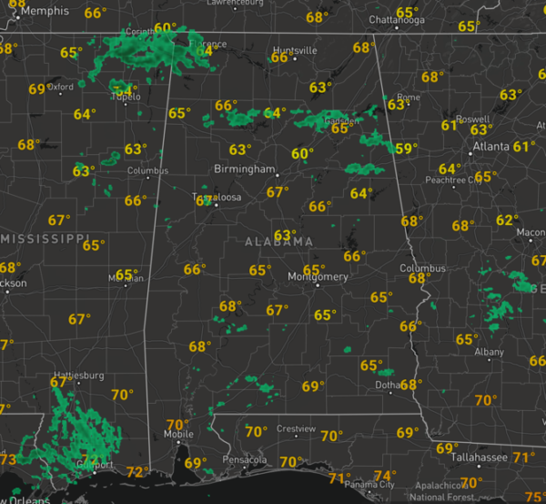
Temperatures are returning to the 60s and 70s across North/Central Alabama despite the lack of sunshine. For the most part, it remains a cloudy and gloomy Saturday, but once again, at least it’s not cold.
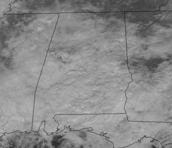
We are seeing some scattered showers across the Alabama landscape again this afternoon, but these are widely scattered and for the most part producing lighter amounts of rain, but there are a few downpours in some of the more robust showers.
Tonight, will be cloudy and very mild for late December as temps should hold in the 60s, and we should see an uptick in the coverage of showers with perhaps a few rumbles of thunder mixed in, but there is no threat of severe weather tonight.
STORMY SUNDAY: For now, we are still expecting a low end threat of severe weather in Alabama tomorrow, as the SPC maintains, nearly all of Alabama in a “marginal risk” (level 1/5) for severe storms on tomorrow.
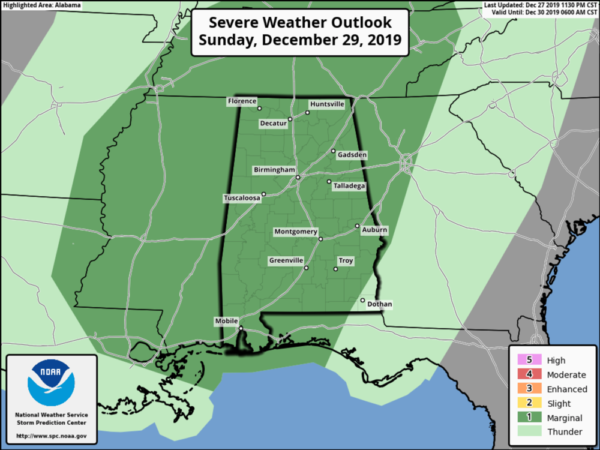
A cold front will be pushing through the state tomorrow and ample dynamics in the form of shear and helicity will be present. There will be some surface-based instability, but with expected clouds and and rain ongoing tomorrow, instability will be the limiting factor in the overall threat, but don’t let your guard down, there remains a threat. More often than not, in the winter months, ample dynamics can overcome the limited instability and still produce some severe weather in Alabama.
Our Sunday should be another very mild day with temperatures surging into the upper 60s and lower 70s across the state. Areas of rain will be ongoing in the morning, but we should see increasing coverage of showers and storms through the day as the front approaches the state with the main window for the threat of strong to severe storms will come during the afternoon, evening, and early night hours tomorrow. For now, the timing should be noon tomorrow through midnight Monday morning. The main threat from this event should be the possibility of damaging wind gusts, and the threat for a few brief, isolated tornadoes. So make sure you have your severe weather plan ready to act and have multiple, reliable sources to receive severe weather alerts if and when watches and warning are issued.
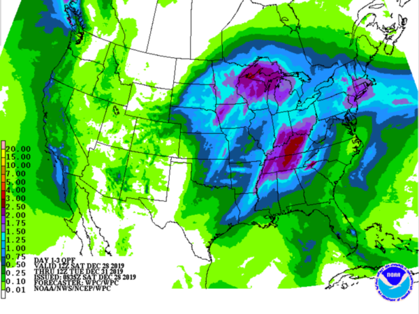
Rainfall will have to be monitored as well as the overall threat for flash flooding is low, but with recent rain keeping the ground saturated, there will be plenty of run-off and there could be some areas of flooding, especially in poor drainage areas. Rainfall totals the next 24-36 hours across North/Central Alabama should be in the 1-2 inch range, with the possibility of some isolated higher amounts.
BEACH FORECAST CENTER: Get the latest weather and rip current forecasts for the beaches from Fort Morgan to Panama City on our Beach Forecast Center page. There, you can select the forecast of the region that you are interested in visiting.
WORLD TEMPERATURE EXTREMES: Over the last 24 hours, the highest observation outside the U.S. was 117.9F at Shakawe, Botswana. The lowest observation was -63.6F at Ekyuchchyu, Russia.
CONTIGUOUS TEMPERATURE EXTREMES: Over the last 24 hours, the highest observation was 86F at Naples, Miles City, and Panther West, FL. The lowest observation was -18F at Peter Sinks, UT.
WEATHER ON THIS DATE IN 2004: Los Angeles (downtown) broke a daily rainfall record for the month of December (5.55 inches). This was the third wettest calendar day in Los Angeles since records began in 1877.
Category: Alabama's Weather, ALL POSTS
About the Author (Author Profile)
Macon, Georgia Television Chief Meteorologist, Birmingham native, and long time Contributor on AlabamaWX. Stormchaser. I did not choose Weather, it chose Me. College Football Fanatic. @Ryan_StinnetSubscribe
If you enjoyed this article, subscribe to receive more just like it.


