Parts Of Central Alabama Upgraded To A Slight Risk For Today
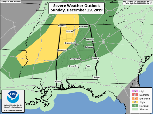
The Storm Prediction Center has upgraded the western and northwestern parts of Central Alabama to a Slight Risk for severe storms throughout the day today. Much of the rest of the area remains in a Marginal Risk for severe storms. We are continuing with the main threats of damaging winds up to 60 MPH and a brief tornado or two.
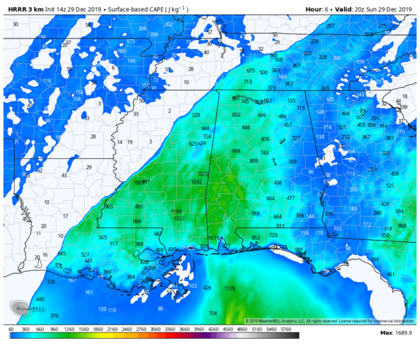
The latest runs of the HRRR are showing an increase in instability over the western and northwestern parts of the area with values reaching as high as 900 J/kg around 6:00 pm. Helicity values look to be as high as 500 m2/s2, and couple that with strong shear around 60-65 knots, the ingredients are there for the potential of rotating updrafts that could lead to supercell development and the possibility of a few tornadoes.
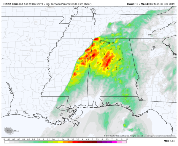
Significant Tornado Parameter values valid at 6:00 pm will verify that about the other parameters for severe weather, as we are seeing increased numbers ranging from 2.0-4.0 over portions of the west and northwestern parts of Central Alabama.
We’ll continue to have updates throughout the day. I’m about to join in on a conference call with NWS Birmingham to discuss today’s potential for severe storms.
Category: Alabama's Weather, ALL POSTS, Severe Weather
About the Author (Author Profile)
Scott Martin is an operational meteorologist, professional graphic artist, musician, husband, and father. Not only is Scott a member of the National Weather Association, but he is also the Central Alabama Chapter of the NWA president. Scott is also the co-founder of Racecast Weather, which provides forecasts for many racing series across the USA. He also supplies forecasts for the BassMaster Elite Series events including the BassMaster Classic.Subscribe
If you enjoyed this article, subscribe to receive more just like it.


