CANCELED – Severe T-Storm Warning: Parts Of Tallapoosa County Until 3:45 PM
BULLETIN – IMMEDIATE BROADCAST REQUESTED
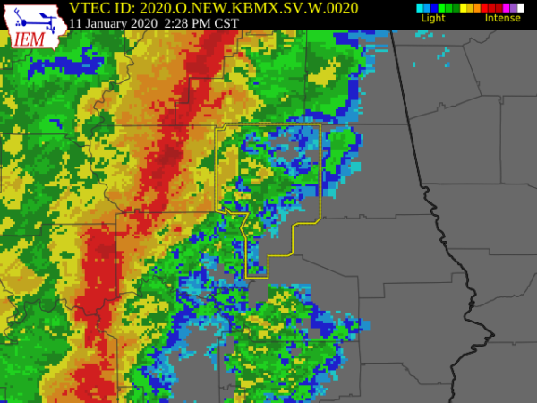
Severe Thunderstorm Warning
National Weather Service Birmingham AL
227 PM CST Sat Jan 11 2020
The National Weather Service in Birmingham has issued a
* Severe Thunderstorm Warning for…
Tallapoosa County in east central Alabama…
* Until 345 PM CST.
* At 227 PM CST, severe thunderstorms were located along a line
extending from near Bradford to Montgomery, moving east at 60 mph.
HAZARD…60 mph wind gusts.
SOURCE…Radar indicated.
IMPACT…Expect damage to roofs, siding, and trees.
* Locations impacted include…
Alexander City, Tallassee, Dadeville, Camp Hill, Jacksons’ Gap, New
Site, Waverly, Goldville, Reeves Airport, Southern Lake Martin,
Hillabee Creek, Eastern Lake Martin, Liberty City, Western Lake
Martin, Tallapoosa City, Northern Lake Martin, Wind Creek State
Park, Still Waters Resort, Daviston and Hackneyville.
PRECAUTIONARY/PREPAREDNESS ACTIONS…
A Tornado Watch remains in effect until 800 PM CST for southeastern
and east central Alabama.
For your protection move to an interior room on the lowest floor of a
building.
Category: Alabama's Weather, ALL POSTS, Severe Weather
About the Author (Author Profile)
Scott Martin is an operational meteorologist, professional graphic artist, musician, husband, and father. Not only is Scott a member of the National Weather Association, but he is also the Central Alabama Chapter of the NWA president. Scott is also the co-founder of Racecast Weather, which provides forecasts for many racing series across the USA. He also supplies forecasts for the BassMaster Elite Series events including the BassMaster Classic.Subscribe
If you enjoyed this article, subscribe to receive more just like it.


