Severe Threat Is Over, But The Rain Only Gives Us A One-Day Break
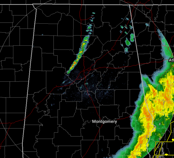
As of 6:00 pm, all Tornado Watches have been canceled across North/Central Alabama and the severe threat is finally over for today. Other than a small band of showers that are crossing the I-65 corridor just north of I-20, the only rain left in the area is the back edge of the line that is pushing out of the southeastern portions of Central Alabama.
We had plenty of damage reports come in throughout the event, and unfortunately, three people lost their lives in an apparent tornado down in Pickens County near Carrollton. Several structures were damaged to go along with numerous trees and power lines downed. As of 6:00 pm, there are 84,000 customers without power and additional crew resources are on the way to help out.
NWS Birmingham will be sending out three teams to survey the damage that occurred earlier today. Team One will survey damage in Pickens Co. near Carrollton. Team Two will survey the damage that occurred near Forkland in Greene County. Team Three will survey an area near Baker Hill in Barbour County where a debris signature was observed on radar.
Once these lingering showers move out of the area, we will be dry with much cooler temperatures during the overnight hours. Skies will be partly to mostly cloudy with lows dipping into the lower 40s to the mid-50s.
Sunday will be a much better day across Central Alabama as we’ll have dry conditions during the daylight hours. Once we get to the evening time, the cold front that moved through today will start to return north as a warm front and will bring a chance of showers to the southeastern parts of the area during the evening and overnight hours. Highs will be in the upper 50s to the upper 60s across the area.
We look to have some rain at times on Monday as the warm front continues to work through the area. Highs will be in the mid-60s to the mid-70s. We will continue in an unsettled weather pattern on Tuesday with rain and a few thunderstorms likely at times. Skies will be cloudy when not raining and highs will be in the upper 60s to the mid-70s. Much of the same story on Wednesday as rain will be likely at times, but a cold front will be approaching from the west that will finally help push this activity off to the east. Highs will be in the 70s across the area.
By Thursday, the cold front will have moved through the area and it looks like we’ll finally get a chance to dry out somewhat. Rain looks to come to an end during the morning, but skies will remain mostly cloudy during the afternoon and evening. Highs will be in the mid-50s to the lower 70s.
Friday looks to be a mainly dry day across the area, but we could have a few sprinkles form during the heating of the day. Any sprinkles that form will diminish by the evening hours. Skies will remain mostly cloudy with highs in the upper 50s to the mid-60s.
Category: Alabama's Weather, ALL POSTS, Severe Weather
About the Author (Author Profile)
Scott Martin is an operational meteorologist, professional graphic artist, musician, husband, and father. Not only is Scott a member of the National Weather Association, but he is also the Central Alabama Chapter of the NWA president. Scott is also the co-founder of Racecast Weather, which provides forecasts for many racing series across the USA. He also supplies forecasts for the BassMaster Elite Series events including the BassMaster Classic.Subscribe
If you enjoyed this article, subscribe to receive more just like it.


