A Little Break In The Rain Today Before Showers Return To Stay For A While
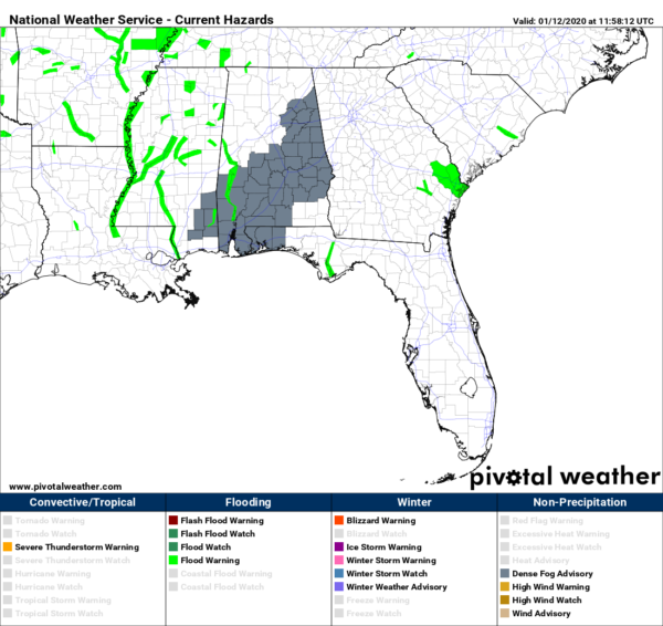
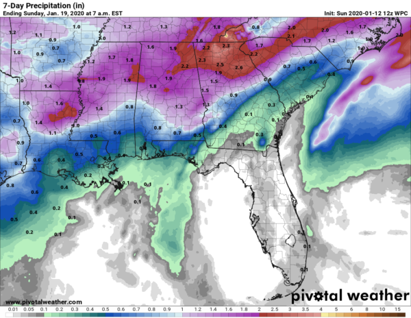
TODAY: We’ll have drier and cooler conditions across Central Alabama with skies becoming partly cloudy for much of the area by the afternoon hours. Unfortunately, the cold front that worked through yesterday will start to return to the north as a warm front. That will bring a chance of rain to the southern half of the area during the late afternoon hours, and to nearly all of the area for the overnight hours. Highs will be in the upper 50s to around 70 degrees from northwest to southeast.
MONDAY: We’ll have periods of rain throughout the entire day as the warm front continues to work northward into the area before becoming stationary across the southern half. There might be just enough instability for a few claps of thunder, but no severe weather is expected. Highs will be in the mid-60s to the mid-70s.
TUESDAY: Much of the same as we’ll continue to have unsettled weather due to the warm front starting to move northward again across the area. Rain will be likely at times with a few claps of thunder. Highs will top out in the upper 60s to the upper 70s.
WEDNESDAY: A cold front will be heading in our direction from the west that will help to push out much of the moisture, but we’ll have to put up with showers and thunderstorms. A few of these may be strong as there looks to be some surface-based instability across the area. Highs will be in the 70s.
THURSDAY: After the cold front has moved through the area, we do continue to see our weather stay a little unsettled. We’ll continue to have a small chance of showers and thunderstorms mainly over the northern half of the area and we’ll have to watch to see if any of these could become strong as we’ll continue to have some instability in place. Highs will be in the lower 60s to the mid-70s.
FRIDAY: A combination of high pressure off to our northeast and a low gathering strength with an approaching cold front out to the west will continue to keep rain in our forecast. Coverage at this point looks to be scattered at best over the northern and northeastern parts of the area. Highs will be in the mid-60s to the lower 70s.
SATURDAY: The cold front will move through throughout the day bringing rain and maybe a clap of thunder to Central Alabama. At this point, it doesn’t have a severe weather look as there just doesn’t look to be enough instability; plus, the dynamics will be far off to the north as the low will be located over the Great Lakes region. Rain will move out late in the day and finally, the rain chances come to an end. Highs will be in the lower 60s to the lower 70s.
NEXT SUNDAY: Taking a small step into Voodoo Land, the GFS shows Central Alabama being nice and dry and we’ll finally see a good bit of sunshine. Highs look to be in the lower 60s to the lower 70s.
Category: Alabama's Weather, ALL POSTS, Weather Xtreme Videos
About the Author (Author Profile)
Scott Martin is an operational meteorologist, professional graphic artist, musician, husband, and father. Not only is Scott a member of the National Weather Association, but he is also the Central Alabama Chapter of the NWA president. Scott is also the co-founder of Racecast Weather, which provides forecasts for many racing series across the USA. He also supplies forecasts for the BassMaster Elite Series events including the BassMaster Classic.Subscribe
If you enjoyed this article, subscribe to receive more just like it.


