Cold Front on the Way
Rain showers have been increasing in coverage this morning across the state ahead of the cold front which will bring winter temperatures back to Alabama for the week ahead.
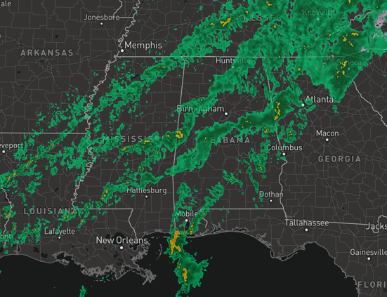
At midday, the cold front was currently still back in northwestern Mississippi, but it is making rapid progress towards the south and east. For the rest of today, expect a wet go of it, with occasional showers with a few embedded storms; no worries with severe storms, there is hardly any surface based instability, and dynamic support is not especially strong. Rainfall amounts should be around 1/2 inch, so no flooding concerns.
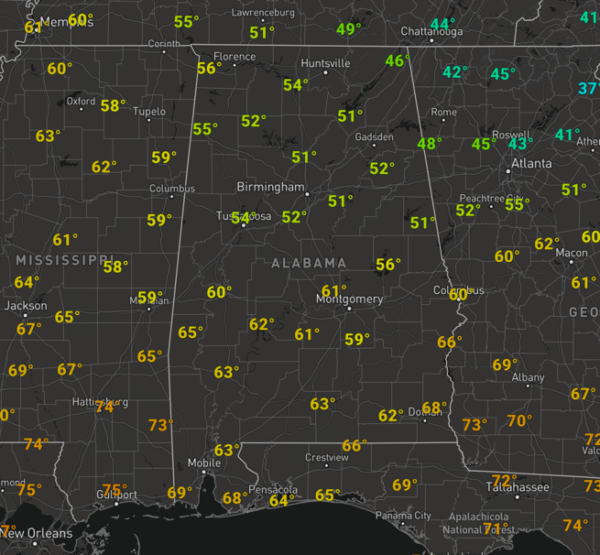
Temperatures are cool this afternoon, with 50s and lower 60s dotting the maps across the state.
SUNNY, COLD SUNDAY: The front will pass through the state late today, bringing drier and much colder air into the state. The sky clears tonight, and we should drop down into the lower and mid 30s. Tomorrow, sunshine will return in full supply as we are forecasting a bright, sunny day, but it will be noticeably colder. The high tomorrow will be in the upper 40s, and with northwesterly winds of 10-20 mph at times, it will be feeling colder. Tomorrow night, will be clear and cold; we drop into the mid 20s by daybreak Monday.
COLD FIRST HALF OF WEEK: Cold, dry weather continues during the first half of the week with sunny days and clear nights. The high Monday and Tuesday will be in the 40-45 degree range, with morning lows well below freezing, and colder pockets across North/Central Alabama will dip into the upper teens early Tuesday morning. A warming trend begins Wednesday afternoon as temperatures rise into the low 50s.
BEACH FORECAST CENTER: Get the latest weather and rip current forecasts for the beaches from Fort Morgan to Panama City on our Beach Forecast Center page. There, you can select the forecast of the region that you are interested in visiting.
WORLD TEMPERATURE EXTREMES: Over the last 24 hours, the highest observation outside the U.S. was 115.2F at The Augrabies Falls, South Africa. The lowest observation was -61.2F at Ekyuchchyu, Russia.
CONTIGUOUS TEMPERATURE EXTREMES: Over the last 24 hours, the highest observation was 87F at Naples, FL. The lowest observation was -29F at Clayton Lake, ME.
WEATHER ON THIS DATE IN 1987: A storm in the south central U.S. blanketed Oklahoma City with eight inches of snow, their highest total since 1948. Snowfall totals in Oklahoma ranged up to 13 inches at Gage, with drifts five feet high. Roof collapses across the state resulted.
Category: Alabama's Weather, ALL POSTS
About the Author (Author Profile)
Macon, Georgia Television Chief Meteorologist, Birmingham native, and long time Contributor on AlabamaWX. Stormchaser. I did not choose Weather, it chose Me. College Football Fanatic. @Ryan_StinnetSubscribe
If you enjoyed this article, subscribe to receive more just like it.


