High Risk Of Flash Flooding Issued By The WPC Through Tuesday Morning
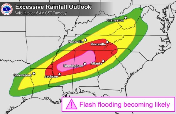
The NWS Weather Prediction Center has issued a High Risk for flash flooding over much of North/Central Alabama with a Moderate Risk for the rest of the area.
Rainfall totals over the next 18 hours or so will make flooding issues likely over much of the northern half of Alabama and into the central parts of Mississippi. Some flooding issues are possible over the rest of North/Central Alabama.
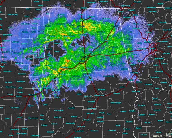
As of 11:10 am, much of the rainfall continues to occur along and north of the I-20/59 and I-20 corridors. The heaviest cells are currently over portions of Sumter and Tuscaloosa counties. If the rainfall continues to stay heavy over those locations, a flash flood warning may be issued within the next hour or so. Another heavier cell is located over portions of Winston County. The rest of the rainfall is light to moderate at this point.
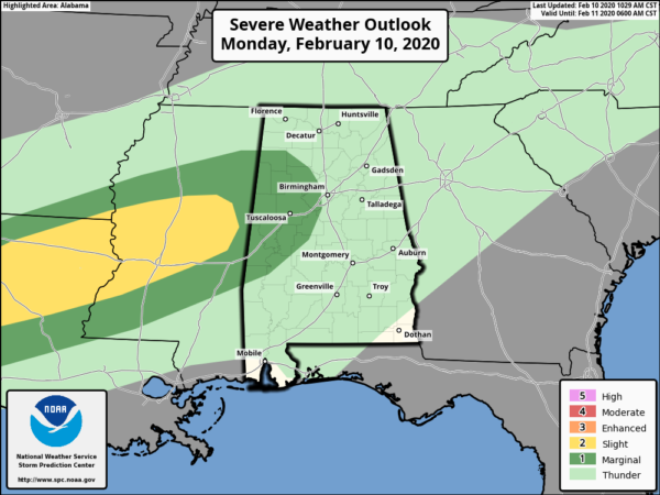
We may have to deal with a few strong storms over the western half of the area as there is a Marginal Risk for severe storms through the afternoon hours. Isolated damaging winds up to 60 MPH will be the main threat, but there is a non-zero threat of a tornado or two as well.
While a few strong storms are possible, the biggest concern for North/Central Alabama through tonight is flooding. If you live along a river, creek, or stream, or in a flood-prone area, pay close attention to the warnings, advisories, and statements put out by the National Weather Service.
Category: ALL POSTS
About the Author (Author Profile)
Scott Martin is an operational meteorologist, professional graphic artist, musician, husband, and father. Not only is Scott a member of the National Weather Association, but he is also the Central Alabama Chapter of the NWA president. Scott is also the co-founder of Racecast Weather, which provides forecasts for many racing series across the USA. He also supplies forecasts for the BassMaster Elite Series events including the BassMaster Classic.Subscribe
If you enjoyed this article, subscribe to receive more just like it.


