

Alabama Update at 7:45 p.m.: Major Flooding Continues Tonight; More Rain on the Way
it is a mess out there across Alabama tonight, with two main swaths where heavy rain today on top of a soaked ground has caused major flooding.
Here is the total rainfall observed so far, using the storm total rainfall product off the Birmingham Doppler Radar.
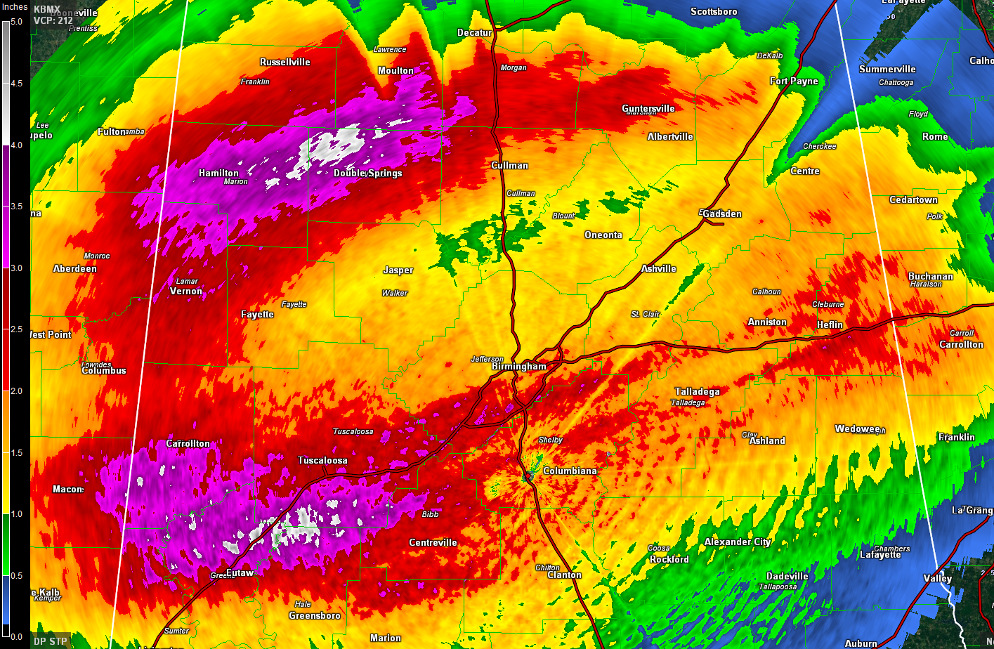
The first, generally along the I-20 Corridor has produced 2-5 inches of rain from Pickens, Greene, and Sumter counties on the west through the southern half of the Birmingham Metro down to Clanton then over to Calhoun, Cleburne, and northern Randolph Counties. There are numerous instances of very high water across these areas.
I have received 4.32 inches so far just off Acton Road in southern Jefferson County. It produced major flooding at my home. So these radar observed amounts are likely low since the radar is only showing just under 3 inches at my location.
Another swath of heavy rain has occurred from Lamar, Marion, and Fayette Counties northeastward through Winston, Franklin, Lawrence, Cullman, Morgan, and Marshall Counties.
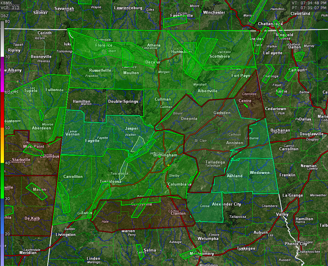
The two swaths are blanketed in flash flood and areal flood warnings. The flash flood warnings are in red, the areal flood warnings are in the darker green, with river flood warnings in the brighter green.
Flash Flood Warnings are issued for flooding usually occurring immediately after heavy rain. An Areal Flood Warning is issued for flooding that occurs over time from prolonged and persistent moderate to heavy rainfall. A River Flood Warning is issued when a river is forecast to go above its designated flood stage at the forecast point.
Alabama Power warns residents near their lakes and dams to pay close attention to the latest information concerning floodgate releases.
Be aware that numerous school systems are closing or delaying their starts tomorrow.
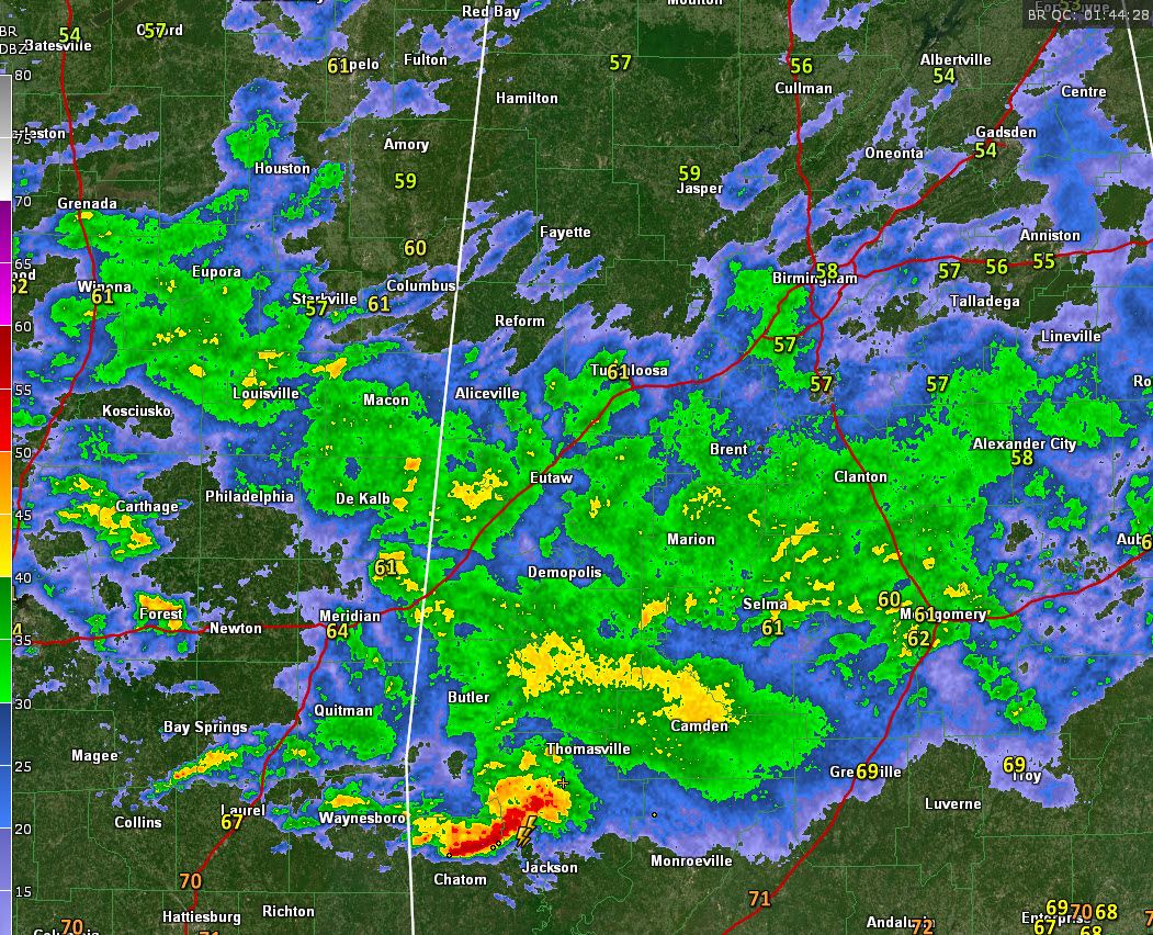
At this hour, moderate to heavy rain covers much of Central Alabama and more heavy rain is building over eastern Mississippi. This rainfall will be lifting back over the already waterlogged areas along and north of the I-20 corridor over the next several hours, making the flooding worse.
That storm near Grove Hill in Clarke County in Southwest Alabama has had a history of triggering tornado warnings.
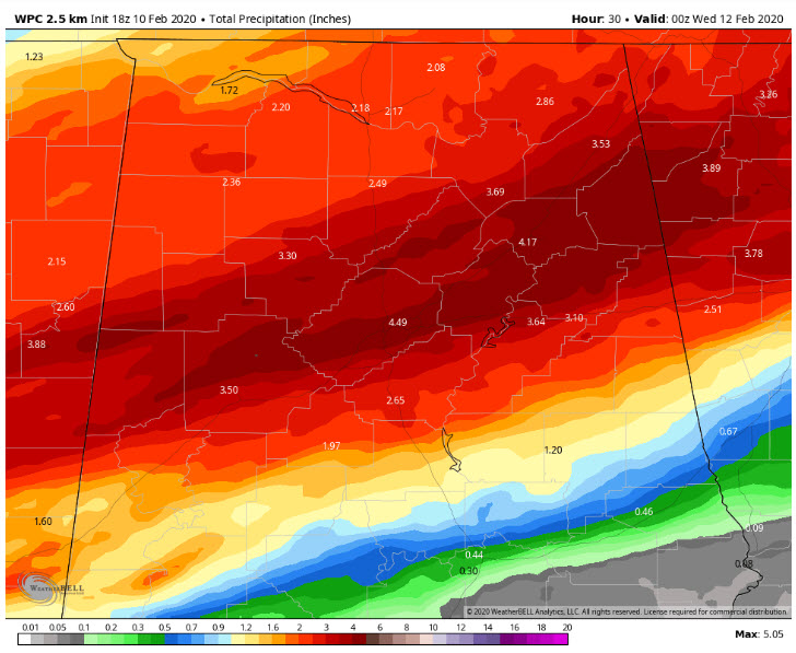
The WPC QPF forecast is for this much more rainfall overenight and during the day on Tuesday:
Needless to say, traveling in the flooded areas is discouraged. Stay alert for rapidly rising water in your neighborhood is heavy rain sets in. And keep an eye to the radar to see if heavy rain is coming your way. Be ready to leave for higher ground is flooding begins. Remember our number one rule: Turn Around, Don’t Drown: don’t walk or drive into floodwaters. They are even more dangerous at night.
Category: Alabama's Weather, ALL POSTS
About the Author (Author Profile)
Bill Murray is the President of The Weather Factory. He is the site's official weather historian and a weekend forecaster. He also anchors the site's severe weather coverage. Bill Murray is the proud holder of National Weather Association Digital Seal #0001 @wxhistorianSubscribe
If you enjoyed this article, subscribe to receive more just like it.


