An 8:35 p.m. Look at the Alabama Weather Situation
Taking a look at the Alabama weather situation at 8: 30 p.m. tonight.
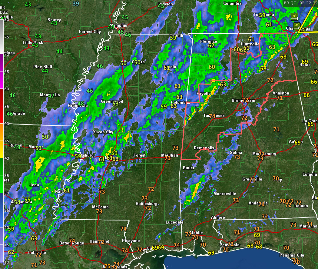
As expected, our line of storms is starting to move more slowly, with its forward progression slowing down. At 8:30, it extends from eastern Jackson County in Northeast Alabama, through Marshall, Blount, Cullman, Walker, Fayette, and Pickens Counties.
In Central Alabama, the strongest storms are over Fayette County, from southeast of Fayette to near Carrollton in Pickens County. Overall lightning continues to decrease in the line of storms, indicating weakening, but the storms are still capable of producing damaging winds.
A second band of showers has formed to the east from Shelby and Talladega counties through Shelby, Bibb, Chilton, Perry, and Dallas Counties and on into Southwest Alabama. No lightning yet, but it will be interesting to see if some can form in this band as it pushes eastward.
Instability is waning quickly with surface-based CAPE values over 500 joules/kg now limited to Southwest Alabama from Sumter County to the south, but there is not much convection there anyway. There is still plenty of wind shear, but without instability, it will be hard to get very organized updrafts. Damaging wind is still a possibility with the line of storms.
Rainfall rates are running one half to one inch per hour in the heavier storms from Pickens through Fayette into Walker and Blount Counties according to MRMS data. Some localized flooding could occur in the areas of heavier rainfall. Flash flood watches do remain in effect.
We are watching lightning output increase back over Louisiana into Central Mississippi. That is probably associated with the right rear region of the jet streak that is swinging through Arkansas and Louisiana. That increases lift in that portion of the jet streak.
The severe thunderstorm watch continues for several North and Central Alabama counties, but an additional watch is not expected to the east of the current one.
Category: Alabama's Weather, ALL POSTS, Severe Weather
About the Author (Author Profile)
Bill Murray is the President of The Weather Factory. He is the site's official weather historian and a weekend forecaster. He also anchors the site's severe weather coverage. Bill Murray is the proud holder of National Weather Association Digital Seal #0001 @wxhistorianSubscribe
If you enjoyed this article, subscribe to receive more just like it.


