EXPIRED – Severe Thunderstorm Warning for Parts of Hale County until 615 a.m.
The National Weather Service in Birmingham has issued a
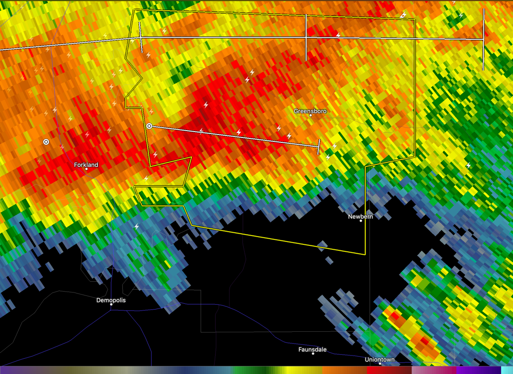
* Severe Thunderstorm Warning for…
Central Hale County in west central Alabama…
* Until 615 AM CST.
* At 533 AM CST, a severe thunderstorm was located over Walden
Quarters, or 7 miles south of Eutaw, moving east at 45 mph.
HAZARD…60 mph wind gusts and quarter size hail.
SOURCE…Radar indicated.
IMPACT…Hail damage to vehicles is expected. Expect wind damage
to roofs, siding, and trees.
* Locations impacted include…
Greensboro, Newbern, Sawyerville, Greensboro Municipal Airport,
Wedgeworth, Selden Lock And Dam and Cedarville.
Category: Alabama's Weather, ALL POSTS, Severe Weather
About the Author (Author Profile)
Bill Murray is the President of The Weather Factory. He is the site's official weather historian and a weekend forecaster. He also anchors the site's severe weather coverage. Bill Murray is the proud holder of National Weather Association Digital Seal #0001 @wxhistorianSubscribe
If you enjoyed this article, subscribe to receive more just like it.


