SPC Upgrades To Slight Risk For Parts Of The Area
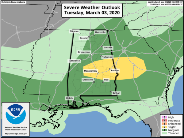
The Storm Prediction Center has upgraded the Marginal Risk for the southern and southeastern parts of the area to a Slight Risk through the rest of the morning hours.
This includes Marion, Orville, Selma, Jemison, Clanton, Billingsley, Prattville, Montgomery, Union Springs, Hurtsboro, Goodwater, Alexander City, Roanoke, Auburn, Phenix City.
Though the more obvious shortwave trough in the northern stream will pass north of this area today, an organized cluster of storms is moving into west-central AL this morning in association with a 40-45 kt segment of the low-level jet and enhanced warm advection. This cluster could pose an increasing threat for damaging gusts and a couple of tornadoes from central AL into central GA today, as the low levels destabilize with surface heating in cloud breaks and some continued low-level moistening with boundary-layer dewpoints in the low-mid 60s. Embedded bowing segments and supercells will be supported by modest buoyancy (MLCAPE of 500-1000 J/kg), effective bulk shear in excess of 50 kt, and locally enhanced SRH with the low-level jet segment.
Category: Alabama's Weather, ALL POSTS, Severe Weather
About the Author (Author Profile)
Scott Martin is an operational meteorologist, professional graphic artist, musician, husband, and father. Not only is Scott a member of the National Weather Association, but he is also the Central Alabama Chapter of the NWA president. Scott is also the co-founder of Racecast Weather, which provides forecasts for many racing series across the USA. He also supplies forecasts for the BassMaster Elite Series events including the BassMaster Classic.Subscribe
If you enjoyed this article, subscribe to receive more just like it.


