

SPC: Threat for Isolated Damaging Wind Gusts and Marginally Severe Hail Continues
Mesoscale Discussion issued by the Storm Prediction Center at 2:29 p.m.
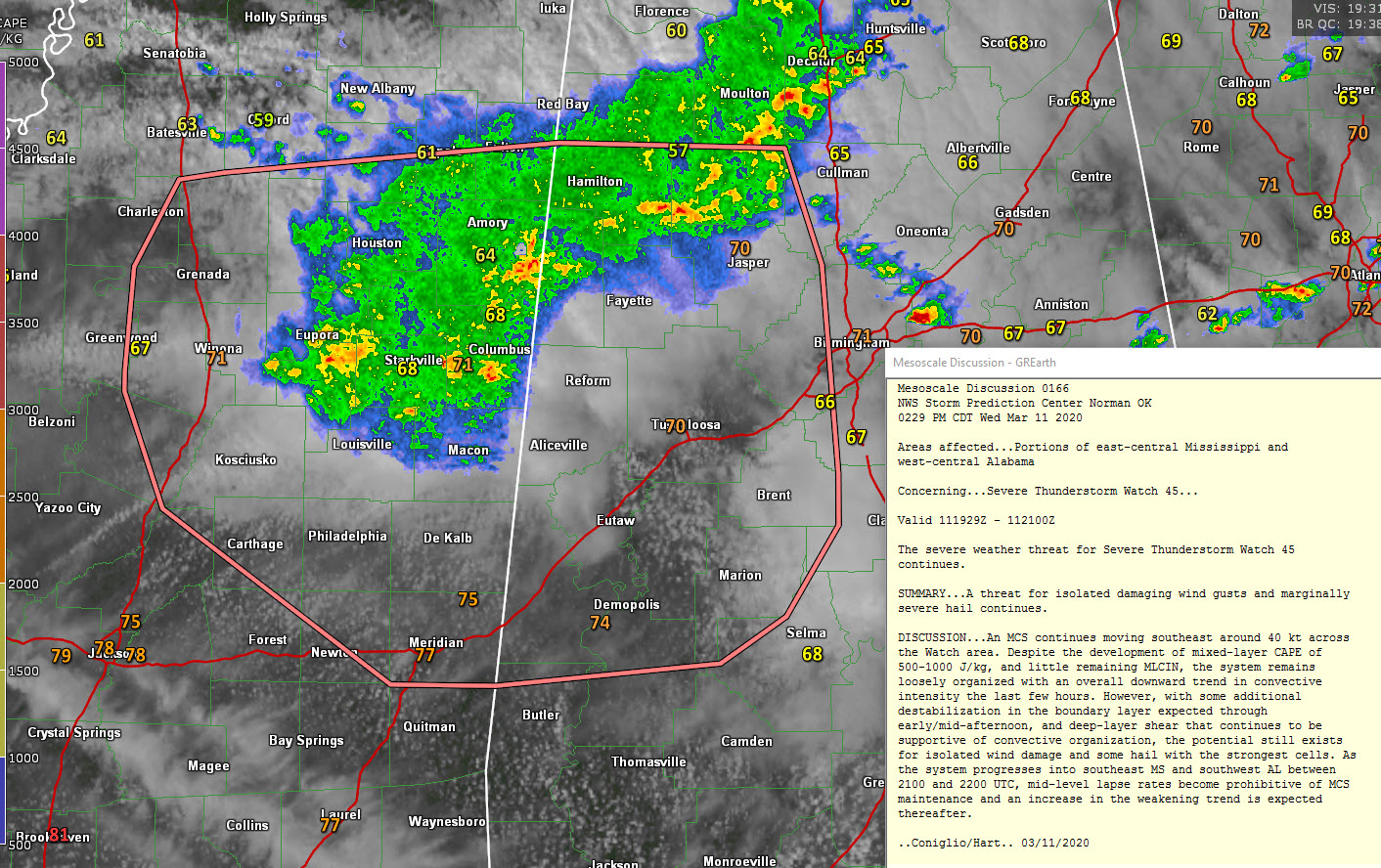
Mesoscale Discussion 0166
NWS Storm Prediction Center Norman OK
0229 PM CDT Wed Mar 11 2020
Areas affected…Portions of east-central Mississippi and
west-central Alabama
Concerning…Severe Thunderstorm Watch 45…
Valid 111929Z – 112100Z
The severe weather threat for Severe Thunderstorm Watch 45
continues.
SUMMARY…A threat for isolated damaging wind gusts and marginally
severe hail continues.
DISCUSSION…An MCS continues moving southeast around 40 kt across
the Watch area. Despite the development of mixed-layer CAPE of
500-1000 J/kg, and little remaining MLCIN, the system remains
loosely organized with an overall downward trend in convective
intensity the last few hours. However, with some additional
destabilization in the boundary layer expected through
early/mid-afternoon, and deep-layer shear that continues to be
supportive of convective organization, the potential still exists
for isolated wind damage and some hail with the strongest cells. As
the system progresses into southeast MS and southwest AL between
2100 and 2200 UTC, mid-level lapse rates become prohibitive of MCS
maintenance and an increase in the weakening trend is expected
thereafter.
Category: ALL POSTS
About the Author (Author Profile)
Bill Murray is the President of The Weather Factory. He is the site's official weather historian and a weekend forecaster. He also anchors the site's severe weather coverage. Bill Murray is the proud holder of National Weather Association Digital Seal #0001 @wxhistorianSubscribe
If you enjoyed this article, subscribe to receive more just like it.


